Date Completed: July – August 2023
Difficulty: Intermediate due to number of rapids and isolation (virtually all rapids can be portaged)
Method of Travel: Canoe
Region/Location: Woodland Caribou Provincial Park (Ontario) and Atikaki Provincial Wilderness Park (Manitoba)
Trip Duration: 13 days
Distance: ~230km total
Loop: No
Fees/Logistics: Woodland Caribou is operating park (permits required); Atikaki is non-operating (no permits); access via floatplane from Red Lake, ON or Bisset, MB and egress via Bloodvein River Bridge by road shuttle; used Goldseekers Outfitting and Superior Airways).
The River that Gives Life: A Journey Down the Bloodvein River
East of Lake Winnipeg and north of Lake Superior, in the central boreal uplands of the Canadian Shield, runs an ancient wilderness river of incredible natural beauty and great human heritage. Over its course of more than 300 kilometres (km), the Bloodvein River surges over more than 100 rocky rapids and waterfalls as it passes through a forest landscape of extreme contrast: rich, green and verdant swaths of jack pine and black spruce; black and barren expanses of land ravaged by fire. Eagles and osprey drift over this lonely land in abundance, while wolverine and woodland caribou ramble through its mossy rockscapes and shadowy recesses. Red ochre pictographs on the river’s innumerable cliffs – the bison, the war canoe, the shaman – shed an aura of mystery and sanctitude, and remind the traveler of the old traditions born here in a far distant time.
Legends suggest that the waterway’s traditional name, Miskweyaabiziibee in Anishinaabemowin, the Blood River, originated from a large tribal battle waged at the river’s mouth, that tinged the waters red with the blood of fallen warriors. The name “Bloodvein”, however, gained prominence during the fur trade era, in supposed reference to the red granite veins that can often be found running through the dark rock at riverside.
The Bloodvein watershed is the homeland of several Anishinaabe communities including the Bloodvein River First Nation, Little Grand Rapids First Nation, Pikangikum First Nation and Lac Seul First Nation. These communities and their ancestors have long acted as stewards of this land and have historically used the river for trade, food harvest, transportation and spiritual purposes. Archaeological records – artifacts, graves, village sites – suggest that human habitation of the region extends back as far as 9,000 years, corresponding with the retreat of the glaciers and drainage of Lake Agassiz – North America’s largest prehistoric glacial lake. Many of the pictographs of the region date back as far as 3,000 years, with the site on Artery Lake considered a site of national significance.
In the era of the fur trade, the land encompassing the Bloodvein became known by the voyageurs as Le Petit Nord – the Little North; a place they viewed as distinct from “Le Grand Nord” which contained the vast lands north and west of Lake Winnipeg. In the late 1700s and early 1800s the river itself became a significant transportation and supply route for the fur trade, linking Lake Winnipeg with interior trapping and hunting grounds. Innumerable trading posts and trapping cabins were established in the region, including posts erected by the Hudson Bay Company and North West Company. Supposedly, the remnants of some of these structures may still be found at the river’s confluence with tributaries such as the Gammon and the Sasaginnigak Rivers.
Today, the Bloodvein is recognized as a Canadian Heritage River and is permanently protected in both Ontario and Manitoba within the respective boundaries of Woodland Caribou Provincial Park and Atikaki Provincial Wilderness Park. These large protected areas aim to conserve not only the historical and cultural heritage features of the area, but also the region’s outstanding natural heritage features. Notably, the parks preserve the largest and most intact example of boreal shield on the continent and the habitat of several rare or threatened species such as the woodland caribou, wolverine, lake sturgeon, chestnut lamprey and bank swallow.
In 2018, in acknowledgement of the natural and cultural importance of the vast wilderness that encompasses the Bloodvein and other watersheds, UNESCO designated the region as a World Heritage site called Pimachiowin Aki — “The Land that Gives Life”. Pimachiowin Aki is the only site of Canada’s 20 World Heritage sites to be recognized for both its cultural and natural significance. The site is particularly noted for the longstanding tradition practiced by Indigenous peoples called, Ji-ganawendamang Gidakiiminaan — “keeping the land” — which pays respect to all life forms and seeks the preservation of harmony between creatures.
In its description of this tradition, UNESCO states that this principle “guides relations between Anishinaabeg and the land; it is the framework through which the cultural landscape of Pimachiowin Aki is perceived, given meaning, used and sustained across the generations. Widely dispersed across the landscape are ancient and contemporary livelihood sites, sacred sites and named places, most linked by waterways that are tangible reflections of Ji-ganawendamang Gidakiiminaan.”
Trip Report
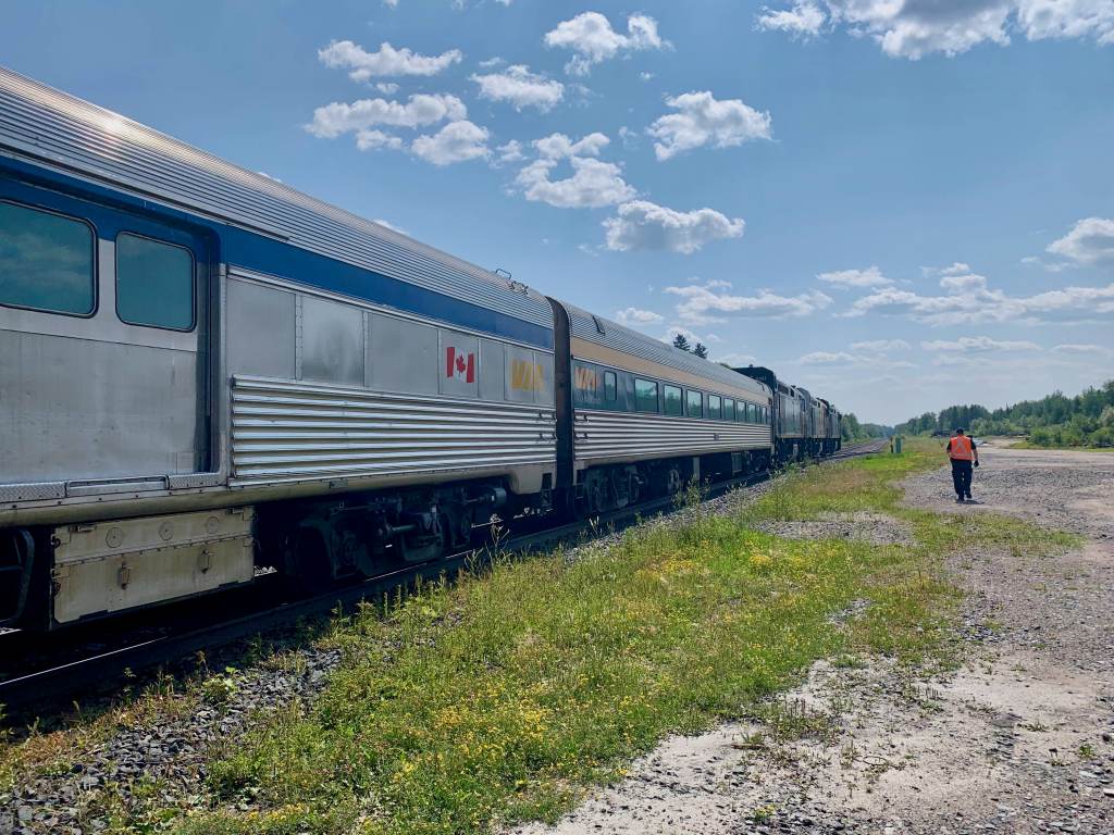
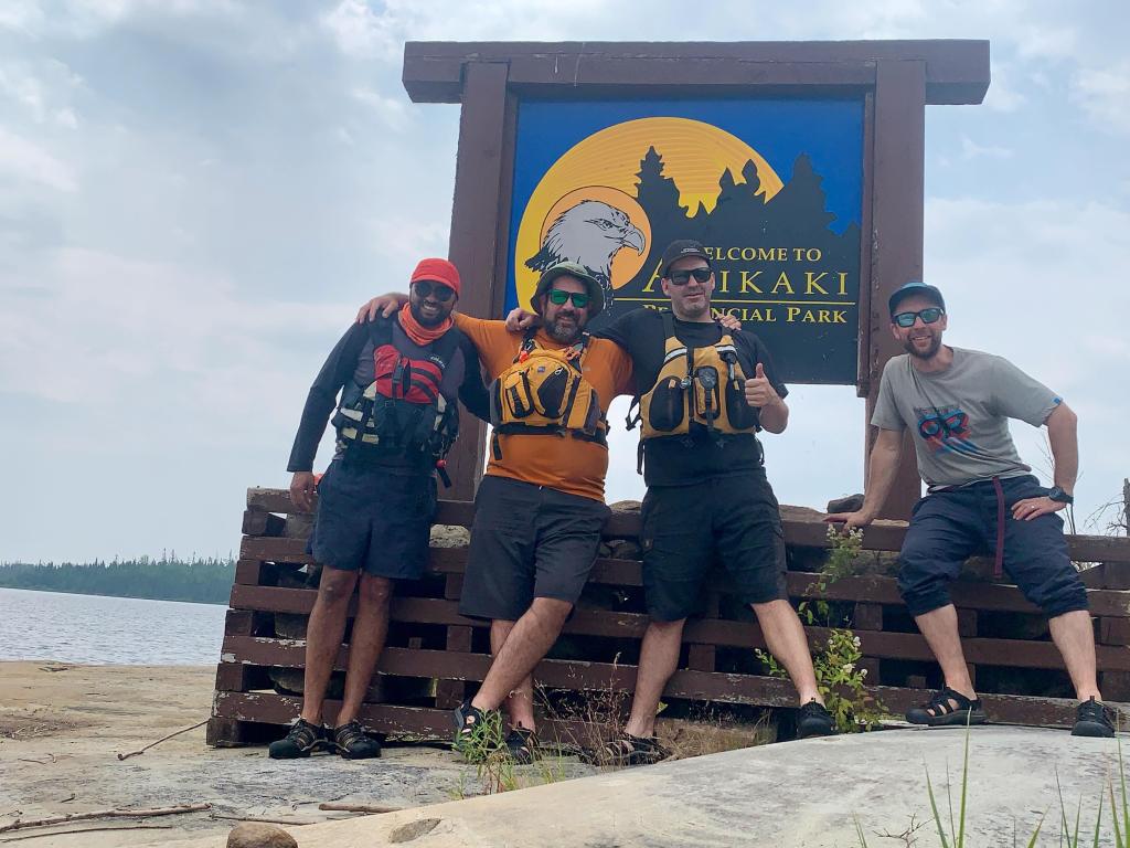
On July 23, 2023, our party of four (Jono Kuketz, Kevin Groombridge, Lachlan McVie and myself) met at Union Station in Toronto and boarded a Via train destined for Red Lake Road in northwestern Ontario. Following the 29-hour train ride, we were shuttled an additional two hours north to the town of Red Lake, by Albert Rogalinski of Goldseekers Canoe Outfitting, where we stayed the night.
Our plan was to depart Red Lake in the morning by floatplane and land on Artery Lake at the western edge of the Ontario border in Woodland Caribou Provincial Park. From here we would paddle a 230-kilometre stretch of the Bloodvein River over 13 days through Atikaki Provincial Wilderness Park in Manitoba, egressing at the Bloodvein River bridge – approximately 10 km from Bloodvein River First Nation on Lake Winnipeg.

Day 1: Artery Lake to Moosebone Rapids (14 km)
The morning was cool, calm and clear – a vibrant sunrise cast a strong orange hue over the town of Red Lake as we prepared for our departure at the docks of Superior Airways. To access the park we would rely on a double 30-minute flight aboard a 1950s de Havilland Beaver. Jono and Lachlan boarded the first flight and took off at around 7 a.m. as Kevin and I looked on from the dock.
After spending some time in Red Lake’s Norseman Park – a municipal park that honours Red Lake’s aviation heritage and the legendary Noorduyn Norseman bushplane – Kevin and I took our seats in the Beaver and set off to the west as well.
With the plane at altitude, we quickly passed into the boundary of Woodland Caribou Provincial Park. Though a blanket of haze from northern fires hung thick over the landscape, the view of the boreal was remarkable with an array of sparkling lakes and rivers, lush peatlands and rugged rock barrens stretching endlessly in all directions. The flight also provided a unique vantage of the devastation caused by the 2021 wildfires that charred almost 800,000 hectares of land surrounding Red Lake.

We soon touched down on Artery Lake and taxied to a sandy peninsula where we unloaded and bid farewell to our pilot. Before turning west toward the Manitoba-Ontario boundary line and our first campsite, we opted to paddle ~3 km to the east to visit the famous Artery Lake pictograph site.
In his well-known 1962 work, “Indian Rock Paintings of the Great Lakes”, Canadian artist and Indigenous rock art expert, Selwyn Dewdney referred to the Artery Lake site as “one of those rare experiences that are the supreme reward of pictograph-hunting.”
The site is indeed impressive — the best I have yet seen in my travels — owing to its size, condition, detail and diversity of subject matter, which includes fascinating depictions of a figure paddling a canoe, a thunderbird, a shaman, medicine serpents, a canoe brigade, a porcupine, a large bison, and various other images. As we admired and attempted to decipher the images, Jono produced tobacco and we each made an offering to pay respect to this sacred place.
Pimachiowin Aki holds over 30 known pictograph sites with hundreds of collective images — the largest collection of pictograph sites in all of Canada. Artery Lake is but one very special site. Some of the expressions that appear on the rock here seem clear — the bison or the war canoe, for instance. Many others, whether due to their fading condition or unknown meaning, emanate a true sense of mystery.
In his essay, “Lessons on Stone”, Hap Wilson writes: “The Bloodvein River conveys a message understood by very few. I resign myself to that place of bewilderment, like most others who travel its waters, play in the rapids and walk the nastawgan trails, getting caught up in the waterplay and the landscape and the camaraderie, and such vain pleasures that appease the physical senses. But I hope, as I visit these places and revel in the sanctity of ancient wisdom, that I may someday understand more about what went on here, in the mind of the teacher who left us such cryptic lessons on stone.”

We now moved to the west and would generally follow that trajectory, toward Lake Winnipeg, for the remainder of our journey.
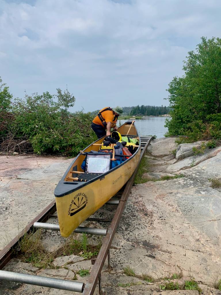
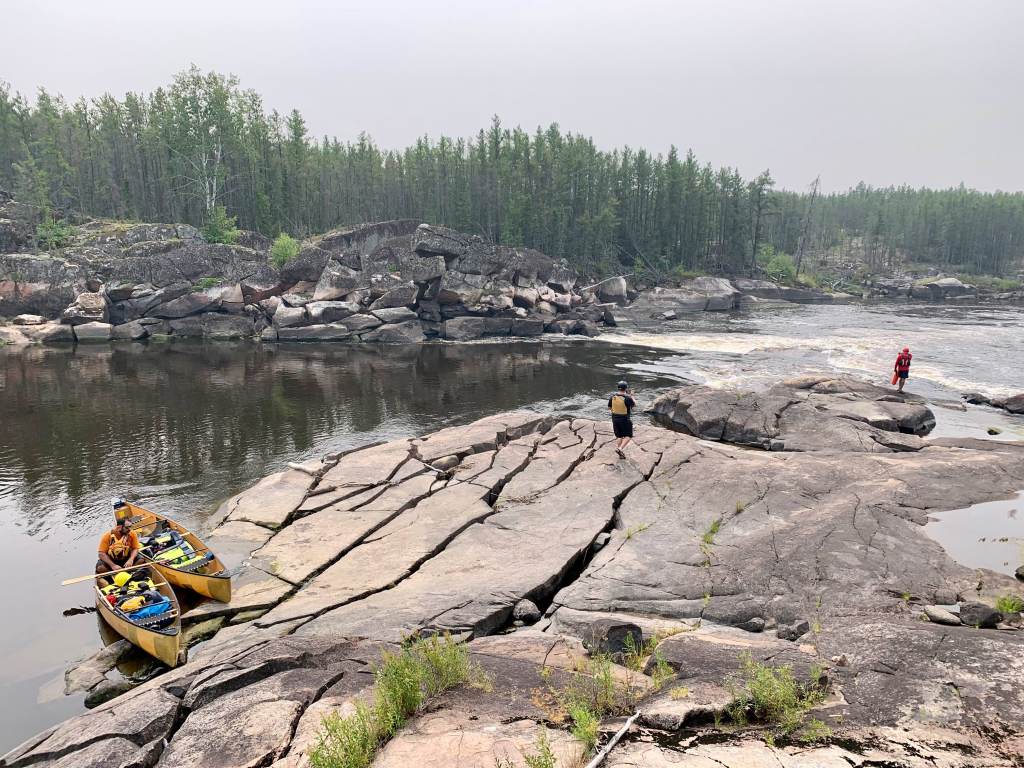
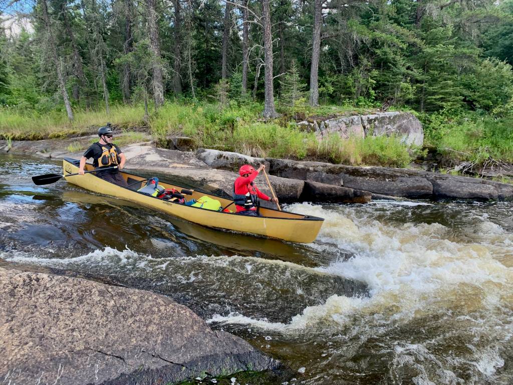
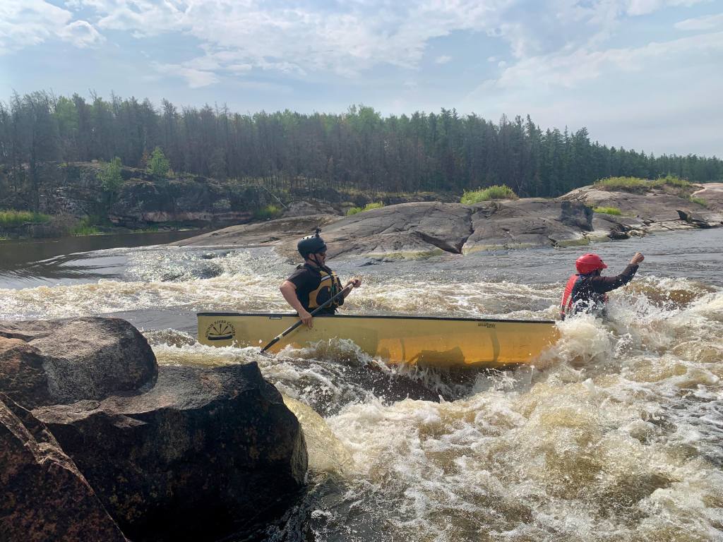
Soon we encountered the first of 77 rapids found along the portion of the river we planned to paddle. This rapid, marked as rapid #10 in Hap Wilson’s definitive guide to the river, “Wilderness Rivers of Manitoba”,[1]bears the unique feature of a boat ladder. The contraption, which includes a series of rollers spanning a steel rail, is designed to assist patrons of a nearby flight-in fishing outpost in transporting their tin vessels downstream. We happily made good use of the ladder to avoid the carryover.
A kilometre or so past rapid #10 we approached a sign marking the Manitoba-Ontario border and stopped here to savour the relatively rare experience of paddling across a major jurisdictional boundary.
Having now passed into Atikaki Provincial Wilderness Park, we discovered a plaque at the bottom of the next rapid (#11), celebrating the designation of the Bloodvein as a Canadian Heritage River. The plaque read: “Over 100 rapids and falls, cryptic pictographs on silent rock faces and a profound sense of wilderness – these are the contributions of Manitoba’s portion of the Bloodvein River to the Canadian Heritage Rivers System. The Bloodvein’s unique natural values are enhanced by the opportunity its timeless setting provides to recreate the feelings and challenges which faced early Canadians long ago. The perspective gained through experiencing the natural forces of wind and rapid, and the gentler force of constancy within renewal, bring sharply into focus the priceless heritage the Bloodvein River holds in trust for the nation.”
As we read the plaque, a deep tremble of thunder rumbled in the grey distance behind us, and we decided to move onward.
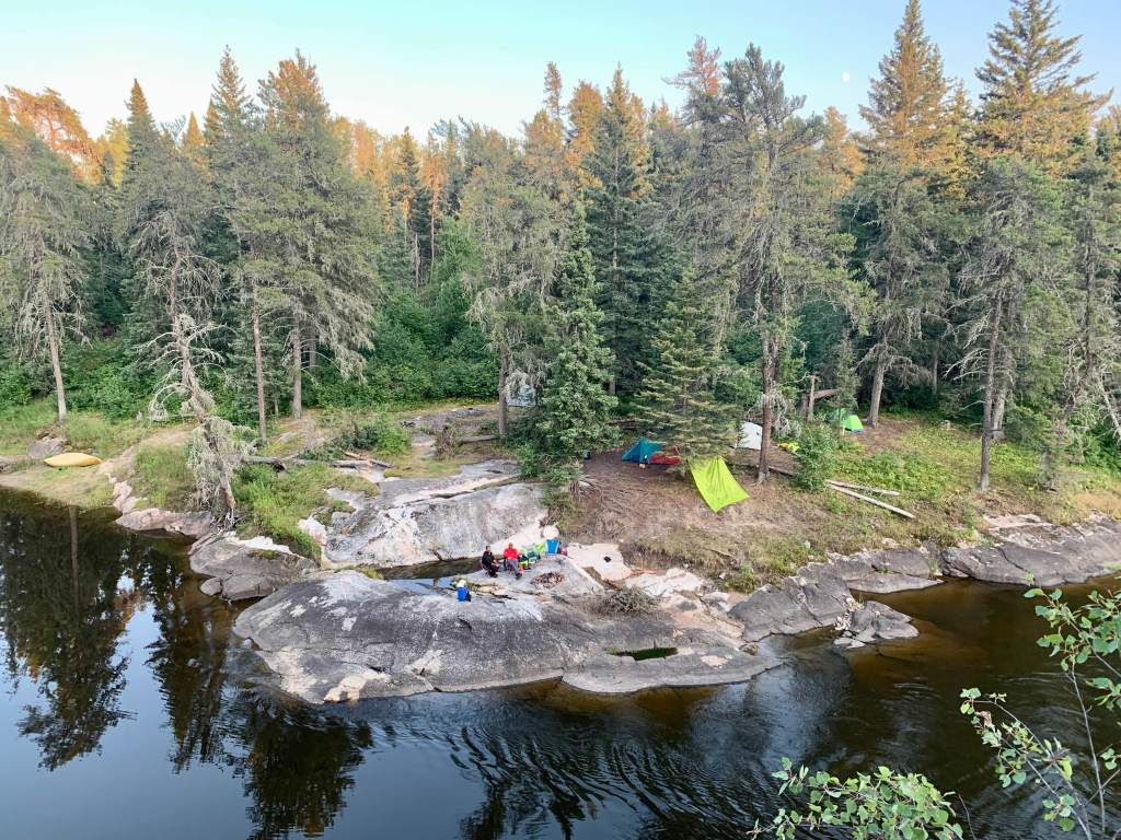
We paddled quickly to Moosebone Rapids (#14), passing by river otters playing in the water and bald eagles drifting in the sky. Though the thunder seemed to loom in the distance without advancing, we opted to set up camp here to avoid the risk of getting caught in the storm. We spent the remainder of the afternoon paddling and fishing the rapid, catching a walleye on virtually every cast.
Late in the day, the slow-moving thunderstorm finally caught up to us and sat over our campsite for several hours, well into the night.
Day 2: Moosebone Rapids to Stonehouse Rapids (23.5 km)
In the morning, with puffy grey and white clouds dispersed across the sky, we set off down river. We first paddled an easy class I rapid (#15) and portaged and lined two more (#16-17) marked as do not run (DNR) on our map, before arriving at Nut Cracker Falls (#18). The land opens up at the bottom of this picturesque falls as the river enters Bushey Lake, the first of three remaining lakes on our route.
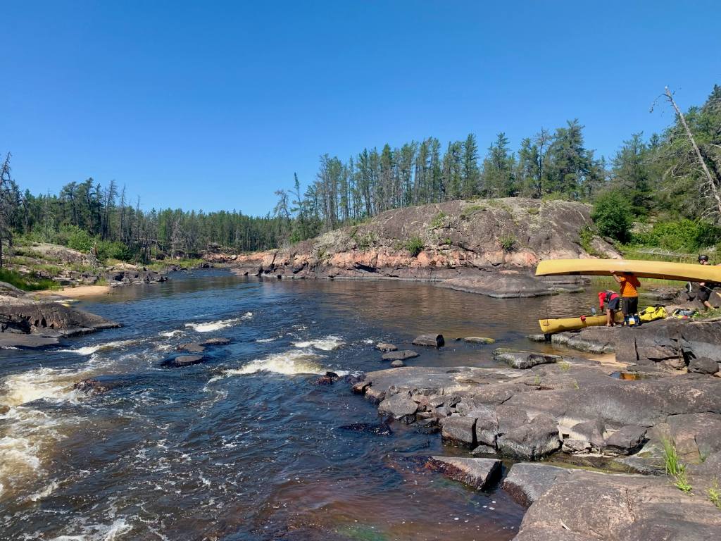
One of the primary characteristics of the Bloodvein is the quantity and frequency of its rapids, which span the full spectrum of difficulty. However, the consistent presence of portage trails, opportunities to line/wade and ‘pool and drop’ nature of the river, mean that the route can generally be paddled by those with any level of whitewater experience.
By the end of our journey we had run approximately 40 rapids along the route and likely would have opted to run an additional five or six, had we used plastic whitewater boats as opposed to the less rigid, but lighter kevlar boats supplied by our outfitter. In time, we would generally agree that the trade-off of skipping a few runnable rocky rapids for easier overall portaging was acceptable given the sheer number of portages on the river.
After portaging another DNR, known as Bruise Easy Falls (#19), we spotted a number of pictographs on the cliff face to our right, including thunderbirds, a snake, a figure in a canoe, and what Dewdney refers to as a “bird man” – an interesting humanoid figure with outstretched arms and a triangular body.
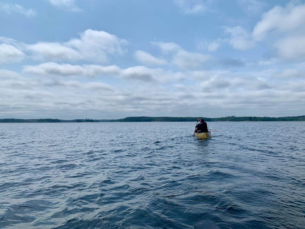
The river soon widened again into a long channel speckled with islands, known as Stonehouse Lake, where we encountered several pelicans and bald eagles.
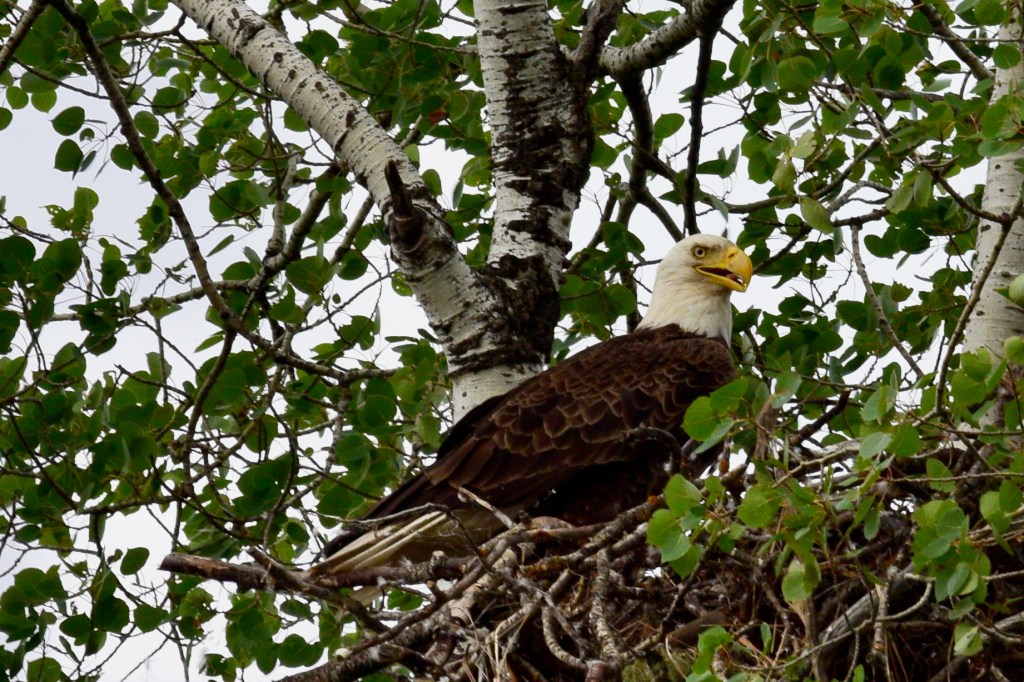
At the lake’s northwest end is Stonehouse Rapids (#21-23) – a series of two impressive waterfalls that cut dramatically through the shield followed by a class III rapid, where we pitched our tents atop a broad flat, pine-speckled outcrop. In one of the trees here, we found a large eagle’s nest occupied by mother and her fledgling.

As we ate dinner, thunder once again crept over our campsite and we were suddenly hit by strong, swirling gusts. Lightning flashed constantly overhead and a torrential rain pummeled our camp.
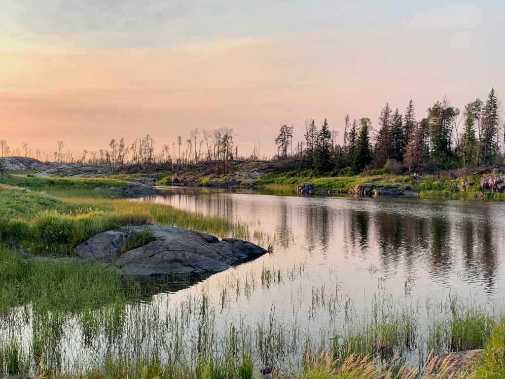
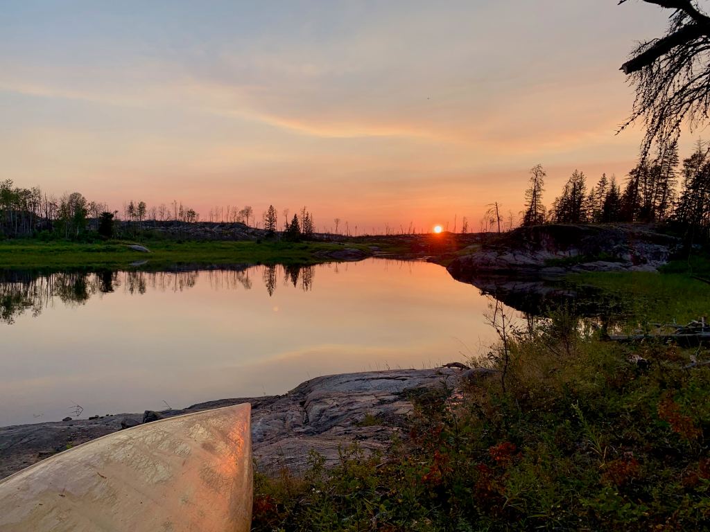
By 9 p.m. the sun had emerged to yield a pale sunset that tinted the air orange and painted a faint rainbow on the southern sky.
Day 3: Stonehouse Rapids to South of Gooseneck Rapids (29 km)
The morning changed rapidly from calm and clear to overcast with relentless headwinds from the west. These winds, which blow hard off of Lake Winnipeg, are common impediments to travel on all the boreal rivers in this region.
Past rapid #24 we entered into a large burn for the first time on the trip. Open rolling white rock barrens, stripped clean of foliage by the prior years’ fires, were the dominant feature of the landscape. The portage around rapid #25 brought us sharply up to a scorched plateau above the river. Lush, green shrubs under the dead trees of the plateau endowed the otherwise colourless grey landscape with colour and life.

After stopping briefly for lunch at X-Rock Rapids (#26) we set off again into strong mid-day headwinds that we would battle for the remainder of the afternoon.
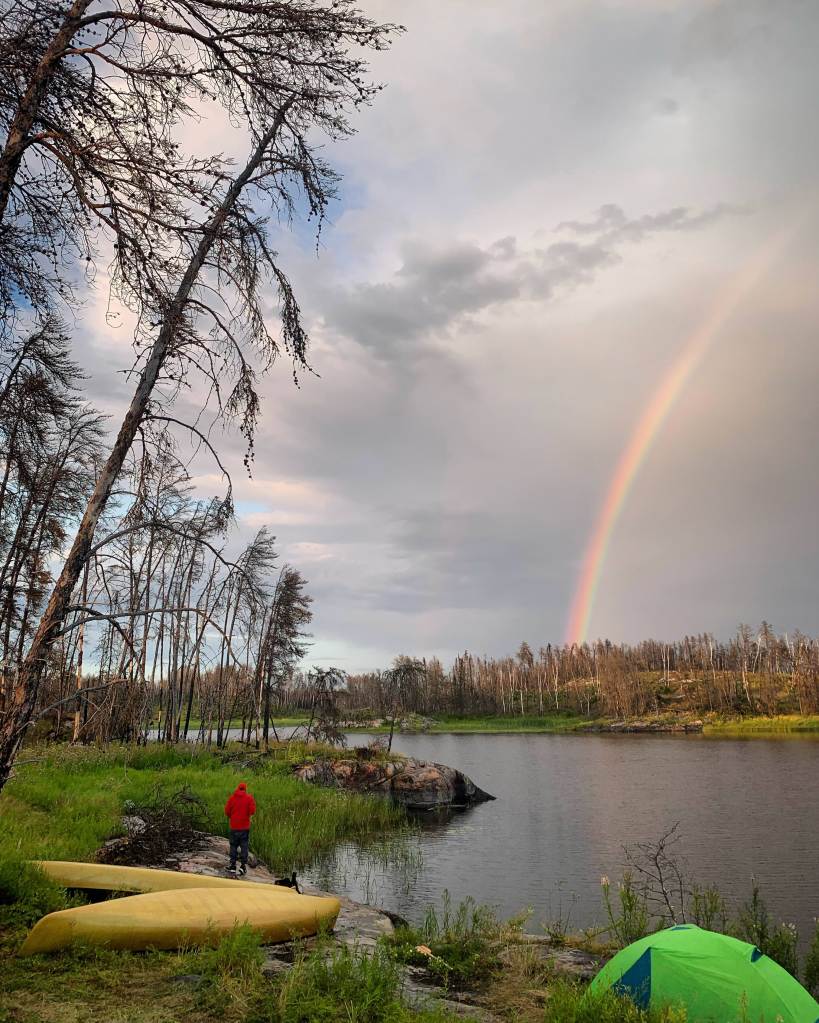
With evening approaching and our energy spent, we found a viable site on a burnt island south of Gooseneck (Nekesepe) Rapids. The site was flat and grassy, but covered with blackened trees, which would have provided a significant deadfall hazard in high winds. Given the lack of alternatives we settled for the site, though placed our tents away from the worst-looking trees.
At dinner, as I cooked bannock over the fire, another late day rainfall swept over our campsite, leaving behind a brilliant rainbow before sundown. This colourful spectrum of light arced delicately over the largely blackened landscape, illustrating the contrasting sources of beauty that are so present this land.
Day 4: South of Gooseneck Rapids to Red Rock Café (18.6 km)
Downstream from our campsite lay Gooseneck Rapids (#29), a stretch of water that takes the distinct form of goose’s neck as it curls around a bend in the river. The 450 metre (m) trail around the rapids – one of the longest of the route – cuts through a tangled mess of burnt trees, over rock barrens and past clusters of multi-coloured wildflowers before meeting back with the river.
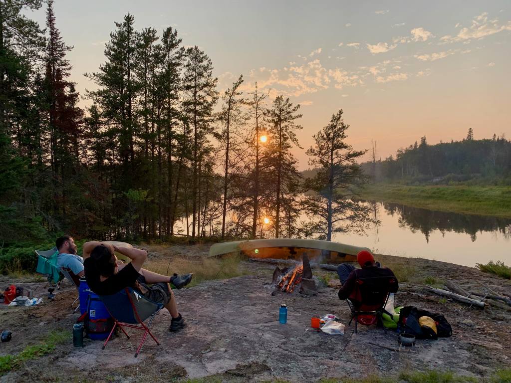
Further along we opted to paddle a thrilling class III chute (#31) and lengthy class II rapid (#33), before arriving at the “Red Rock Café” campsite, where we would stay for the evening. This campsite, which lies at the junction of the Gammon River, is named for the red granite cliff face that sits over the river from the campsite.
As dusk fell, with a campfire ablaze and the cliff face across the river shrouded in darkness, a remarkable scene unfolded. Thousands of white mayflies emerged to float silently through the air over the river like fluffy snowflakes. In time, fish noticed the presence of these creatures and a frenzy of splashes erupted wherever the insects drifted too close to the water’s surface. Above this, swallows acrobatically snagged the hovering insects in mid-flight. As we observed this sudden feeding frenzy, a deep swooshing of wings sounded through the air above us, just out of arm’s reach – a squadron of pelicans had cruised over our heads in formation and were now quickly making their way up river.
Day 5: Red Rock Café to Okeegee Falls (27 km)
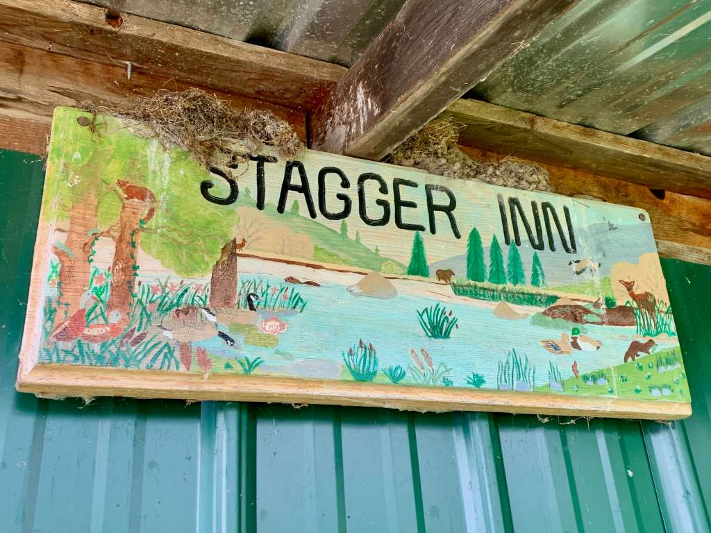
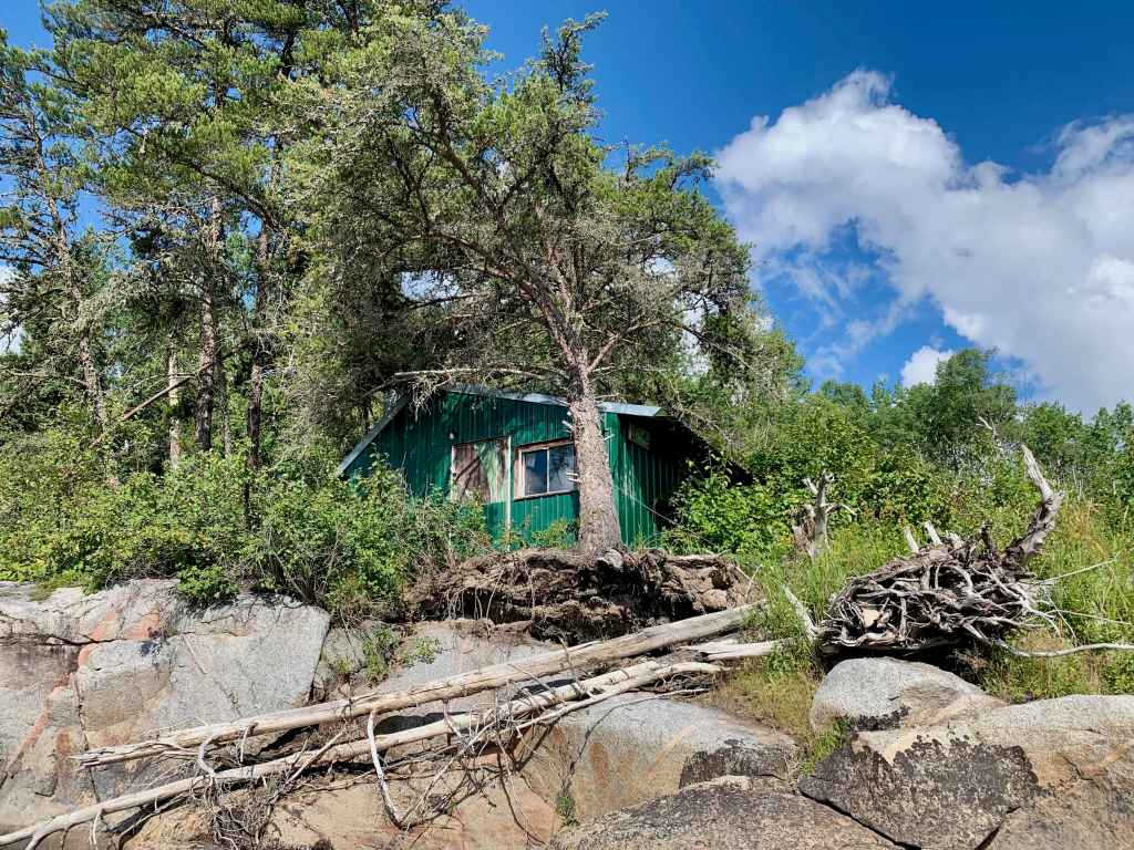
We started a sunny day of paddling by running Rapid #34 and soon arrived at the Bennet trapper’s cabin, also known as the “Stagger Inn”, as suggested by the beautifully painted sign that adorns the cabin’s exterior.
Up until very recently, the cabin had been kept in immaculate condition, provisioned with everything needed for an extended stay in any season (wood stove, snowshoes, ice auger, lanterns, traps and snares – even a generator to operate basic electronics).
Unfortunately, the contents of the cabin were in disarray owing to the work of a bear or other wild animal that had somehow gained access to the dwelling. We found that a tree had also fallen and struck the cabin’s exterior, though apparently had not significantly damaged its structure. Before leaving, we signed a guestbook and noted that a few other groups had paddled the river this season.
Past Rapid #37, the land transitions briefly from a rocky, winding and narrow river to a broad, grassy and prairie-like marshland. Here, about half way through the marsh we found evidence of an old structure on the shore, as well as mooring rings and bundled beams.
At rapid #38 we successfully paddled a large wave train then proceeded down a northern fork in the river toward Rapid #39, where Lachlan would bag his first channel catfish of the trip.
Prior to emerging from the northern fork and rejoining the main river, we also came to a large chute with a five-foot drop (Rapid #40) that was too tempting to avoid. Despite taking on a lot of water, both boats were able to emerge from the run without swamping.
We soon reached our campsite, “The Overlook”, at Okeegee (Eddying) Falls (#46), which afforded a terrific east facing vista atop a large open clearing in the forest.
Day 6: Okeegee Falls to Chap Falls (22km)
For the first time on the trip, we awoke to a thick, sun-obscuring haze caused by distant fires. The day offered a break from rapids with over 20 km of flat water, including a 1.5 km crossing of Kautunigan (Perch Dish) Lake, en route to camp at Chap Falls. Luckily, for much of the day the northwestern winds maintained a tame demeanour and we took advantage of the calm conditions to explore this interesting portion of the route.
At the northern end of Kautunigan we spotted some faded pictographs and searched, in vain, for the supposed ruins of a fur era trading post at the confluence of the Sasaginnigak River. Shortly past this tributary, we came upon an old fly-in hunt camp on the river’s north shore accompanied by a few make-shift moose hangs further down river.
We arrived at picturesque Chap Falls late in the afternoon. Though the campsite here was of high quality, recent fires had effectively killed its trees and we hesitantly pitched our tents amongst a patch of dead, fire-blistered pines.
Day 7: Chap Falls to Dancing Fire Rapids (21 km)
We departed Chap Falls at mid-morning opting to run the lower half of the rapid. Evidently, the grey haze of the prior day had not lifted and we resigned ourselves to another day of paddling through smoke. This would be offset by relatively fair conditions and excellent whitewater canoeing.
Our first test was an easy centre run through Rapid #49 followed by a massive, high-volume class III at Sekak (Skunk) Rapids (#50). Kevin and I scouted the run from the right before making the decision to give it a shot, knowing that the rapids’ central standing waves could well swamp us. After taking a slight angle to the approach from river right, we blasted through the chaos of the centre and slayed any nerves we held at the top.
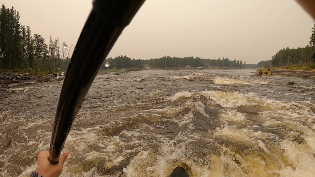
We now entered the Omacheetayshemowin (Dancing Fire) Rapids section of the trip, which spans rapids #53 to #58 and is known for the beautiful stretches of red granite that line this serpentine portion of the Bloodvein. Here we ran rapids #53 to #56, before pulling off the river to scout #57 (class III) from an island in the middle of the river. In preparation for our trip down the Bloodvein, I had read many journals and trip reports of the route and recalled this rapid well, with its broad width and long, devilish tongue. We determined that we would not let the opportunity to challenge this run pass and dashed off the island into the middle of the tongue and through its large standing waves to emerge victorious in the eddy below.
Toward the end of the day, we found an excellent campsite atop rapid #58 and settled in for the night under a smokey orange moon.
Day 8: Dancing Fire Rapids to North of Kakasannapeekak Rapids (24 km)
The group was somewhat surprised to awake to an early morning thunderstorm that struck our camp with a good deal of rain. Fortunately, the storm had the effect of clearing the haze from the sky and improving our air quality.
Within the first few kilometres of the day we encountered an additional six rapids that we variously paddled or portaged. After emerging from the last set of this section we were greeted by a large female moose and her calf grazing peacefully along the north bank of the river.
Past rapid #65 the river forks around a large island. Here we opted to diverge from the river’s main channel and take the northern fork where we bumped and scrapped our canoe on the river’s bottom while negotiating two class I rapids (#69 and #70). Ultimately, we made it through and rejoined the main river on approach of Manitou (Gods) Rapids (#71).
The river here veers to the northwest and holds this general trajectory through scorched barrens for much of its final ~80 km. Judging by the lack of vegetation and stripped, arid rock, the fires through this section of the river must have been especially extreme.
In the case of Kashaweposenatak “Unloading” Rapids (#72), which appeared to be the nastiest rapid on the river, the fires had destroyed the portage trail on the western shore. This relegated us to clambering over rocks on the river’s eastern side, as the thunderous torrent roared its mighty song feet away.
Past Kakasannapeekak “Sharp Rock” Rapids (#73) we were able to find an overgrown, west-facing campsite that we quickly revitalized.

Before sundown, Lachlan and I paddled across the river to explore the broad, open, fire-ravaged landscape that sat adjacent to our site. Here we found rippling hills of ravaged brown and grey rock, almost entirely devoid of trees, with only a few tall, defiant, limbless trunks sporadically dotting the landscape. To many this landscape would have appeared desolate. However, tremendous signs of rebirth persisted. Green brush enveloped the black logs that littered the ground in all directions. Countless bees and other pollinators hummed through the pale late afternoon air, passing from flower to flower in a boundless, multi-coloured field. Trumpeter swans floated slowly in the waters nearby. On returning to our site, the sun dropped low on the horizon and cast a pastel light over the burnt barrens – the land was very much alive.

Days 9-10: North of Kakasannapeekak Rapids to Namay Falls (27 km)
Though we were in no hurry to make distance, we established a tentative objective of reaching Namay Falls – some 25 km away – and set off through the burnt land under a blistering sun.
The river’s apparent low water levels were evident at Kineewi (Golden Eagle) Rapids (#74) as we noticed driftwood perched on rocks several feet above the water.
On exploring Little Birch Falls (#76) at lunch, we found a weather-beaten federal survey marker from 1925, embedded in the granite near the falls. The marker read: “Dominion of Canada – 7 years Imprisonment for Removal”. Such surveyor markers were placed throughout the country in the decades following confederation to establish a system for land description in Canada.
Beyond Little Birch Falls, the Bloodvein merges with a minor tributary known as the Kapeeskeekwaytekwayak Creek before moving through a grassy pasture-like landscape on approach of Ankuasi Falls (#79) – a picturesque DNR waterfall that splits an island.
We reached Namay Falls (#80) late in the day and with less than 30 km remaining and time to spare we decided that we would use a rest day here. The large, flat and open site is perched high above the falls on a bluff and provides an excellent vantage of the flowing river.
Our rest day at Namay was spent swimming in the eddies below the falls and exploring the burned forests around the camp, where we found the bones of a small teepee and a fire ring. In the evening, Lachlan caught a smallmouth bass, that we breaded and deep-fried in oil as a supplement to dinner.
Day 11: Namay Falls to Lagoon Run (18 km)
Upon waking up to a light rain with the rumble of with thunder in the distance we agreed to paddle as far as the conditions would allow. The Bloodvein River Bridge – our takeout point – was about 25 km away now. We aimed to put ourselves close enough to the bridge to get there easily in the event we faced weather delays or other externalities.
Past the first bend from Namay Falls we took the east channel at the fork in the river toward the Leyond River confluence. Given the low water conditions, we believed that this channel was preferrable over the shorter, but shallower, western fork.
On the eastern fork, we ran class I and II rapids (#81 and #82), then traversed a western fork around another large island and paddled the bottom half of Namay Rapids (#83 – class III) and ran rapid #84 (class II).
Given bursts of thunder in the grey distance behind us we opted to skip Akeeko Rapids (#85) and paddled quickly to Lagoon Run (#86). With gusts of wind slashing the trees above our site, we were each able to pitch our tents just as a brief, but hard storm rolled in.
Day 12-13: Lagoon Run to the Bloodvein River Bridge (7 km)
With only 7 km and one rapid to go, we moved off from Lagoon Run late in the morning, with clear skies overhead.
Slightly past Kaneeshotekwayak Creek we came upon the Bloodvein River hydrometric station – the chief source for gaining information on water levels for the route.[2]
Soon we approached and paddled a fun curling rapid (#87) – the last of the trip – and found a campsite 600 m from the Bloodvein bridge, which could be seen from our site’s rocky shoreline.
In the early evening, we heard the yelping of coyotes over the river; a beaver swam through the placid waters of the Bloodvein; an eagle – perhaps the seventh we had spotted that day – flew overhead.
In the morning we packed up and loaded our boats as Goldseekers Outfitters arrived across the river. As we approached the bridge, we noticed beautifully illustrated plaques on its abutments. On one plaque was the head of an eagle emerging through the clouds and into the rays of the sun cast over the land. On another, a collage with two eagles, a large wing, a teepee, a sun and a moon over a wild landscape. A third plaque reads:
“Welcome to the Bloodvein River
Deep in the Heart of the Land
Canadian Heritage River – Designated 1987
Home to Bald Eagles, Black Bears, Walleye, and Sturgeon”.
Epilogue
During our trip down the Bloodvein I read a collection of essays by the late nature writer, Barry Lopez, entitled, “Embrace Fearlessly the Burning World.” This posthumous compilation spans an array of themes, but is often bound by a message that would resonate well with those who find meaning in exploring wild places; be fully attentive in the land, embrace its creatures, its histories, its stories – pursue its infinite secrets. Listen carefully.
In one of his essays, Lopez writes about the life of rivers and their mysteries – rivers wild and free – just like the Bloodvein:
“The bass voice of the river can be found in the cataract, the plunge of a waterfall, and in the hollow cavitation of a rapids; but the river speaks, too, with the susurrations, the gurgle and the delicate seethe of the narrower and shallower runs of water.
…[This] is to say nothing of the beings living comfortably in the river – trout, caddisfly larva, behemoth sturgeon (a kind of once-upon-a-time-fish)… or those who fish in them like the merganser and the great blue heron…
It is to say nothing of how darkness does not stem their flow, for they are sleepless, or how sunlight lambent on the surface strains the human eye, which can find no detail in the molten light. It is to say nothing of the sudden clack of cobbles shifting on the river’s bed in the middle of the night, of the way rain hammers the surface flatter, or how soundlessly it accepts the fall of snow…
This is to say that it is kind of an animal itself, containing other animals, and abetting lives of still others, like the osprey and the mountain lion sipping at its bank. It is to point out that rivers are older than humans… it is to say that despite our charts of cubic feet of flow per second, our topographic maps of the precise extent of their watersheds, our catalogs of their aquatic, avian and terrestrial denizens, we hardly know them.”
I will always remember the strange figures etched on the walls of Artery Lake, wondering who placed them there (the meaning of some will always be a mystery); the searing rainbow hanging over the charred landscape near Gooseneck Rapids; the silent flock of the shadowy pelicans drifting over our heads at dusk as the mayflies floated ever-presently in a soft flurry like snow; the boneshaking rumble of Kashaweposenatak Rapids; the bees buzzing between the wildflowers in the scorched barrens before sundown, slowly playing their role in rebuilding the forest on the ancient shores of the river that gives life.
[1] Note: this trip report frequently references rapids using the number system established in “Wilderness Rivers of Manitoba” (2003) by Hap Wilson.
[2] Note: the “low” water levels we experienced over the course of our journey had averaged approximately 29.2 m with a discharge rate of 33 m3/s based on data from this station.