Date Completed: August 2019
Difficulty: Intermediate due to wind/waves on large lakes and technical rapids
Method of Travel: Canoe
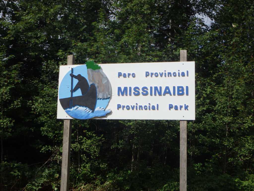
Region/Location: Northeastern Ontario Ontario; Chapleau Crown Game Preserve; Missinaibi Provincial Park
Trip Duration: Six days
Distance: ~85km total (~79km on lake/river; ~6km over 15 portages)
Loop: Yes
Fees/Logistics: Park permit/parking fees required.
Trip Journal:
Preamble
In the boreal highlands northeast of Superior, on the edge of Algoma, is a land of rugged adventure and romance. This country, where it has been spared from steel, is a lush, wilderness paradise that affords the type of quintessential setting that would be nostalgic and familiar to any Canadian: the hill-studded silhouette of the forested horizon, aglow in pink and gold with the last moments of the burning mid-summer sun; the air, sweet, with the fragrance of pine, and silent beyond the quiet murmur of a distant waterfall; two lonely canoes beached upside-down on the sandy shore, their slick hulls casting a reflection off the sky; three small tents nestled in the forest over a floor of pine needles, in their natural place amongst the spiring conifers; the ghostly smoke of a campfire hanging low and curling over the still air of the glassy lake; a dream-like world, which has no earthen match in tranquility or peace.
This is a scene that has been relived on the shores of Missinaibi Lake – the headwaters of the Missinaibi River – by the Algonkian peoples of the region, and traders, trappers and explorers alike since time immemorial.
In this country, northeast of Superior, is an intricate network of cold, dark rivers, lakes and fenlands, infused into a landscape dominated by rolling rocky hills and dark monolithic cliffs of gneiss and granite. The rock, everywhere, is adorned with dense and tangled swaths of balsam fir, spruce and pine. The trees, which cling resolutely to the rocks here, are thin, hardened and frayed from harsh winters, and garnished with long clumps of beard lichen.
Between the trees of this shadowy hinterland are healthy populations of moose, black bear and timber wolf. Beavers, otters, lynx, martens and other small mammals thrive. In exceptionally small numbers, cougar and elk also call these forests home. Above, in the sky, red-tailed hawks and bald eagles soar. In the confines of the forest, gray jays and owls flourish, and on the lake, the loon reigns.
Humans have inhabited this forbidding domain for some 7,000 years. The ancestors of the Michipicoten Ojibway and other First Nations communities established intricate canoe routes throughout the region to accommodate trade and build relationships. Relics of those days – including a number of incredible pictograph sites – are abundant and can be found to this day.
In the 1660s, Pierre Esprit Radisson and Medard de Groseilliers became the first Europeans to travel the route between Lake Superior and James Bay via the Michipicoten, Missinaibi and Moose rivers. Over the following centuries, the fur trade flourished and a trading rivalry between Hudson Bay Company and Northwest Company intensified. The route between Superior and James Bay became one of the most important trade routes in Canada. At various intervals, several key posts were established, relocated and razed along is shores, including key strategic posts Hudson Bay Company posts at Missinaibi and Brunswick lakes.
In 1925, at the culmination of centuries of fur exploitation, the Ontario government created the Chapleau Crown Game Preserve in the highlands northeast of Superior to protect all animals from hunting and trapping (fishing continues to be permitted). At over 7,000 square kilometres, the Chapleau Preserve is the largest animal preserve in the world. Despite restrictions on hunting and trapping, the logging industry continues to operate broadly with the confines of the preserve.
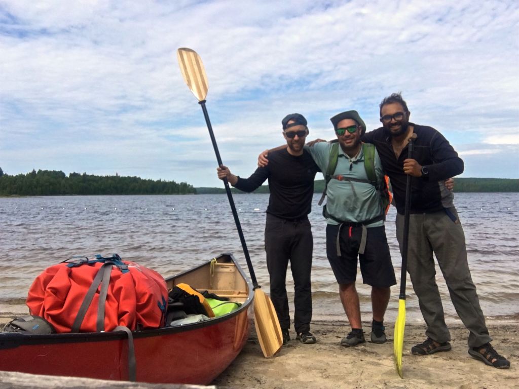
Our plan to paddle through the Chapleau area came together only a few days before we disembarked in early August 2019. Our group of three (Kevin and Jono in one boat and I, solo, in another) had originally planned to canoe the Sand River in Lake Superior Provincial Park (not far from the mouth of the Michipicoten River). This endeavour would have relied on a reasonable amount of rainfall prior to the trip to guarantee that the river would be navigable. Determining that there was a good chance that we would be forced to drag our boats down the dry riverbed of the Sand, I opted to alter the itinerary to a route in the Missinaibi Lake region.
We planned to paddle the historic Shumka-Missanabie route beginning at Bolkow Lake and continuing, over six or seven days and 90 kilometres, through Abbey Lake, over the height of land, through Little Missinaibi River, Missinaibi Lake, and Dog Lake before ending at the town of Missanabie (a small community at the terminus of Highway 651). The route is purported to be one of intermediate difficulty, especially being that the lake system outside of Missinaibi Park is not well travelled and requires passage over several very rough/overgrown portage trails.
The logistics of route are also confounded by the fact that the trip is not a loop. Traditionally, canoeists park their vehicles in Missanabie and take the “Budd” train (operated by Via), 25 kilometres south to Bolkow Lake with their boats and gear to set off. Alternatively, it is possible to take a series of rough logging roads off Highway 651 at Dalton directly to Bolkow Lake, park a vehicle there, and shuttle between Missanabie. Prior to the trip, I spoke to the Ministry of Natural Resources and Forestry (MNRF) District Manager about the quality of those roads and he advised that they were rough, likely passable, but that we should use them at our own risk. While the Budd train would have been the preferable means of accessing the lake system, the train schedule did not align with ours and we opted to attempt the logging road.
Day 1 (August 5) – On the Road
We departed for the north on August 5, 2019. This was the first time in my life that I left for a camping trip under a cloud of morose. My wife had given birth to our son, Raven, in the Spring and this was the first time I would be away from them for an extended period of time. In contemplation of this, I transcribed the following words, from Sam Cook’s “Quiet Magic”, into the first entry of my trip journal:
“There would be no Quiet Magic, nor stories for it, without the support and understanding of my wife… Together we made compromises that permitted so many of my trips and still kept some sense and order in our lives. I thank her not only doing what needed to be done in my absence, but for knowing why I needed to go in the first place.”
The drive to the community of Missanabie from Toronto is about 10 hours. By 8pm we found ourselves travelling down the Dalton logging road (just south of Missanabie) toward the put-in at Bolkow Lake. The road deteriorated quickly and within minutes, the generally flat dirt road turned into a rugged washboard dotted with an ever increasing array of large car-wrecking boulders. About halfway to the lake we stopped to assess Kevin’s hatchback, which had apparent ball-joint damage. While my 4×4 would have been capable of pressing on, we wisely decided to turn back and rethink our game plan to avoid trip-ending damage to Kevin’s car. Those interested in driving to Lake Bolkow via the Dalton logging roads should not attempt the drive in a sedan.
With dark setting in quickly, we abandoned the Shumka-Missanabie route in favour of a week long loop trip beginning and ending at the Barclay Bay Campground at Missinaibi Provincial Park. The new plan would have us travelling west on Missinaibi Lake (also known as “Big Miss”), and south via Trump Lake and Elbow Lake to Little Missinaibi Lake. On Little Missinaibi we would paddle around the lake’s full circuit , exploring its innumerable channels and inlets, before returning to Big Miss via the wild Little Missinaibi River.
The route would be approximately 85 kilometres in distance and include big stretches on open water, navigation of rapids of unknown size/difficulty and a number of portages of unknown quality. MNRF and park staff that I had corresponded with previously, indicated that the sections of the park south of Big Miss were seldom travelled and not recently maintained. They noted that the difficulty of the rapids on the Little Missinaibi River can also vary dramatically depending on water levels.
The land was now fully overcome by the darkness of night and a thick fog had settled in.
The drive to Barclay Bay from the intersection of the Dalton logging roads and Highway 651 would take about three additional hours and involve a backtrack through the town of Chapleau. Worst of all, the 80 kilometre road between Chapleau and Barclay Bay was another dirt logging road, which we could only assume was in better condition than the one we were leaving.
We drove very cautiously south on the 651 and 101 to Chapleau. The fog coupled the late hour had created an elevated danger of an animal collision. Along the course of our drive toward Chapleau, we saw no fewer than nine moose. In one case, a moose dashed in front of our vehicle causing me to brake suddenly.
The condition of the logging road past Chapleau was rough, but still far more civilized than the road we had attempted off the 651. Driving this winding dirt road in the dark was difficult and treacherous. Another animal, this time a bear, crossed the road in front of us causing us again to slow down – Crown Game Preserve indeed. Before long, we were pulling into Barclay Bay. It was now well after midnight and we were thankful to be off the road.
Barclay Bay Campground sits on the south shore of the east arm of Missinaibi Lake. The campground is evidently a popular launching point for fishing trips, but seems underutilized for drive-in camping or back country canoeing (likely due to the Park’s isolation).
We found a vacant site, Jono and Kevin popped up their respective tents, and I fell asleep in my car – tired from the long journey.
Day 2 (August 6) – Barclay Bay to Whitefish Falls
I woke up at about 9am and started preparing my gear. Jono had been up earlier and had already spoken with one of the park rangers about our plans. The ranger indicated that Big Miss is usually calm in the morning with a stout southwest wind throughout the rest of the day. He also reaffirmed that our planned route is not well-travelled, but that a camp group of about 16 people had gone through the area earlier in the summer.
Our goal, today, would be to paddle about 13 kilometres west on Big Miss to the campsite by Whitefish Falls.
In picking up our permits at the ranger station, we had an opportunity to learn a bit more about the route. The ranger told us that most people do not travel as far as the falls in one day. This is because winds on the lake are a routine barrier to paddling any reasonable distance. He noted that a 30 kilometre per hour sustained wind could kick up waves of three feet or more. Luckily for us, the day’s forecast called for mild southwest winds of 11 kilometres per hour.
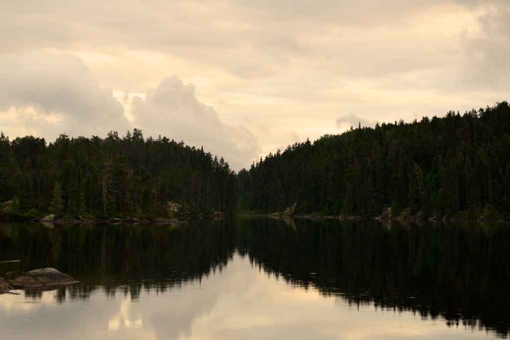
Big Miss is an exceptionally large and beautiful forked lake, measuring 43 kilometres between its furthest points. The lake has a tremendously rich history and includes several points of interest. Of note, a number of remarkable indigenous pictograph sites can be found here, including the large, vibrant and famous collection at Fairy Point. The lake also includes an abandoned Hudson Bay Company outpost, an abandoned logging camp, and old growth pine stands.
Sadly, in 2005, the lake was also the site of one of the few fatal bear attacks in Ontario’s history. The provincial park – which, again, falls in the middle of the largest furbearing animal preserve in the world – unsurprisingly continues to have a high-concentration of black bears. Campers entering the backcountry in this area should be thoroughly familiar with proper procedures for minimizing the risk of negative bear encounters.
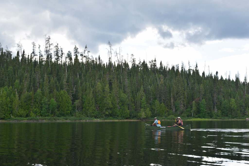
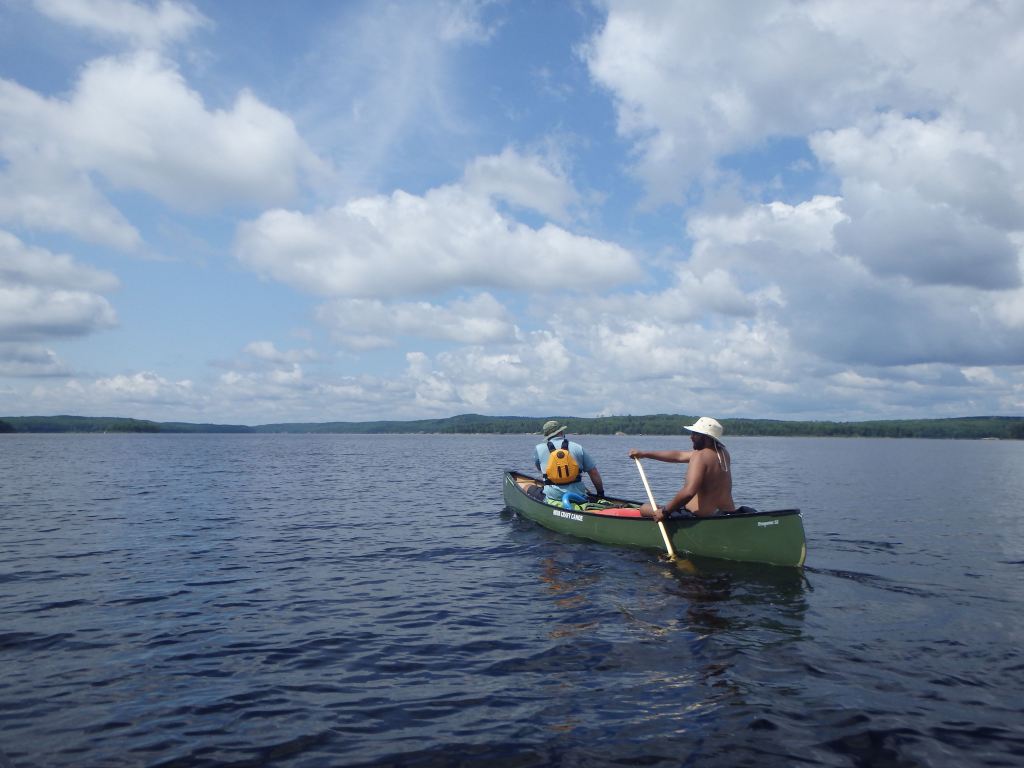
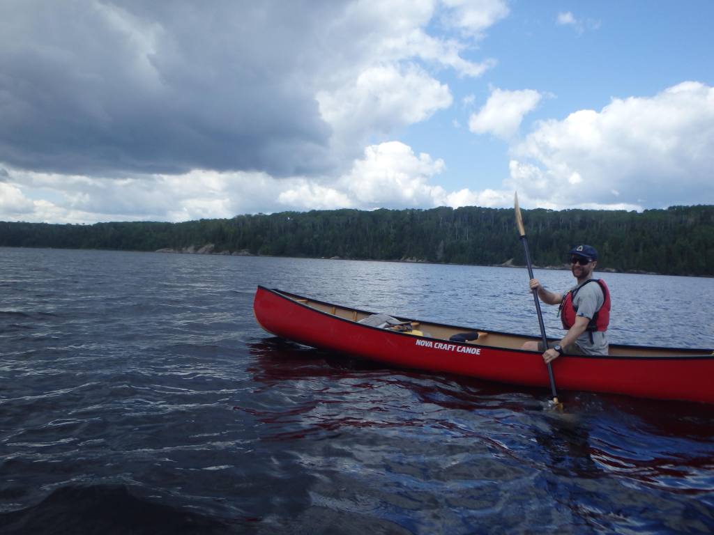
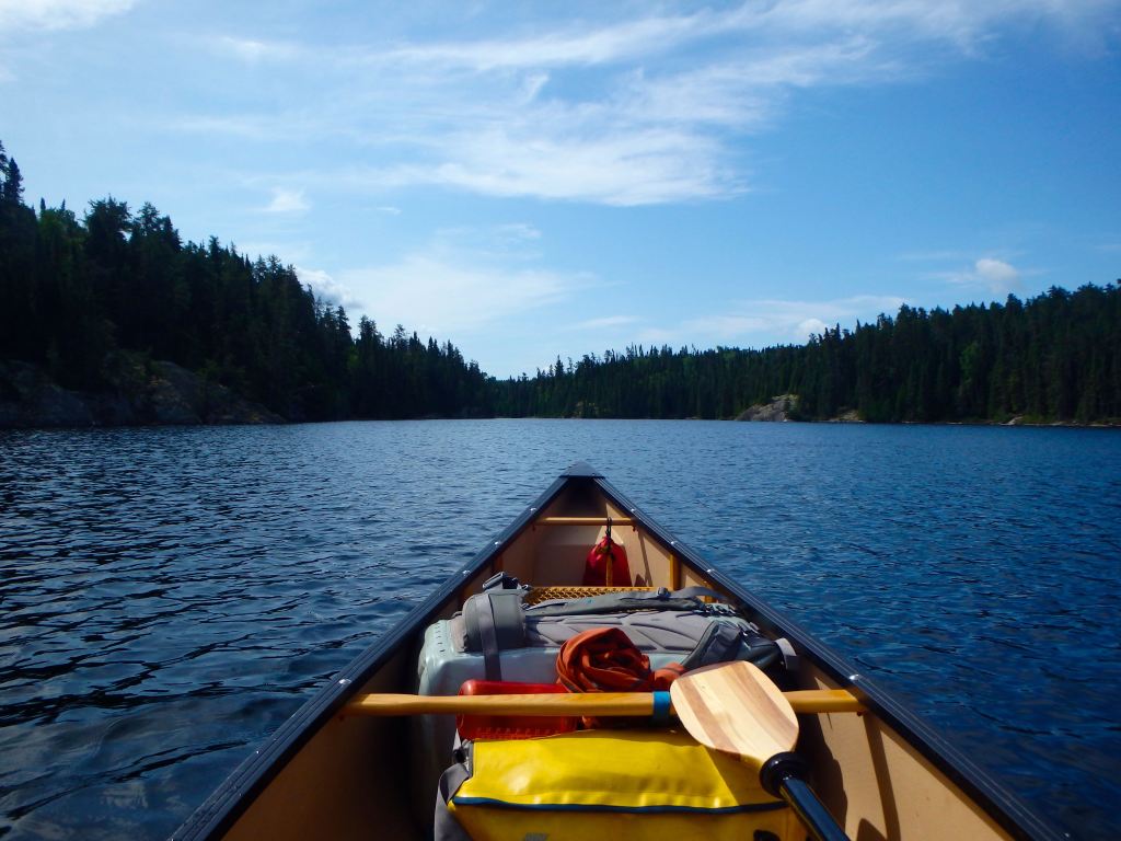
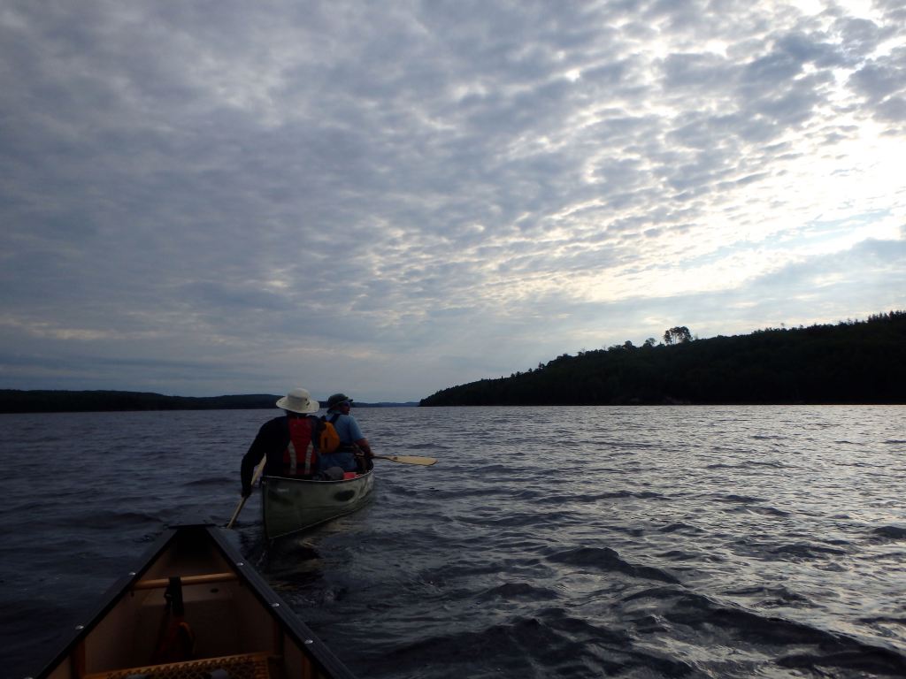
With fair conditions in place and a monotone grey sky above us, we set off in our canoes from Barclay Bay toward Whitefish Falls. On the water it was possible to get a meaningful impression of the sheer expansiveness of the lake, which seems to wind endlessly in both directions. Both the north and south shores are lined by thick boreal forest and majestic hills. The day’s trip west on Big Miss involved a few open crossings that were somewhat arduous in my solo boat, but managed in the end. Our pace was about four kilometres per hour paddling into a headwind.

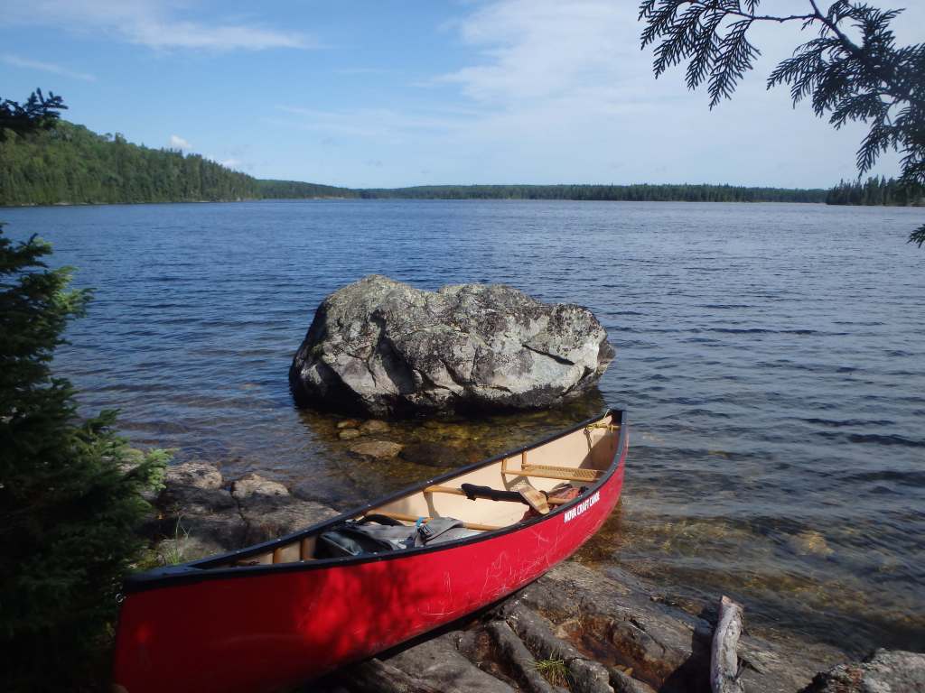
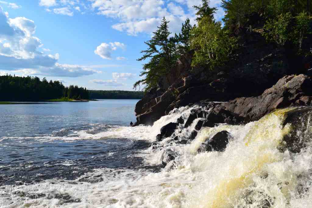
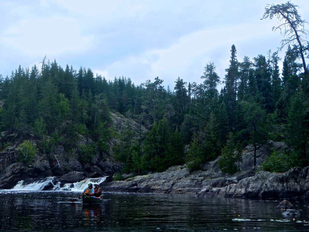
The cove at Whitefish Falls is beautiful and serene. Even in poor weather, this cove would offer excellent reprieve to any vessel on the big lake. The campsite here is about 30 metres west of the cascading falls, has a small beach access, beautiful northern vista and room for approximately three small tents.
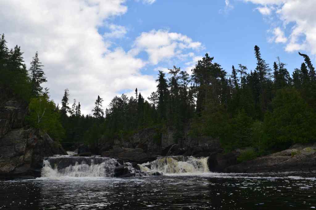
After a late lunch and setting up our tents, we found a trail to the falls and hiked over to take a look. Whitefish Falls, which marks the terminus of the Little Missinaibi River, is a winding, cascading waterfall with numerous drops and chutes. The river is surrounded by tall spruce trees and the shoreline flush with clusters of ripe blueberry plants. In exploring the falls, we found a small memorial to a Vietnam War veteran and Michigan Conservation Officer named, Derryl James Jones.
Back at camp, we set a fire and sat out on the small beach watching the colours of sundown intensify before fading to darkness and giving way to the stars. A beautiful day in the wild.
Day 3 (August 7) – Whitefish Falls to Trump Lake
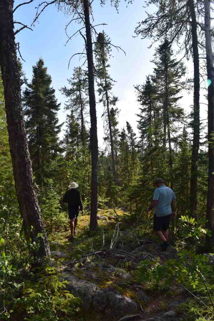
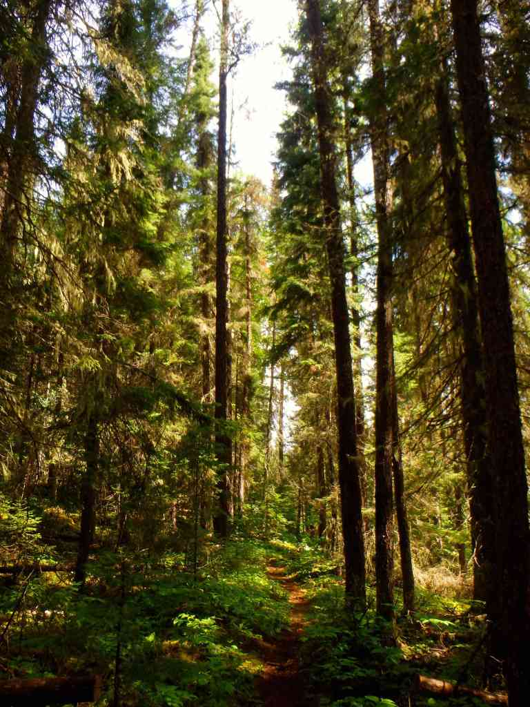
With clear skies to greet us in the morning, we took our time packing up camp. Our objective today was a relatively leisurely trip upstream on the lower Little Missinaibi River to Trump Lake (about 10 kilometres away). Immediately, from the cove at Whitefish Falls and our campsite, there is a one kilometre well-travelled portage that crosses through a section of an old burn. A forest fire swept through the entire south region of the park between Big Miss and Trump Lake in 1987, and over 30 years later, signs of the burn are still evident along the weather beaten apex of this trail.
Back on the water we continued upstream and had made it to the next portage (170 metres around rapids) when dark clouds began to sweep in. It became increasingly apparent that rain was likely and we were still faced with a succession of mandatory portages around river obstructions and rapids before the final 1km portage between the river and Trump Lake.
It is worth noting that the Missinaibi 1 – Chrismar Adventure Map we were using as our primary navigational aid, while an excellent resource, had three minor errors with respect to portage distances and locations. First, the trail on the Little Missinaibi River south of Whitefish Falls marked as a 400 metre on the map is actually about 100 metres. Second, the subsequent 60 metre trail is marked on the wrong side of the river (we were able to line the boats up these rapids to bypass the trail altogether). Finally, the following trail marked as a 60 metre on the map is actually about 400-500 metres.
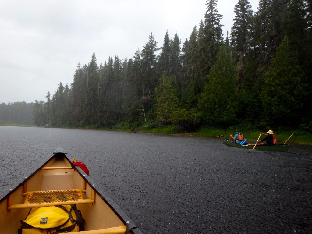
By the time we had made it to the 500 metre trail, which circumvents a small bouldery canyon, the rain had been pummelling us for about 20 minutes. There is something that is intrinsically beautiful about a hard mid-summer rain when travelling along a dark, winding, narrow river such as this. The river had been beautiful to this point – characterized especially by numerous chutes and channels of rugged rock and cobblestone typical of the Shield country. But the rain, on this day, added a dimension of austerity, gloominess and desperation that heightened our senses.
At the start of the Trump Lake portage, which passes through a small campsite, the rain finally subsided. The trail to Trump Lake begins with a steep and slippery climb up an outcrop before levelling out. The trail happened to be fairly overgrown with bramble and shrubs, and was obscured at times by blow-downs. We did our best to clean up the trail for future travellers.
Trump Lake is beautiful, open and surrounded by tall, scraggly pine trees. A slight mist hung over the calm dark waters of the island-freckled lake; skies above were still grey. Reaching this lake was a great reward following a rougher than expected day of paddling and portaging.
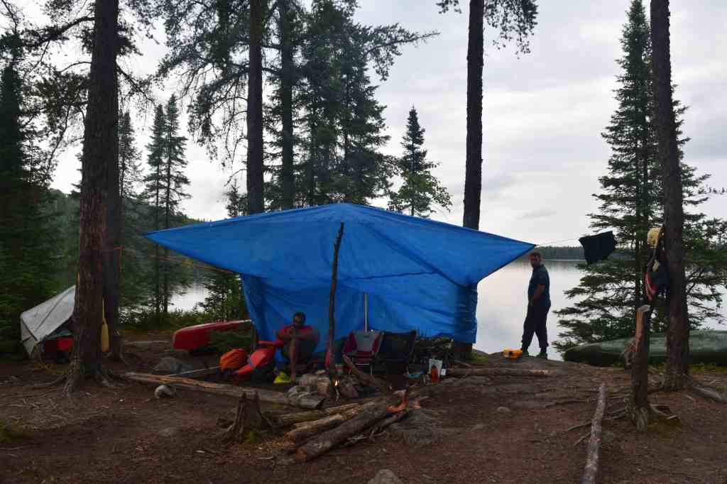
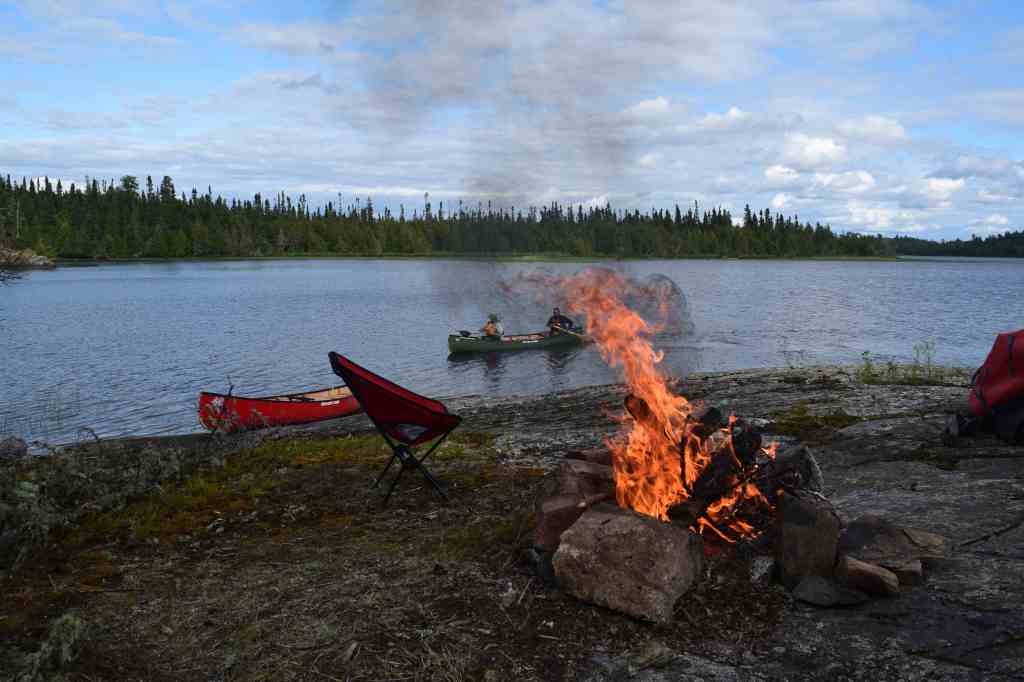
We wasted little time in launching our boats, as the deep rumble of thunder echoed in the distance. We made our way to the aptly named, Refuge Island, and began to unpack our gear. This small flat island is located at the south end of Trump Lake and contains space for approximately 10 tents amongst its large pines.
Kevin wisely erected a tarpaulin as Jono and I gathered wood for a fire. Rain continued to fall intermittently for the remainder of the day, but the group remained in good spirits in our dry, warm refuge, eating food and sipping coffee. Jono even went for a swim and had the misfortune of being attacked by two leeches.
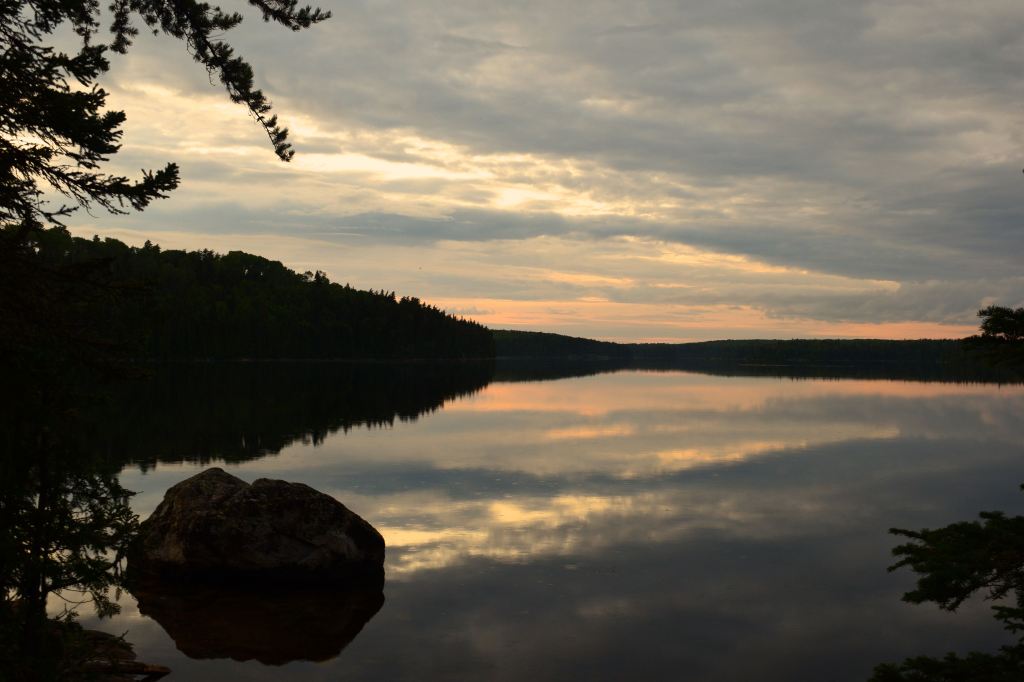
Soon, at dusk, a break in the clouds appeared and we were treated to wonderful glimmers of orange on the horizon. The water continued to remain calm and the slowly shifting clouds added an incredible ambiance to the scene.
Day 4 (August 8) – Trump Lake to Little Missinaibi Lake (Finger Bay)
We awoke at around 9am to another beautiful clear morning and again took our time breaking camp.
Today we planned to paddle about 15 or 20 kilometres to camp on one of the sites in the lower reaches of Little Missinaibi Lake; perhaps either the site at Finger Bay or Stump Bay.
Departing just before 11am, a strong tail wind from the northwest pushed our canoes along and we quickly approached the 220 metre portage between Trump and Elbow Lake. At the start of the trail we found a boat cache, apparently used by one of the fly-in fishing outfits that operate in the area. The trail was in good condition and we quickly advanced to the shore of Elbow Lake where the wind seemed to gain intensity.
With some difficulty, we paddled west for about a kilometre into the headwind. Here we could see the start of a one kilometre portage trail to Abbey Lake; this is the trail that we would have used to access Missinaibi Park from the Bolkow Lake system under our original itinerary. We took note of the trailhead and continue along the shore of Elbow as it wrapped around to the east. With the wind at our back again we pushed on into the far southeast end of Elbow Lake, where the classic, rugged scenery of the Shield began to give way to low-lying muskeg.
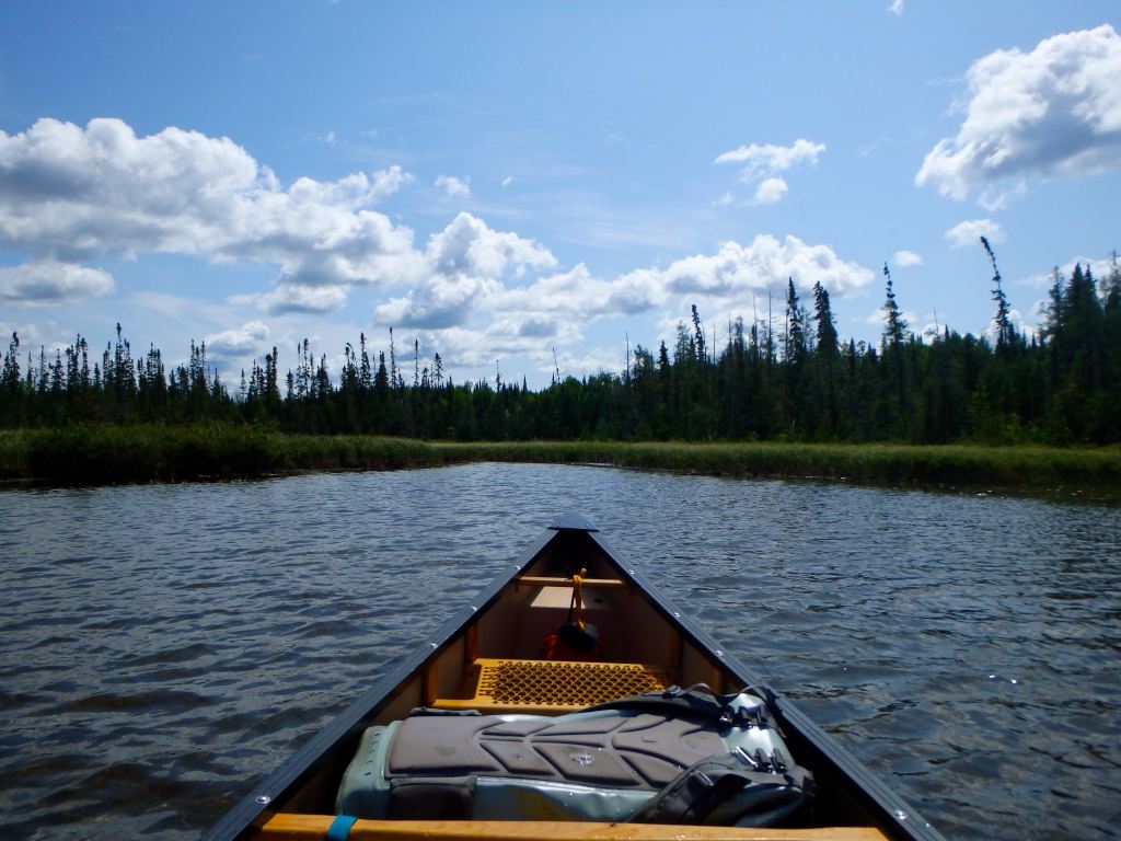
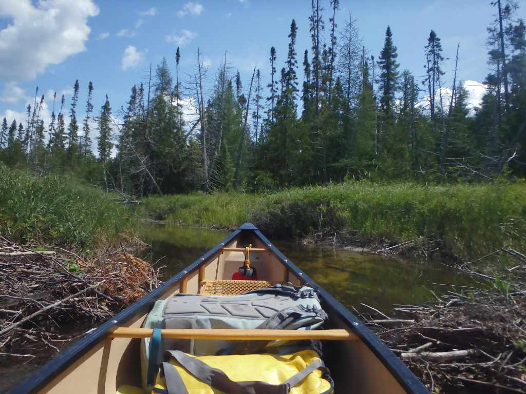
The southeast end of Elbow Lake is extremely shallow and silty and is connected to Little Missinaibi Lake via a narrow, serpentine, marshy creek of about 800 metres. On approach of the creek, we were constantly worried that we would get stuck in the silt of the lake. Even more concerning was the prospect that the creek itself would not be passable whatsoever. We cautiously penetrated the entrance of the creek – which was only wide enough for one canoe – and found that the water level in the creek, at only a few inches, was extremely low.
Hauling canoes through this section is not a desirable option. The creek coils through an expansive area of floating marsh crowned with sphagnum moss and thick bulrushes, and the creek bed is saturated with knee-deep muck.
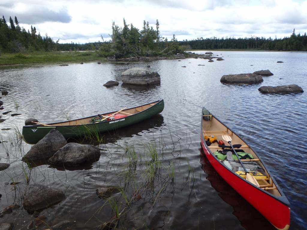
It turned out that Kevin and Jono’s boat was too heavily laden to effectively navigate the creek. However, we found that by transferring some of their bags into my canoe that both boats were able to float with relative ease. We soon made it through the creek at entered the north end of Little Missinaibi Lake. We were met here by harsh winds.
Little Miss is a narrow, twisting lake that curls and meanders around a large land mass at its centre. It is possible to do a loop around this land mass via a 160 metre portage at the lake’s south end – this was our objective. The lake is characterized by various channels and inlets open for investigation, and indigenous pictograph sites and old growth pines stands can be found along its shores.
As we paddled onto Little Miss from the creek, we decided to stop, have lunch and plot our bearing. We opted to travel with the wind, clockwise around the circuit, and wrap around to the west to target an apparent campsite on an island in Finger Bay. We realized that this likely meant paddling an open crossing in heavy headwinds to close out the day, but this seemed to be the best route option.
In the northern section of the circuit, we let the wind push us along; whitecaps crested beside our boats and I struggled hard to keep my canoe from swinging in the surf.
Before long we had reached the reprieve of the eastern section of the circuit which was in the lee of the wind. Here we encountered a group of fly-in fishermen staying at the Air Dale Lodge and exchanged a few brief words before paddling south.
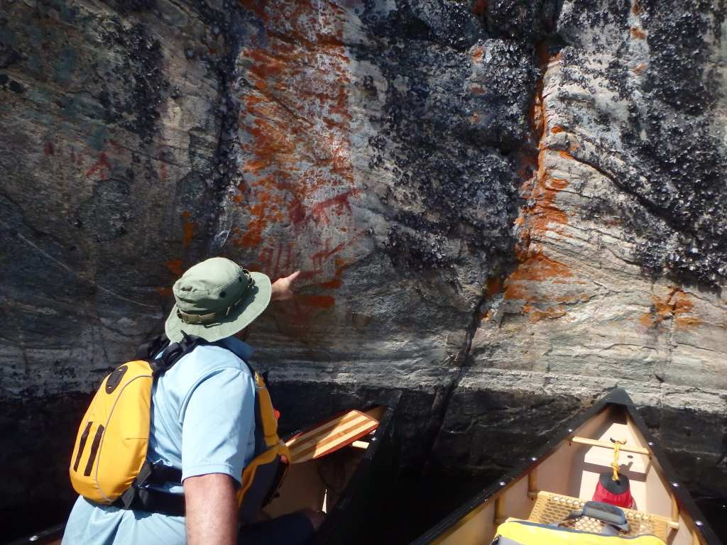
As we wrapped around the circuit toward the west, we were hit by the wind. The only realistic means of making progress into this headwind in my solo boat was to hug the shore and seek occasional rest in a series of sheltered coves. In one of these coves, we were treated to a wonderful and vivid display of pictographs, which included ochre representations of deer, hunters and other objects.
Progress from here to the island – about 1,500 metres away – would be difficult. We waited on the shore of the final sheltered cove before our crossing for about 20 minutes to see if the wind would abate. Sensing we had an opportunity, we hopped in our boats and began to paddle.
I struggled hard to keep the boat straight and made nominal progress. Eventually I started to gain steam, felt progress amongst the waves and decided to cross directly to the island while Jono and Kevin chose to hug the coast and cross at a closer interval.
My decision was a mistake – soon I was in the middle of the bay in the midst of crashing white caps and fighting, with every ounce of strength in my body to keep the boat moving forward. This was probably the hardest I have ever had to paddle and there were moments where I thought I would certainly be pulled sideways and capsize. But after battling through a ruthless final gust of wind, I found myself in the leeside of our island, where I soon met Jono and Kevin. I committed to myself , in my trip journal later that evening, that I would not paddle solo into waves of that magnitude again.
Our rocky island campsite at Finger Bay was terrific and appeared as though it had not been used in years. The site was perched up out of the water amongst a stand of spruce, and held an open west-facing vista. We took advantage of the sporadic sun above to swim in the cold, wavy waters at the base of our site, which helped to relieve my tired, worn muscles.
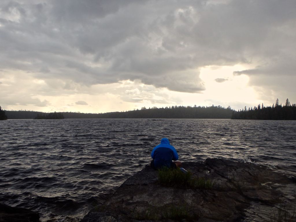
Noticing that clouds were quickly enveloping the sky, we worked swiftly to set up camp, and did so just in time for repeated volleys of rainfall. Thunder began to rumble in the distance – the weather changes quickly out here.
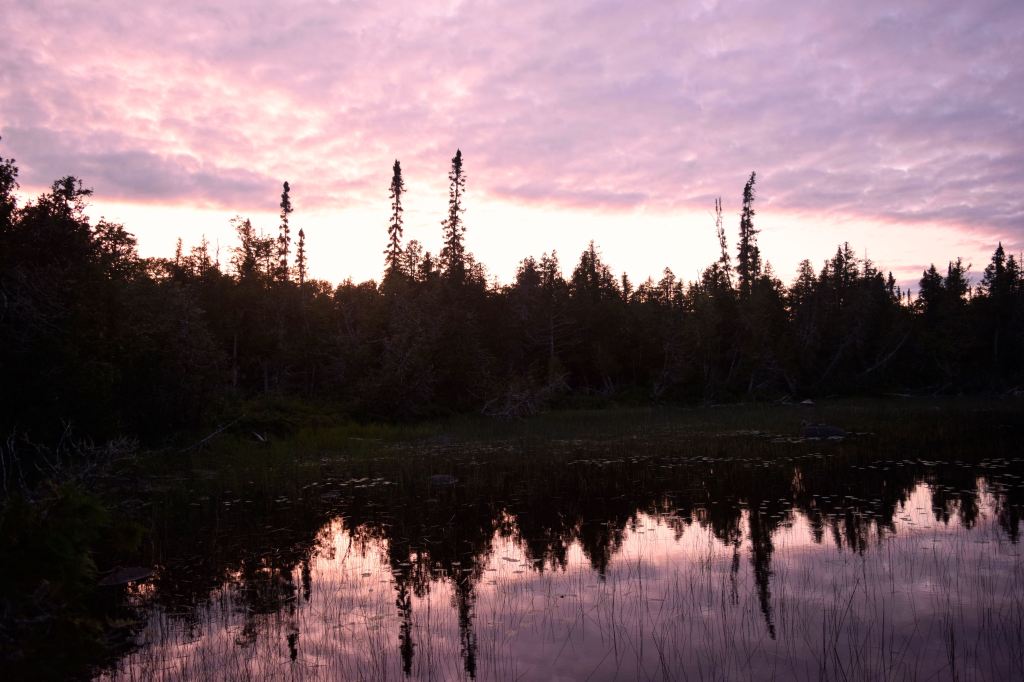
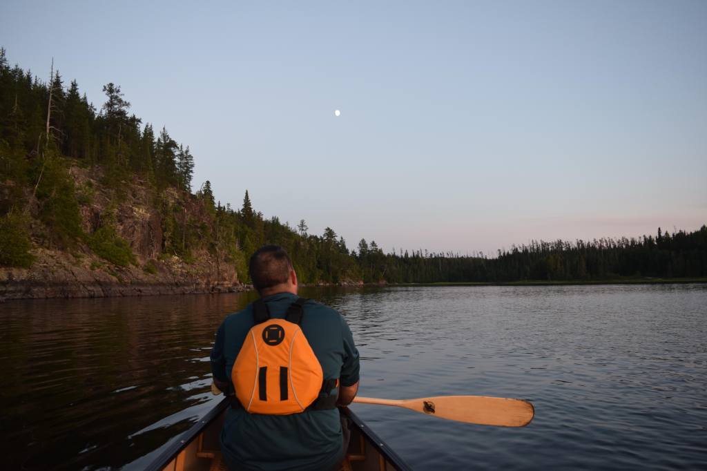
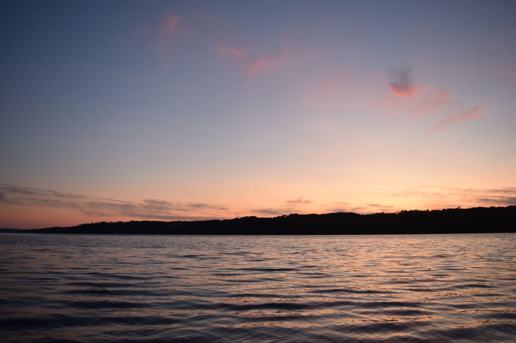
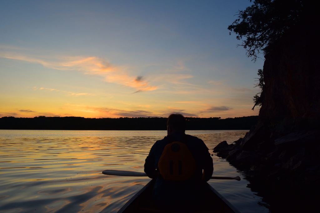
At about 7:30pm the sun came out again. We built a fire, made dinner and watched the sunset to the west. The stars slowly emerged in the sky above.

Day 5 (August 9) – Little Missinaibi Lake (Finger Bay) to Little Missinaibi Lake (North End)
On our fifth day, we woke up at dawn in an effort to avoid the tumult of the midday winds we had experienced the day before. The west wind still ruffled the waters at 6am, but it was safe for paddling. The sky was open with drifting clouds.
We started the day with a three kilometre paddle to the west side of Portage Bay and expected to easily find the 160 metre trail connecting the east and west sides of the Little Missinaibi Lake circuit. The trail was nowhere to be found. For the better part of 40 minutes we systematically combed every inch of shoreline on the west edge of Portage Bay, which was essentially an impenetrable wall of vegetation, and found no trace of any trail.
We talked about our options and bushwhacking seemed far preferable to backtracking 10 kilometres to the north end of Little Miss.
After probing into the bush in search of the best possible routes for a bushwhack, we stumbled across the semblance of an old trail about 50 metres in. In following the trail and repeatedly losing it under overgrowth and extreme amounts of deadfall, we decided that we were, in fact, in the general vicinity of the original portage route. The degree of overgrowth and clutter that obscured the trail led me to believe that it had not been used by anyone within the last 10 or 20 years.
On returning to our boat we extracted wood saws and trail tape from our bags and set to work clearing and marking a path to the other side, as rain clouds again swept in above us and began to open up. It took us about an hour to sufficiently clear a 200m pathway, but ultimately this endeavour was worth our effort – not only for ourselves, but also for future paddlers that may come through the area.
We were now in the southwest corner of Little Miss Lake and travelled quickly through Back Bay and Cam Bay. This portion of the lake is distinct from the east side in that it is generally more narrow and shallow, with broad expanses of reeds covering the water north of Cam Bay.
We soon made it to our campsite on a rocky outcrop at the north end of Little Missinaibi Lake. It was 1pm and we had travelled about 12 kilometres today; we relished the idea of spending a leisurely afternoon in camp around the fire and fishing.
As we were finishing lunch, a canoe with two paddlers pulled into an island campsite across the water from us. We later found out that the pair was from Michigan and had come into Little Miss via the same route as us (through Trump Lake).

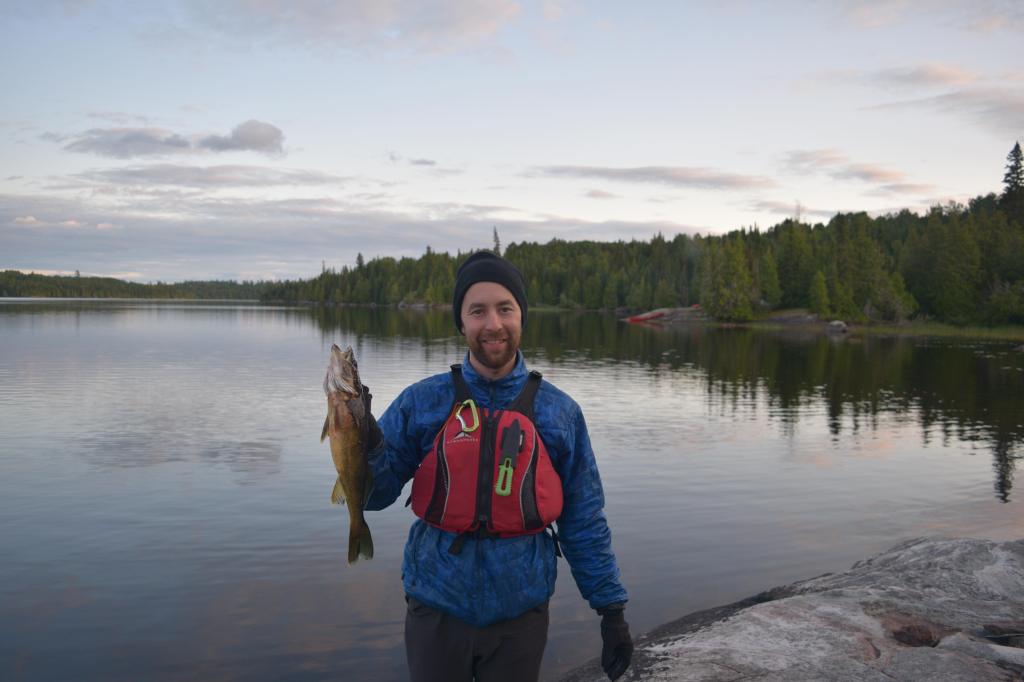
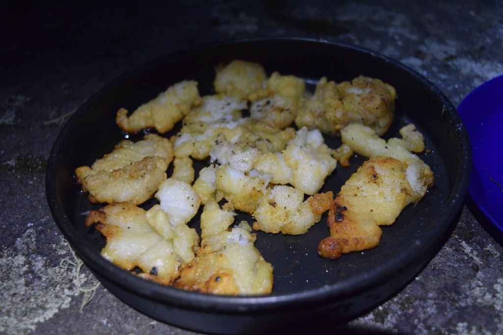
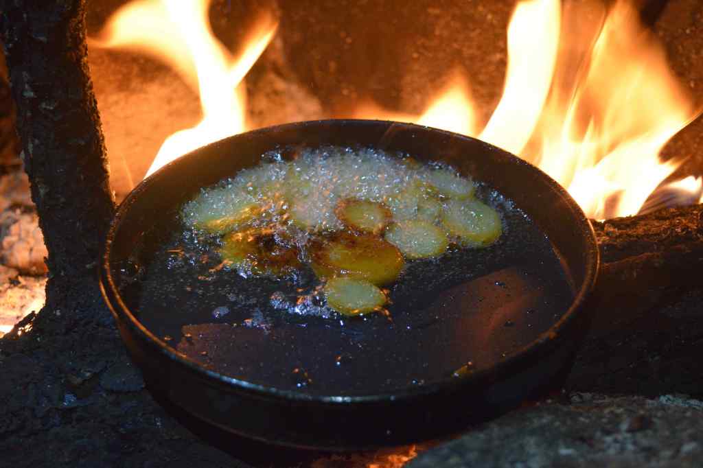
With evening setting in, Jono and I hopped into one of the canoes and started cast out our lines. Within 10 minutes I had landed a large walleye, which we took back to camp to supplement our dinner. As I filleted the fish, Kevin set the fire; Jono put on his chef’s hat and prepared an excellent batter and seasoning mix that he dunked the fillets in before frying them up. He supplemented this with some sliced potatoes fried in oil; an incredible meal of backcountry fish and chips.
Tomorrow we travel back to Big Missinaibi Lake along the full length of the Little Missinaibi River, bypassing Trump Lake and Elbow Lake entirely. We are anxious to see what the rapids will be like.
Day 6 (August 10) – Little Missinaibi River
We broke camp at 9:30am. The weather on this day looked amazing – blue skies with long wispy clouds.
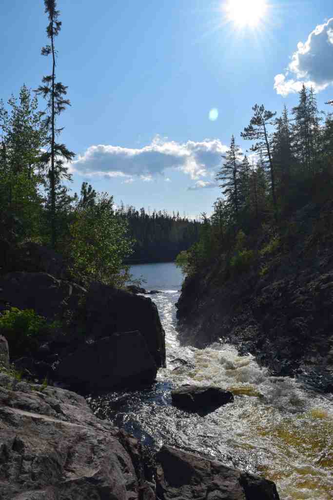
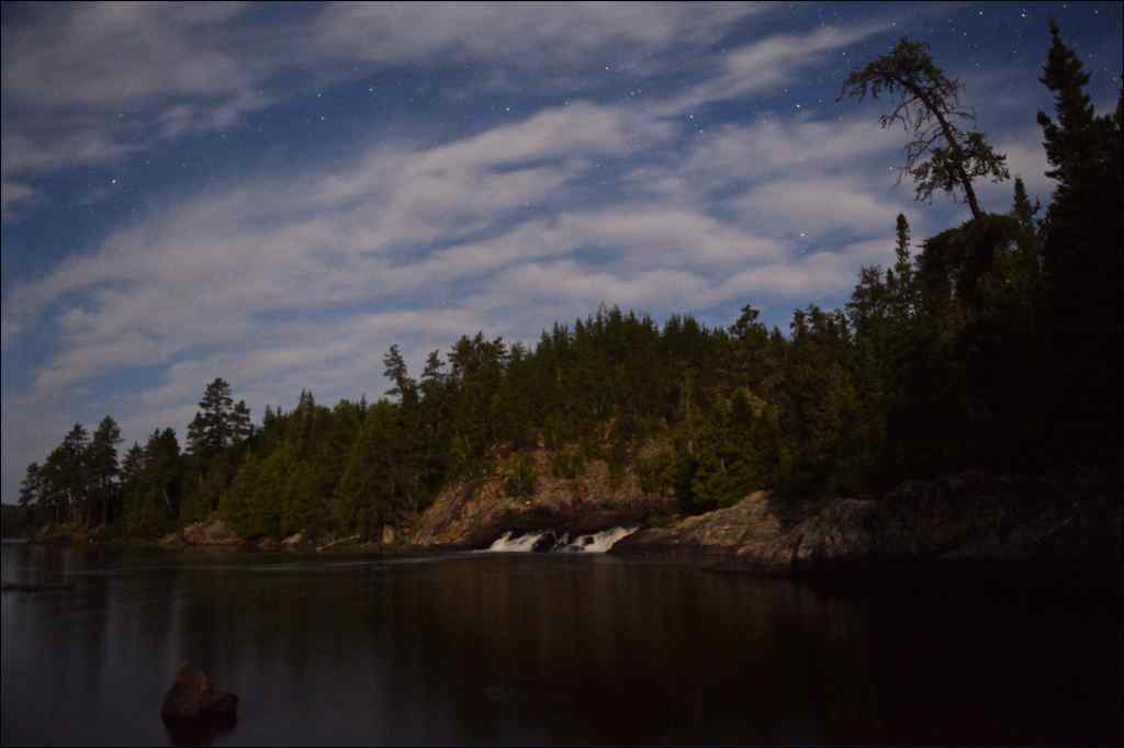
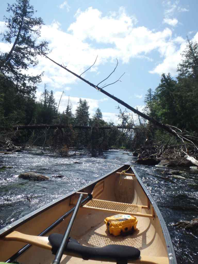
The three kilometre trip to Admiral Falls was a quick paddle. The falls are a spectacular, long cascade and are circumvented by a 220 metre portage on river right. In high water, the falls would represent an extremely dangerous hazard and canoeists would need to take caution in approaching the trail; fortunately the brink of the falls can be spotted well in advance.
We held some collective reservations about paddling the portion of river that followed Admiral Falls. We knew from our conversations with park staff that the rapids in this section are not well traveled and could be dangerous. The Missinaibi 1 – Chrismar Adventure Map notes that the 15 or so rapids below Admiral Falls “are particularly challenging with sweepers, rock gardens, ledges, narrow chutes, and missing portages.” This is a very accurate description of the river; all paddlers travelling this section should be wary and always scout every set.
While the low levels we experienced in our traverse dulled the treachery of the water and all rapids could be categorized as Class I or Class II, virtually all of them required technical manoeuvres or lining and wading. In high levels the rapids would be potentially very dangerous.
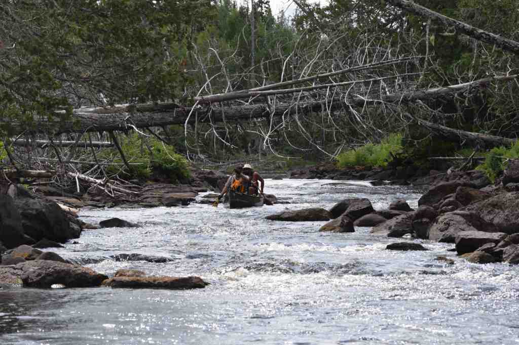
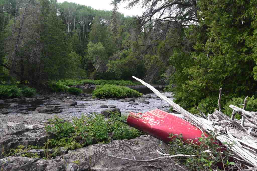
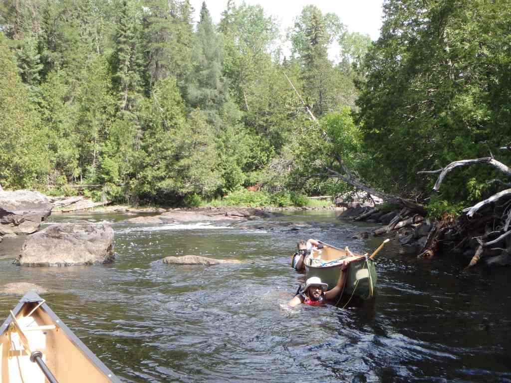
The first rapid, which was probably the most technical of the day, requires a stretch of boulder dodging before the river drops under a pinned sweeper. Just after the sweeper, the river crashes and forks around a large boulder. Unsurprisingly, there was a wrapped canoe around the boulder from some ill-fated voyage in the past.
After scouting, I opted to run the set and dodge the boulder to the right. The low water levels actually made the river quite forgiving, and as one who is relatively new to solo white water canoeing, I felt very comfortable with the overall state of the river and with my ability to challenge these rapids.
We made our way down the rest of the rapids without incident. At various intervals we were required to hop out of the boat and wade around shallow spots and obstructions. It is noteworthy that, past the halfway mark, there is a series of ledges that are bypassed by a very overgrown 80 metre portage trail. Rather than enduring the carry-over, we chose to line and wade our boats down the series. Subsequent to the ledges, the river constricts into a boulder garden within a beautiful little canyon before spitting the paddlers out at the base of the Trump Lake portage that we had travelled a few days before.

Following lunch at the Trump Lake portage junction, we continued on travelling downstream in familiar territory, and made it to the campsite at Whitefish Falls by 4:30pm. We had conceived of crossing Big Miss and staying on a different campsite, but given the time of day and the long hours we had put in on the Little Miss River, we decided to camp again at the site at Whitefish Falls.
A nice bonus of arriving here was that Jono had stashed three beers in the forest off the trail; we celebrated our achievement by clinking our cans together and enjoying a drink.
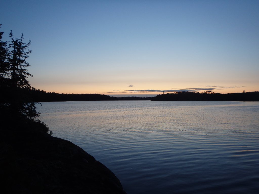
As dusk settled in, Kevin and I paddled out into the mouth of the Whitefish cove to watch the sunset. The water was unusually calm and, with the sky, was aglow in a vibrant hue of bright orange and pink. We slowly made our way over to the edge of the cove, and sat under a large cliff, also illuminated by the dying sun. From this vantage, we could see endlessly down the long, big lake. Glancing up on the wall of the cliff above our little canoe, we spotted faint ochre paintings – this was another pictograph site and one not marked on the map. What a wonderful feeling, to be in the presence of this ancient art, in this remote land, at the golden hour.
Day 7 (August 11) – Whitefish Falls to Barclay Bay
Our aim today would be to traverse the final 12 kilometres of the route and return to our vehicles at Barclay Bay Campground. We had debated extending the trip by another day, but due to the unpredictability of the wind/weather and the long drive that lay before us, we opted to try to take advantage of the relatively calm conditions of the morning.
On the water for about 8am, we exited the cove at Whitefish Falls and were met by a generous tailwind that helped to push us along the big lake. The sky was cloudy and grey, the temperature was cool and after a time it looked as if the wind could pick up and cause us trouble.
With our major crossings out of the way and only a few kilometres from the end, solid whitecaps emerged beside our boats. Much longer on the lake and we might have been in for trouble.
We finished our adventure by pulling our boats out at the Barclay Bay beach and soon bid farewell to the mighty headwaters of the Missinaibi and this extraordinary land.