Date Completed: February 2020
Difficulty: Novice
Method of Travel: Winter hiking
Region/Location: Kawartha Highlands; crown land
Trip Duration: Three days
Distance: ~5km total
Loop: Out and back
Fees/Logistics: No parking permit or park fees as route is on crown land.
Trip Journal:
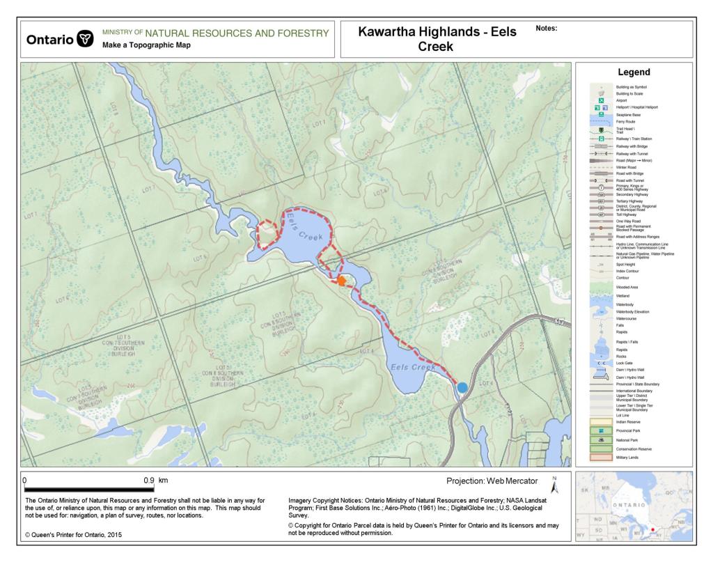
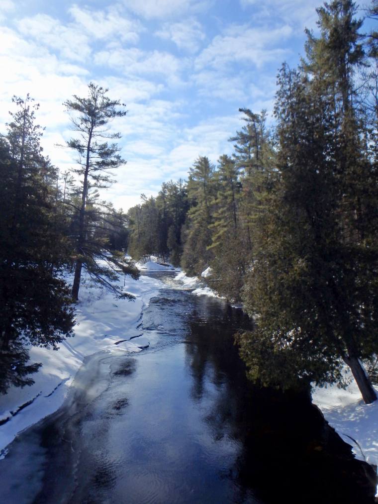
Eels Creek flows through the Kawarthas from the outskirts of Bancroft to Upper Stoney Lake, some 30 kilometres to the south. For much of its course, this small, scenic waterway parallels Highway 28 before branching off to the east at Haultain through a dense swath of crown land wilderness. It is in this section that the river plunges over High Falls – a beautiful cascading slide waterfall that is the definitive highlight of this route – before reaching Upper Stoney.
The intersection of Eels Creek and Highway 28 at Haultain is a common starting point for canoeists interested in taking an overnight trip down the creek. Access is limited from Haultain as there is room for only one or two vehicles at the Highway 28 bridge. Conversely, the lot at Northeys Bay Road, which is the standard terminus for paddle ventures down Eels Creek, offers over 10 spots. In summer months especially, this lot is a popular departure point for hikers and dog walkers who wish to explore this wonderful area.
I first attempted to explore Eels Creek in early December 2018. Anticipating a late freeze up in the Kawarthas, I loaded my canoe onto my car and drove to the Northeys Bay access. My intention was to solo paddle upstream and camp at High Falls. When I arrived, however, I found that the river had very recently frozen over in places and canoe travel would be impossible. Rather than hiking overland to spend the night at the falls, and leaving my cherished canoe unattended in the parking lot over night, I decided to head to Peterborough to visit the Canadian Canoe Museum as a consolation (but not before enjoying a pleasant day hike through the woods).
Little over a year later, in February 2020, I was contemplating places to visit for a last minute, leisurely, two night winter camping trip, when I remembered my failed trip down Eels Creek. This would be a perfect, abbreviated route for me as I had endured ligament reconstruction surgery on my knee the past November and was only then starting to hike again. In fact, this would be my first camping trip since the procedure.
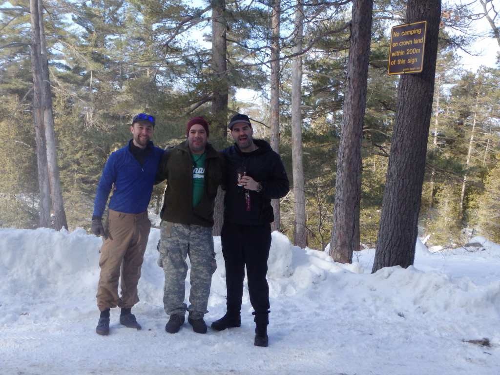
Eagerly, I pulled out my old maps of the area, put plans in place and called up a couple of friends to see who might me interested in joining me. Kevin and Lachlan agreed to make the trip – though Lachlan could only make it for the second night and would have to hike in separately.
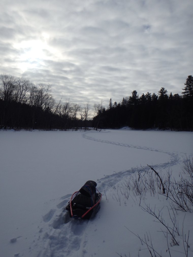
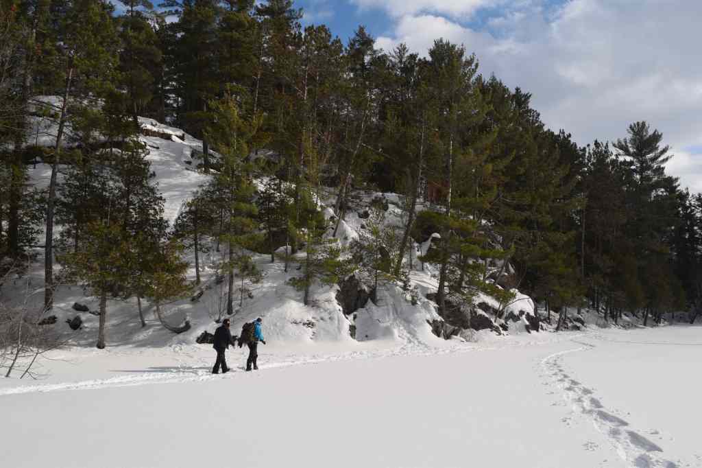
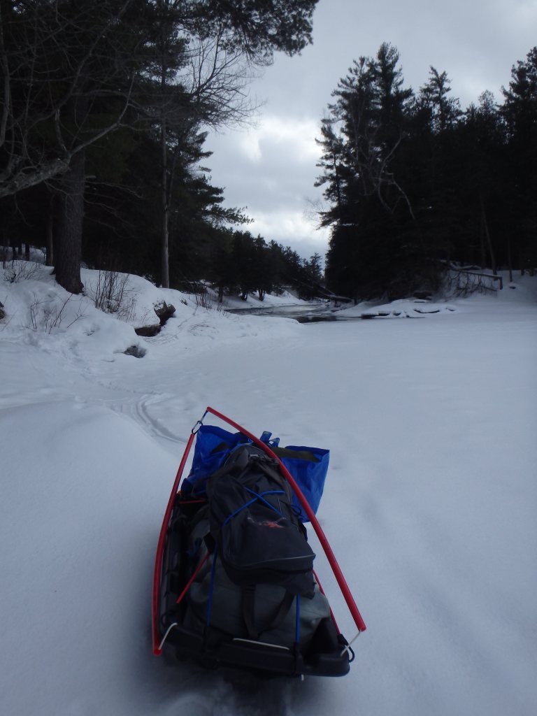
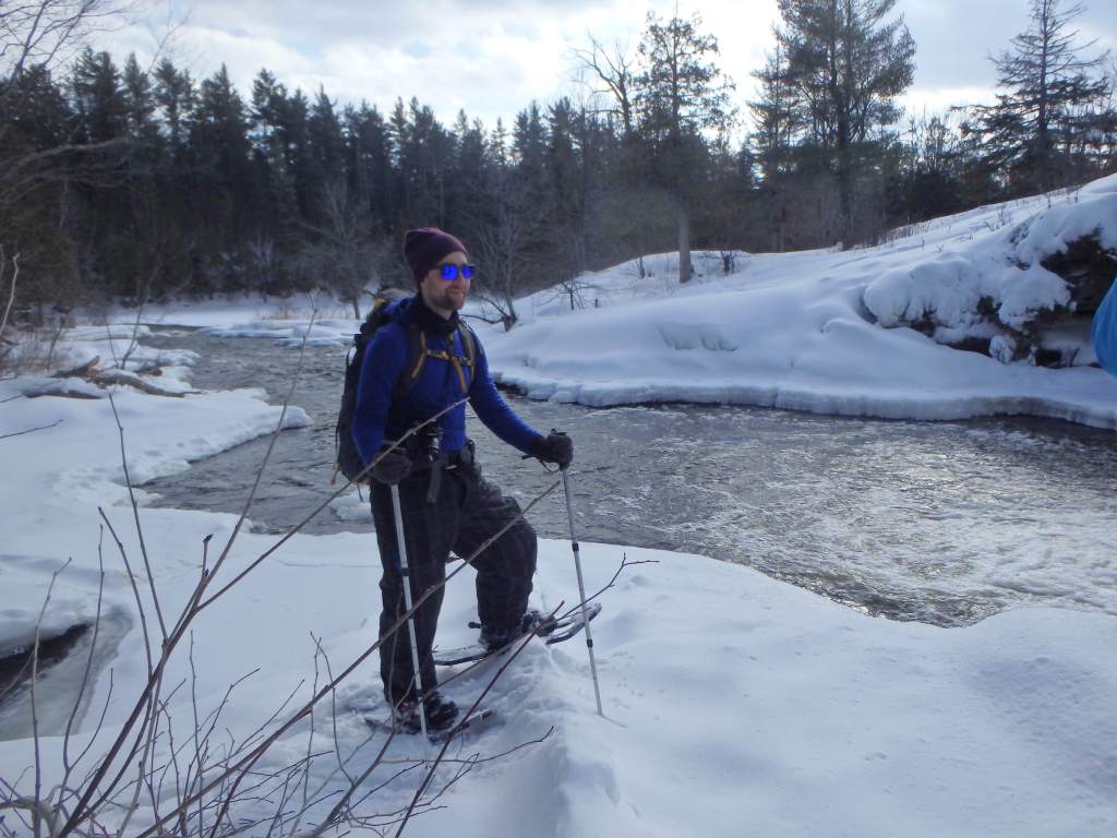
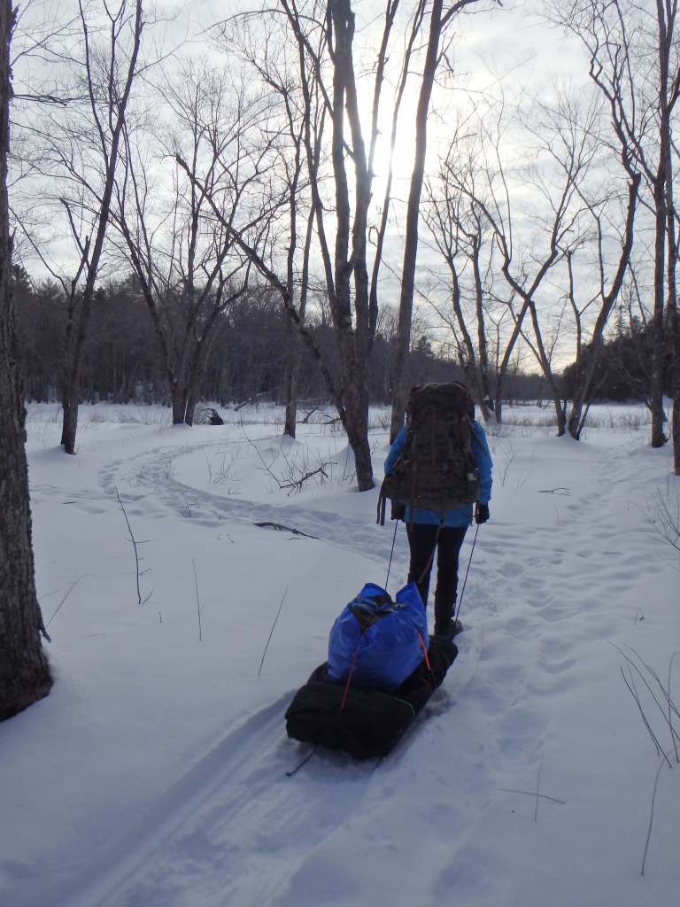
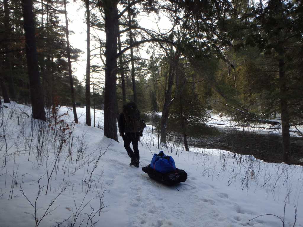
Our plan was – in essence – to complete a short hike along the frozen river and camp somewhere in the vicinity of High Falls (approximately 2.5km away). It is possible to follow the trail from Northeys Bay access all the way to the falls, but I knew from my first experience here that the terrain would not be forgiving with our sleds and it would be much easier to hike directly along the shore of the river itself. This of course held some risk as our winter had been unusually mild. Nevertheless, upon our arrival, Kevin and I were pleased to find that the ice was in stable condition and, in effect, we were soon on our way.
We were fortunate to start our trip under excellent conditions. It was the kind of winter’s day where the sun wavers in its presence from behind the clouds and the air is sufficiently mild to enjoy its warming rays as though the surrounding landscape were not locked in ice. As we broke trail on the snowy river we passed large stands of pine atop cold, grey hunks of granite, and sandy brown swaths of bulrushes; black capped chickadees fluttered amongst the tangled array of tree limbs ashore and a pack’s worth of fresh coyote tracks zigzagged erratically across our intended path.
About one kilometre north of the lot, at the first hook in the river, Kevin and I crossed to the west side and hiked through a patch of low-lying trees before finding ourselves in a beautiful, sheltered cedar grove. We discussed hiking onward to our original objective, but decided the spot – with its flat, spacious ground, abundance of dead wood, and beautiful surroundings – would be a great place for camp (despite the clear profusion of coyote tracks).
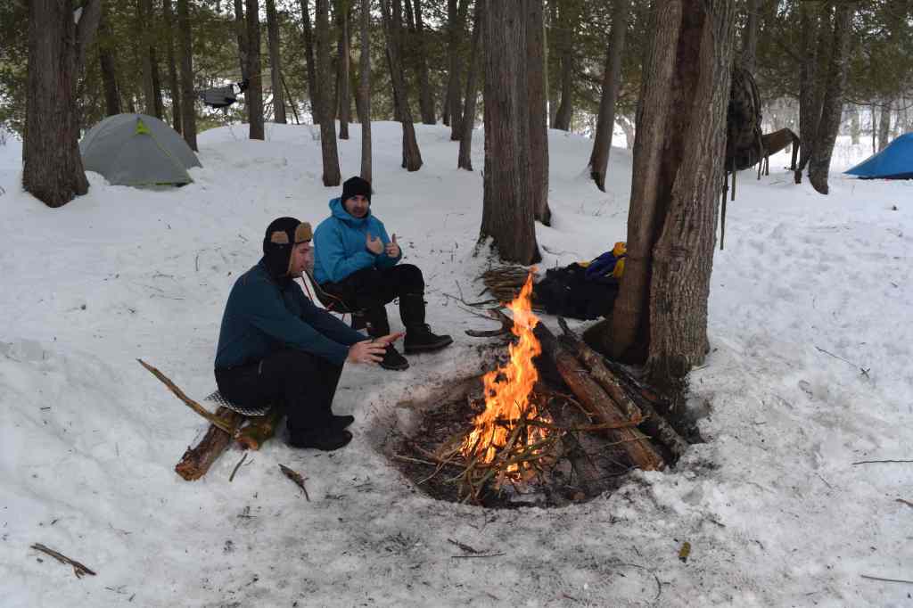
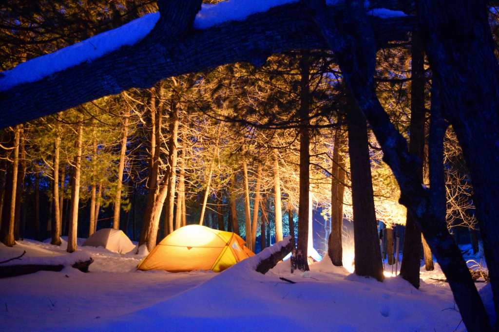
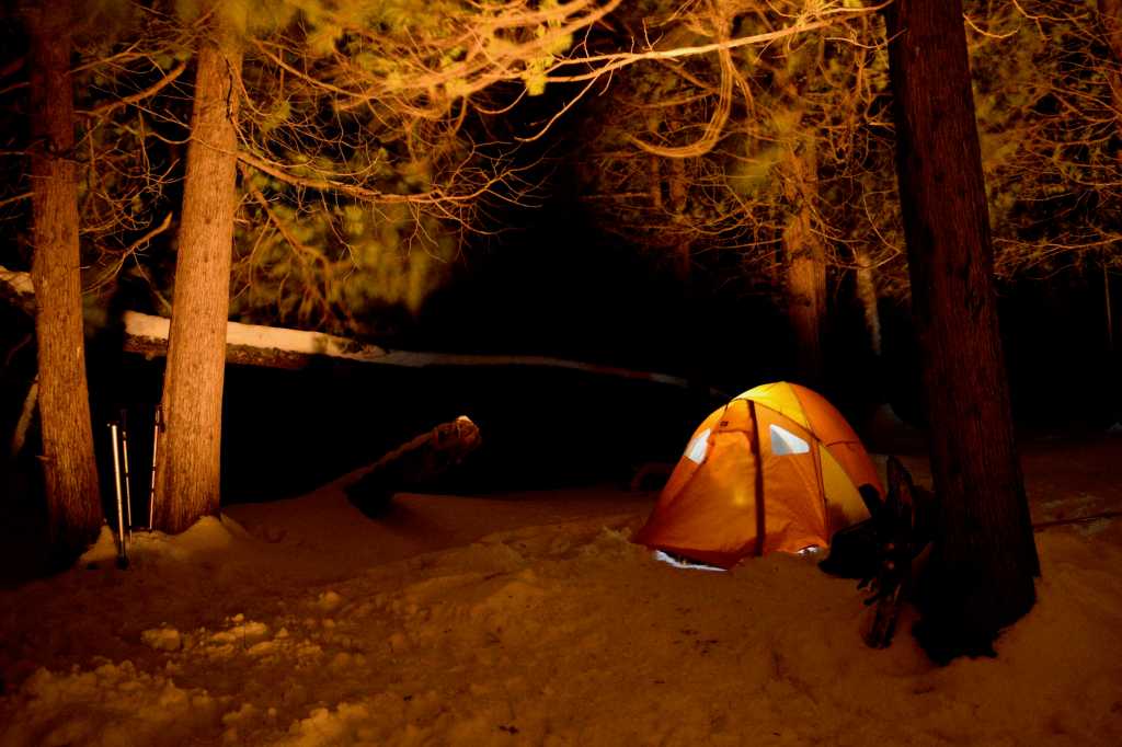
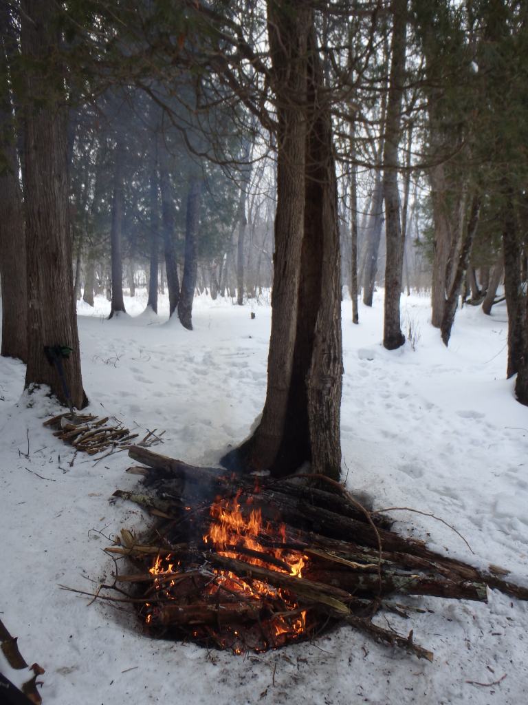
We quickly took to work, pitched our tents and soon had a healthy fire blazing between the trees. With our camp assembled, we discussed hiking to the falls, but opted to save this for the following day with Lachlan’s arrival. We did, however, witness a few groups of day hikers sporadically heading in that direction on the east shoreline – a friendly solo hiker with her dog, following our footsteps, even passed through our camp.
After some brief forays along the shore and into the surrounding forest, we ultimately spent the remainder of the afternoon and evening cooking food, chatting and tending to camp chores. As we settled in for the night we heard the playful pack of coyotes yelping and yapping atop the ridge above our tents – confirmation that they had not moved far.
Late the following morning, while cutting wood, I spotted a dark figure trudging through the snow a couple of hundred metres to our south and immediately identified it as Lachlan. Kevin and I walked out to greet him and discussed our plans for the day.
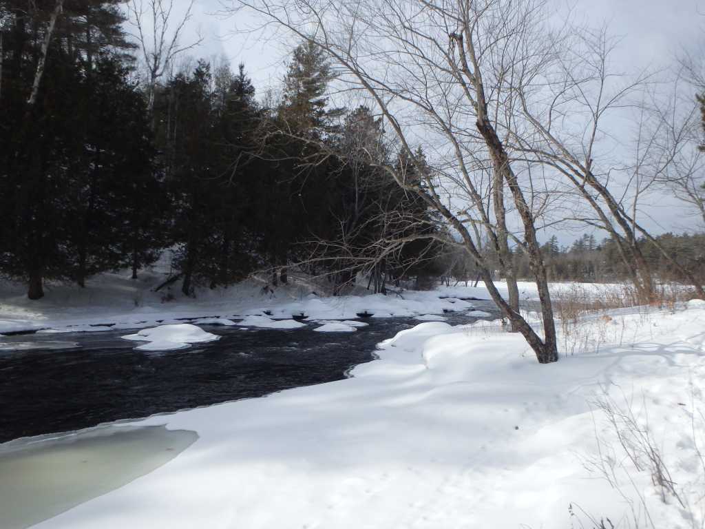
Though the falls were only about a kilometre north of our site, it was separated from us by an expansive bay. Our confidence in the stability of the ice along the shore did not extend to the open bay and so we decided to follow the tracks of other hikers along the perimeter of the water. While this added some time to the trip, it was an easy hike and we soon arrived at the falls.

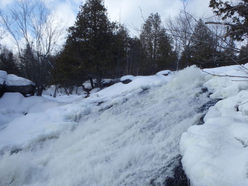
High Falls is a delightful cascading falls that culminates in a large slide where a broad veneer of water rushes over a large, solitary slab of rock. Interestingly, during our visit, parts of the top of the falls were entirely bridged over by snow, creating the illusion that the river could be safely crossed just before its brink.
We spent a good portion of time watching the falls and snapping pictures and –without lamenting our current camp location – agreed that we would likely stay here on our next visit.
It is perhaps worth noting that Petroglyphs Provincial Park abuts this area of crown land and lies approximately five kilometres to the east of the falls. Petroglyphs is a day-use park that houses Ontario’s largest collection of indigenous rock carvings. The carvings are believed to be approximately 1,000 years old of Algonquin or Iroquois origin. In the past, an established trail connected High Falls directly to Petroglyphs Park. Unfortunately, the trail is no longer maintained and is difficult to find, if it still exists at all.
By the time we returned to our campsite, dusk had begun to encroach. We built up our fire once more as a cold breeze swirled. Being that the horizon, from our present vantage, was obscured by the ridges that rose above our site, I decided on a whim to dash back out to the east shore of the bay on my snowshoes to catch the setting sun. Though the colours of this sundown were not pervasive across the horizon, the clouds to the west were like floating ghosts of pink and orange, exuding a wonderful ever-changing spectrum of colour, which was diffused off the snow, illuminating even the darkest recesses of the forest.
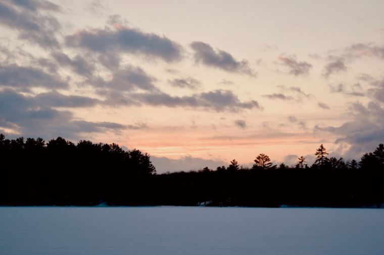
Witnessing the sun set over a lonely, frozen, snow encrusted lake or river in the chill of winter has long been one of my favourite wilderness experiences. There is something endlessly calming and beguiling about our primary source of heat and light, and life, building up to a great crescendo – the pinnacle of its glory – before suddenly fading beyond the farthest trees and leaving behind a cold and silent world; one that is starkly different, but no less enchanting.
As I walked back to camp, stars began to twinkle in the twilight, and I felt glad to be back in the woods once more.