Date Completed: November 2020
Difficulty: Novice (all rapids can be portaged)
Method of Travel: Canoe
Region/Location: Central Ontario; Muskoka
Trip Duration: Two days
Distance: ~13km total (~12.6 on river; ~.4km over 5 portages)
Loop: No
Fees/Logistics: No permit or parking fees; shuttle required.
Trip Journal:
The best time to paddle cottage country, in my view, is the late fall. By November, most cottage towns and communities that were bustling hot spots for vacationers only a few months prior, have all but closed up. Lakes and rivers are devoid of traffic, docks are pulled up, and the waterways of these once pristine landscapes once again assume a wild and austere character.
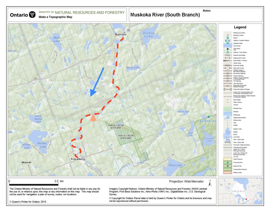
For a quick weekend getaway in November, Lachlan, Kevin, Kai and I decided to paddle a 13-kilometre stretch of one of Muskoka’s finest waterways, the South Branch of the Muskoka River. While paddlers of the South Branch have the option to make a ~50km trip between Baysville and Bracebridge, being limited on time, we planned for shorter overnight trip from Baysville to Fraserburg.
This section of the South Branch includes a number of picturesque rapids and falls and despite the occasional cottage along the way, feels quite remote. From Baysville, the narrow pool and drop river finds a pathway through the rocky shorelines of Muskoka’s shield country before levelling out and meandering into the small settlement at Fraserburg.

A major point of historical interest here is found in the 1837 surveying expedition up the South Muskoka by perhaps the most important cartographer in Canada’s history, David Thompson. Decades after mapping large tracts North America west of the great lakes, Thompson was commissioned by the government of Upper Canada to travel upstream to document the feasibility of the Muskoka River as canal route between the Ottawa River and Lake Huron. Thompson knew from the outset that the river would hold limited viability as a canal due to its innumerable rapids/falls, but he documented the river in great detail nonetheless.
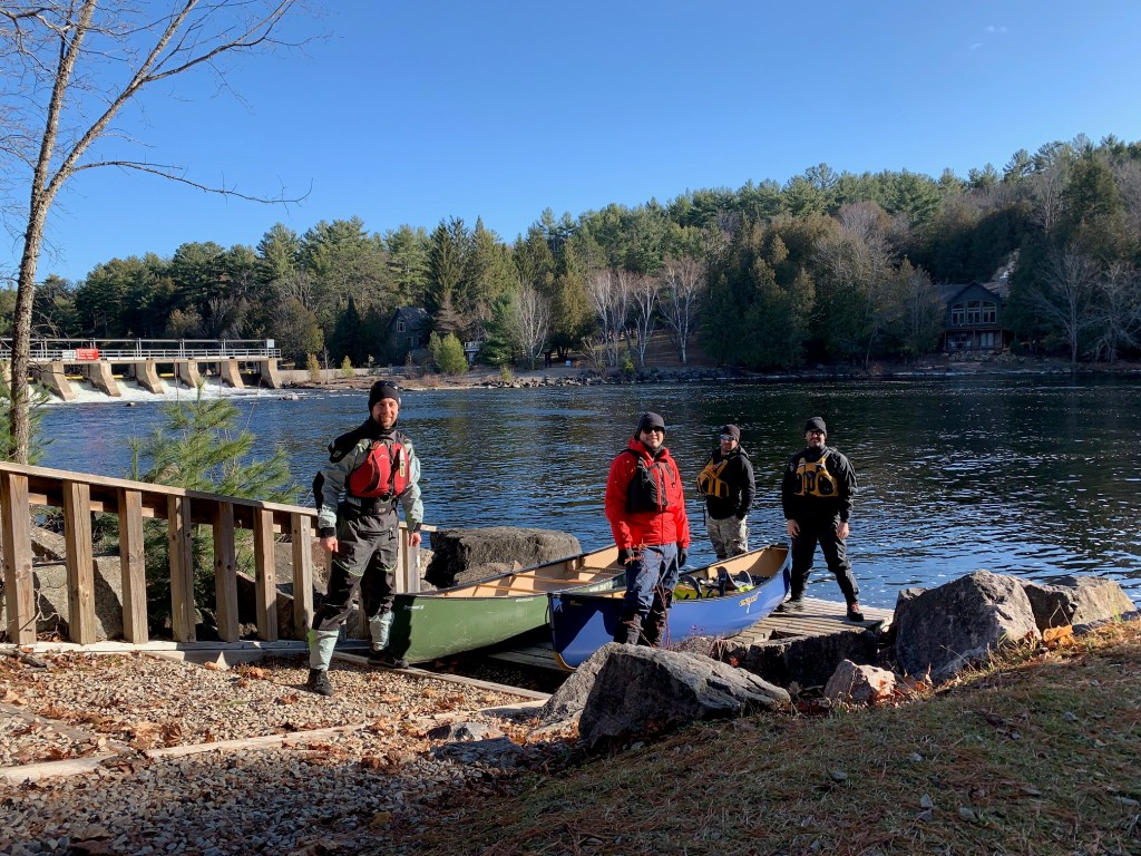
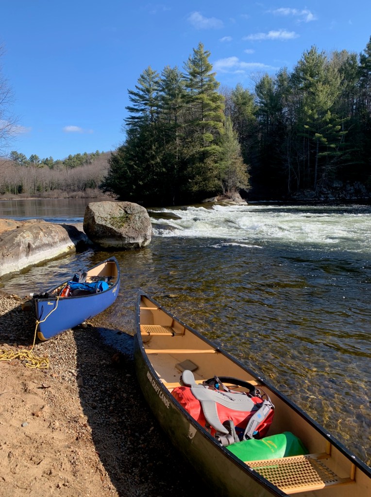
Our foray down the South Muskoka started at the Bethune United Church in Baysville. In order to get an early start on the river on Saturday morning, we decided it might be a good idea to look for a place to camp overnight around town. After weighing some nearby crown land options, Lachlan had contacted the church to see if we could camp out on their property and they warmly obliged. The location was convenient as the property was only a couple of hundred metres from the put in.
Early in the morning, Kai and I made the 30-minute drive to Fraserburg and left one of the vehicles on the edge of Cridiford Road, which runs along the east of the river. Before heading back we surveyed the area around the Fraserburg bridge in search of a good place to pull out the canoes. Most of the shoreline in the town is privately owned, but there is a small, grassy, relatively flat portion of land at the west side of the river abutting the bridge that looked ideal.
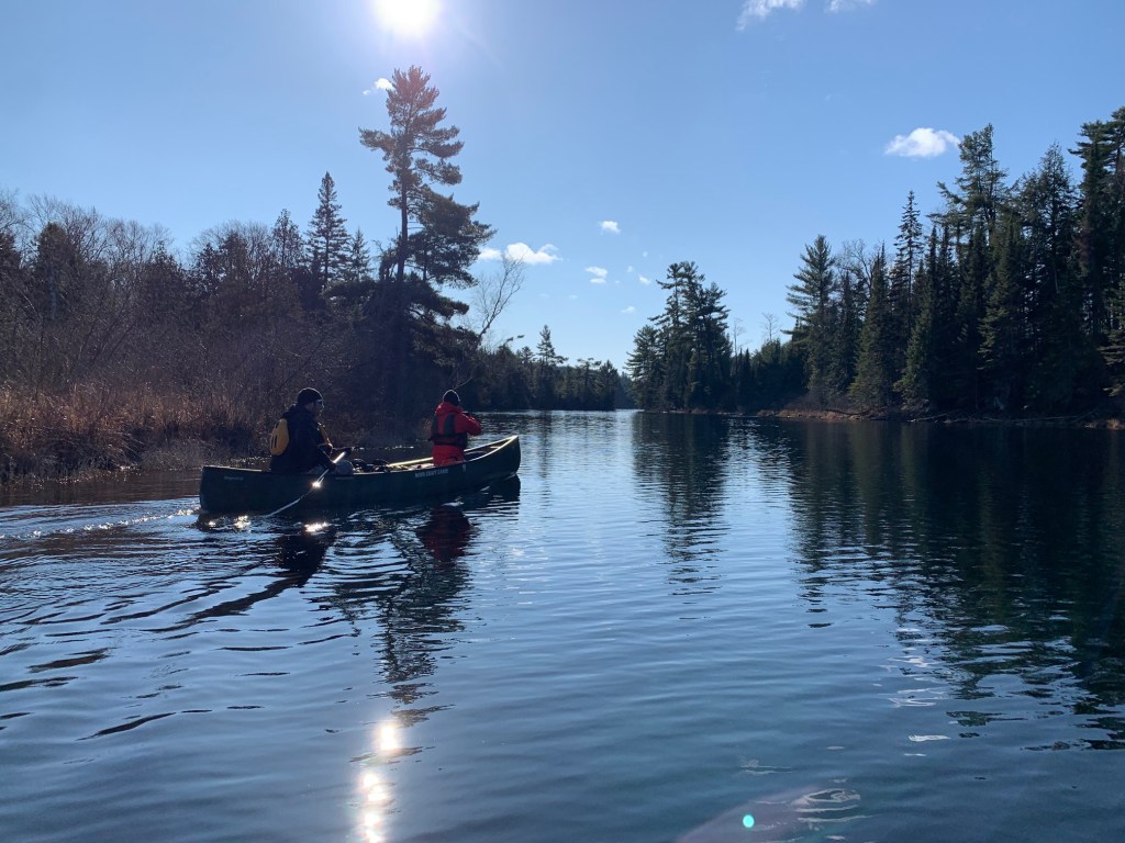
After taking a few photographs by the Baysville dam, we were on our way with sunny skies above and an ambient temperature around freezing. Lachlan and I were particularly excited, as this trip marked the inaugural voyage of our new canoe, an Esquif Pocket Canyon, and we were hoping to try out this white-water tripping boat on a few of the rapids we knew we’d encounter.
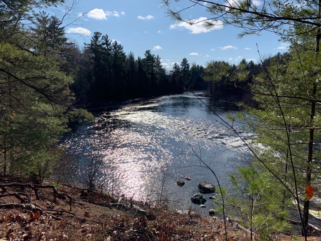
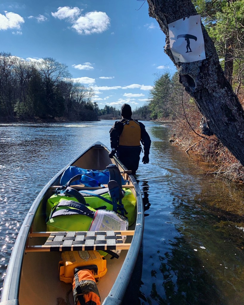
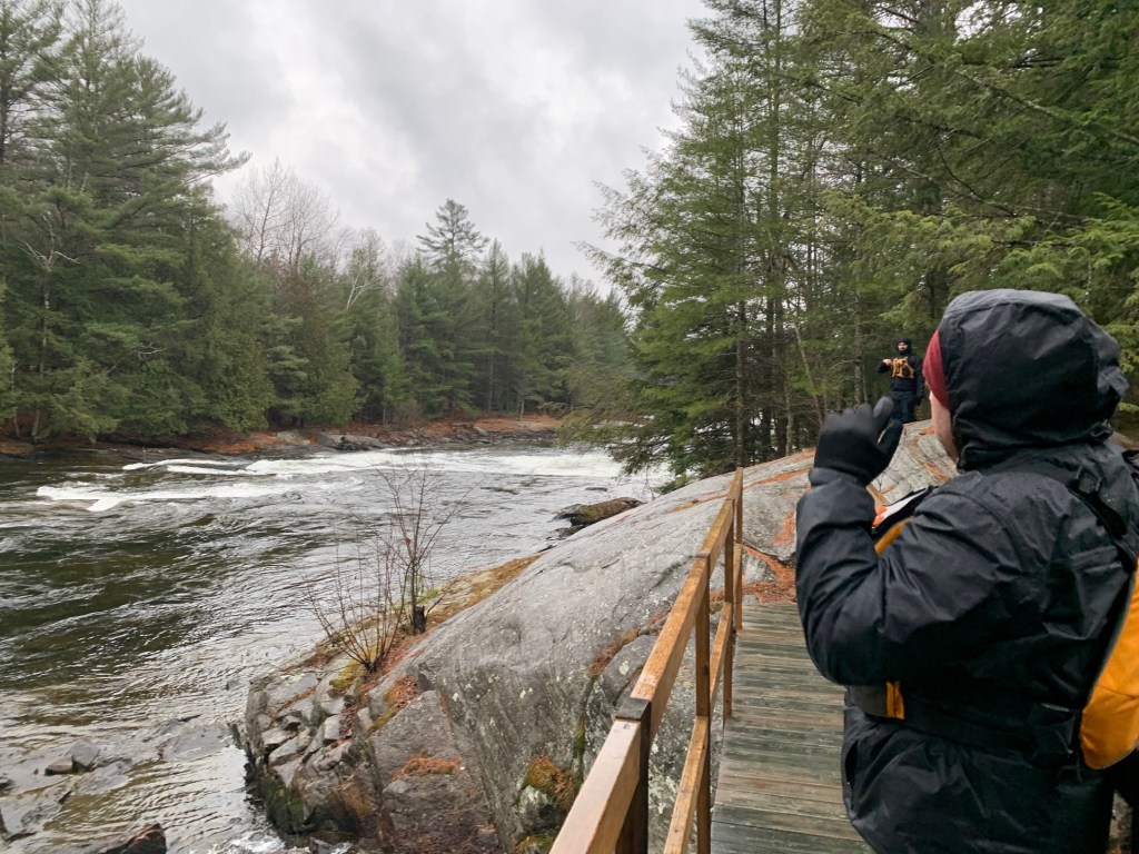
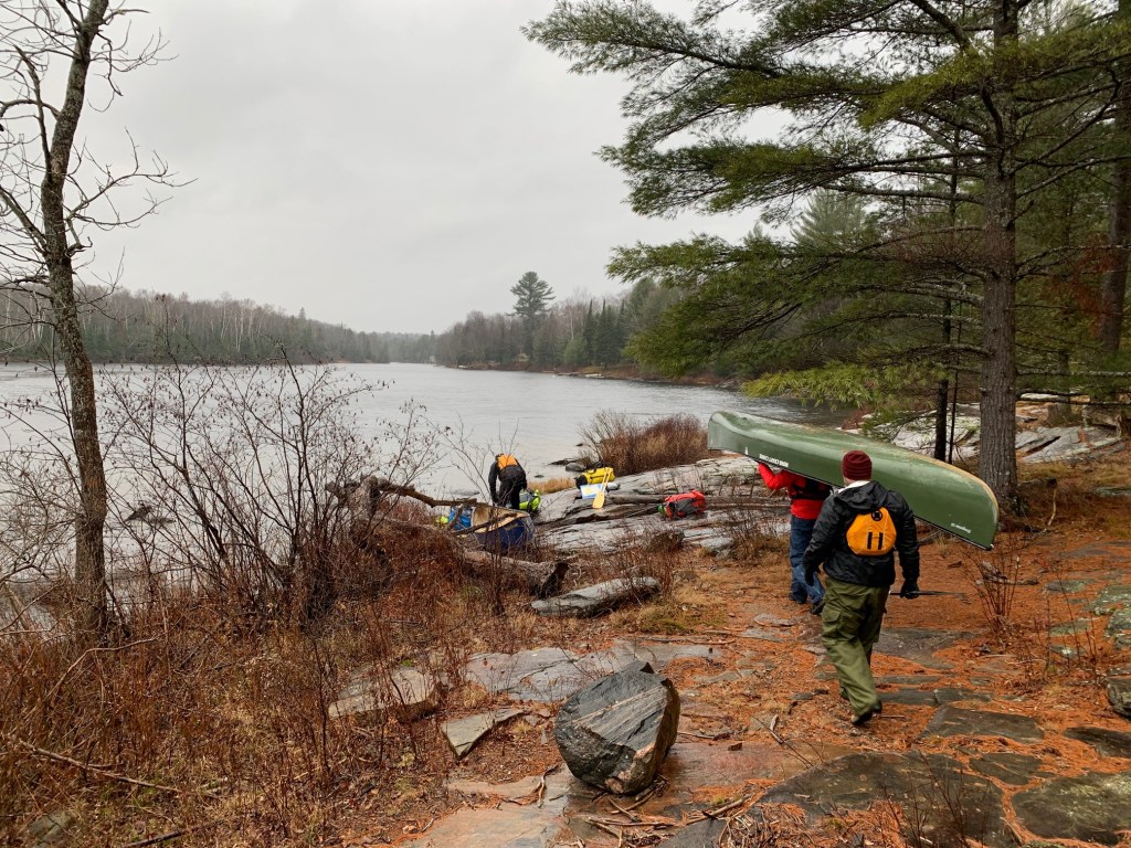
For the first few kilometres south from the Baysville dam, the flat river follows a straight, narrow course until it reaches Fairy Falls. In scouting the falls from the portage (on river left), we recognized that the top part of the rapids was not navigable due to a long, cross-cutting rocky ledge. However, half-way through the portage, a steep side trail cuts back down to the river allowing for the bottom section – an easy CI section – to be run.
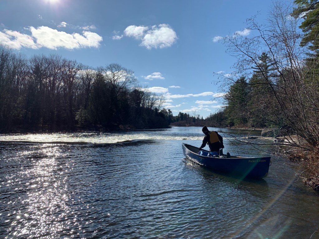
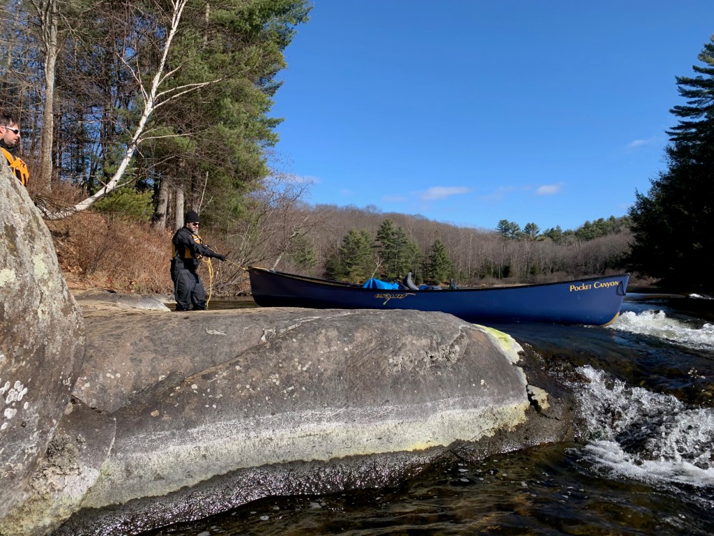
Past Fairy Falls the river speeds up into an enjoyable jaunt over constant swifts, before veering radically to the west and revealing Thompson’s Folly. While likely runnable in higher waters, under the conditions we faced, Thompson’s Folly was essentially a large, rocky ledge.
Lachlan and I, with our drysuits on, waded to the brink and lined our canoe over the edge of the falls on river right, while Kai and Kevin completed the portage. The picturesque falls gave Lachlan a worthy excuse to pull out his drone and capture footage of the area from the sky. In the meantime, I took the Pocket Canyon out onto the river and played in the surf.
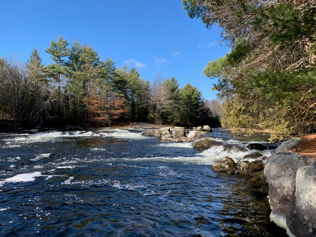
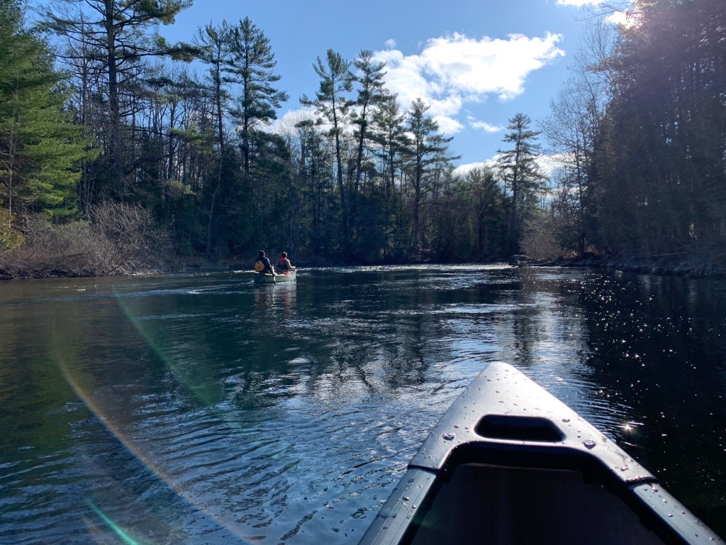
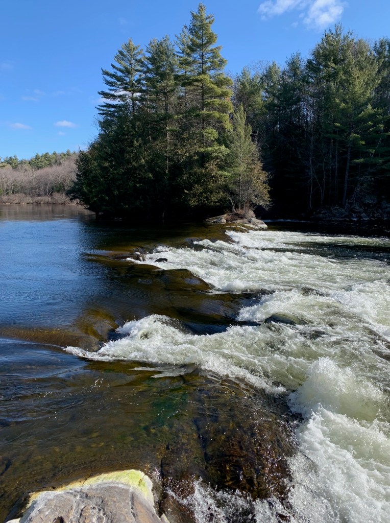
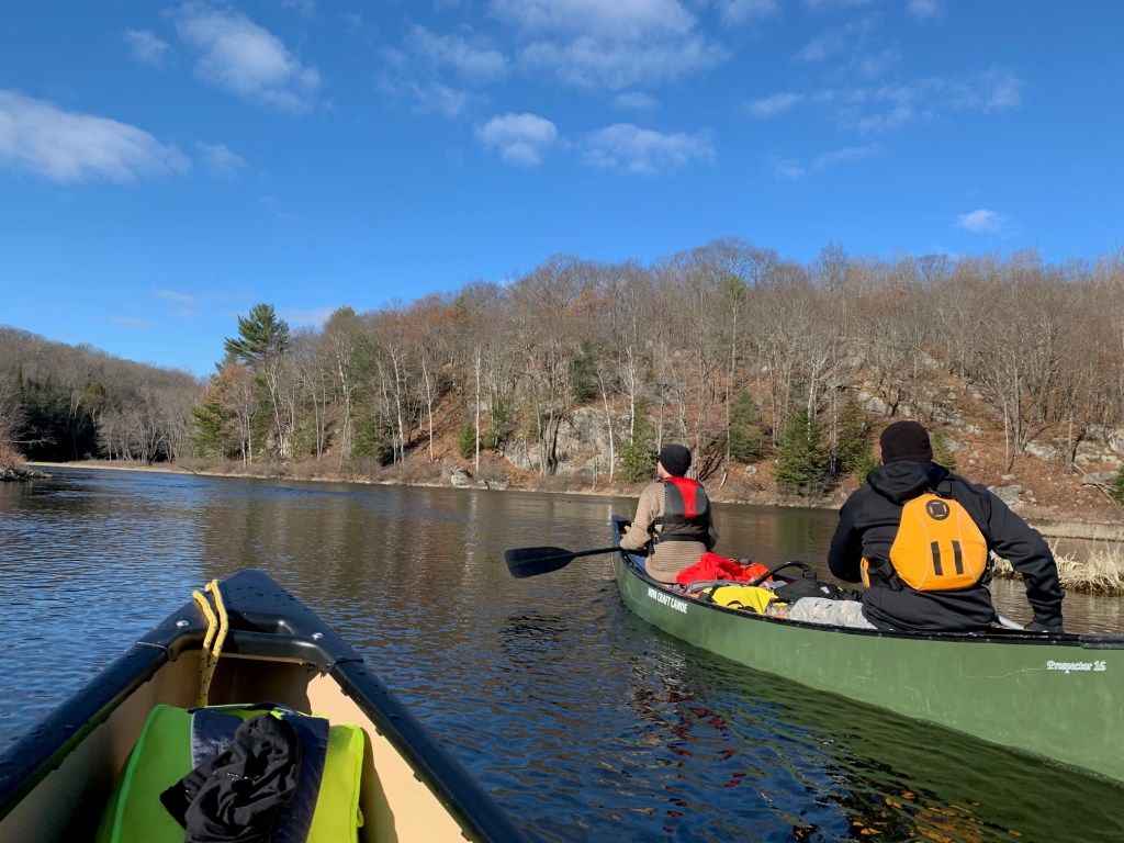
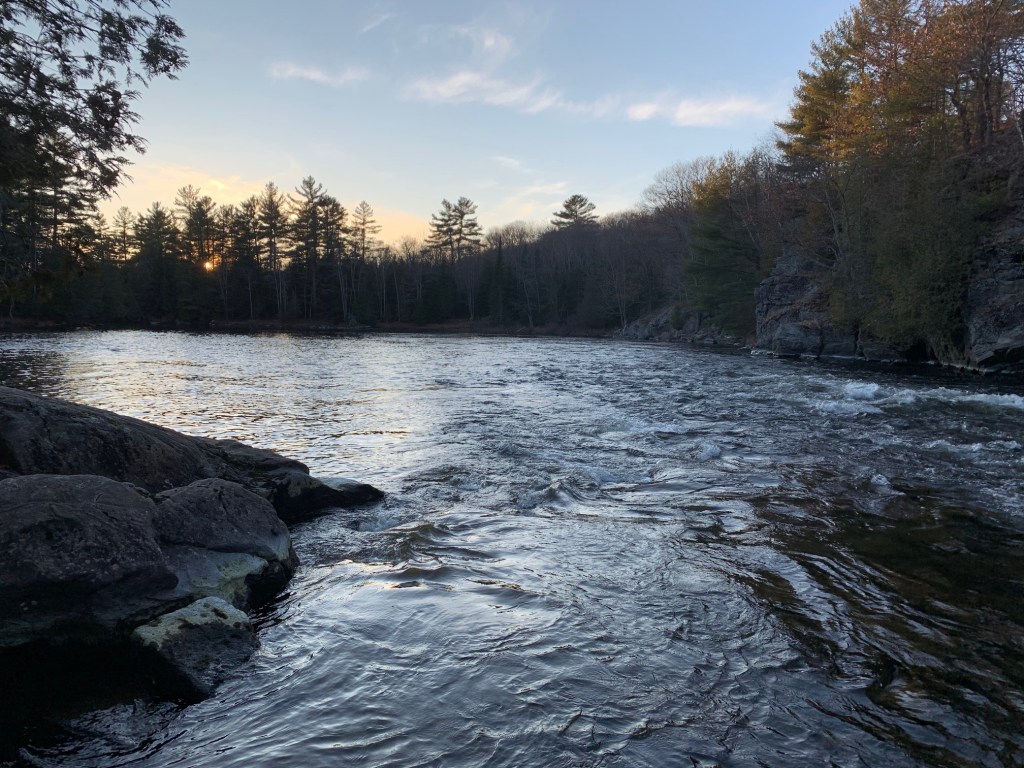
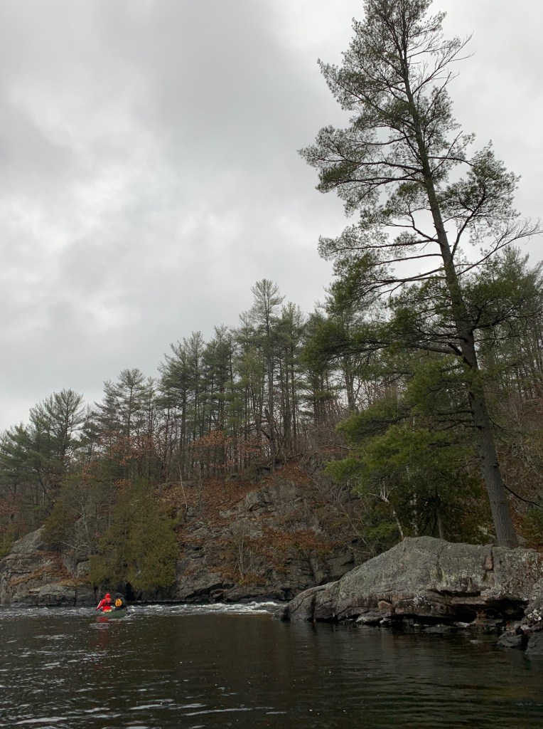
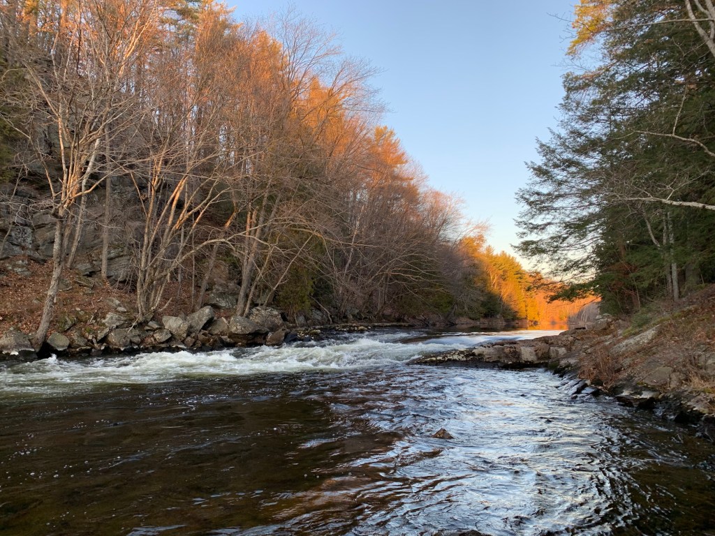
Beyond Thompson’s Folly we found ourselves paddling through picturesque Crown forests, with gently sloping, tree studded hills running up from the rocky shoreline on either side of us. By this time of the season, the splendour of the colourful fall foliage had long passed and in its place were barren deciduous trees, beige leaf litter on the forest floor, coating the hills, and long, dry, sun-bleached grasses along the riverside. We were now approaching Cook’s Falls, a scenic, gurgling CII rapids that lies in the shadow of a towering granite cliff – this would be our campsite for the night.
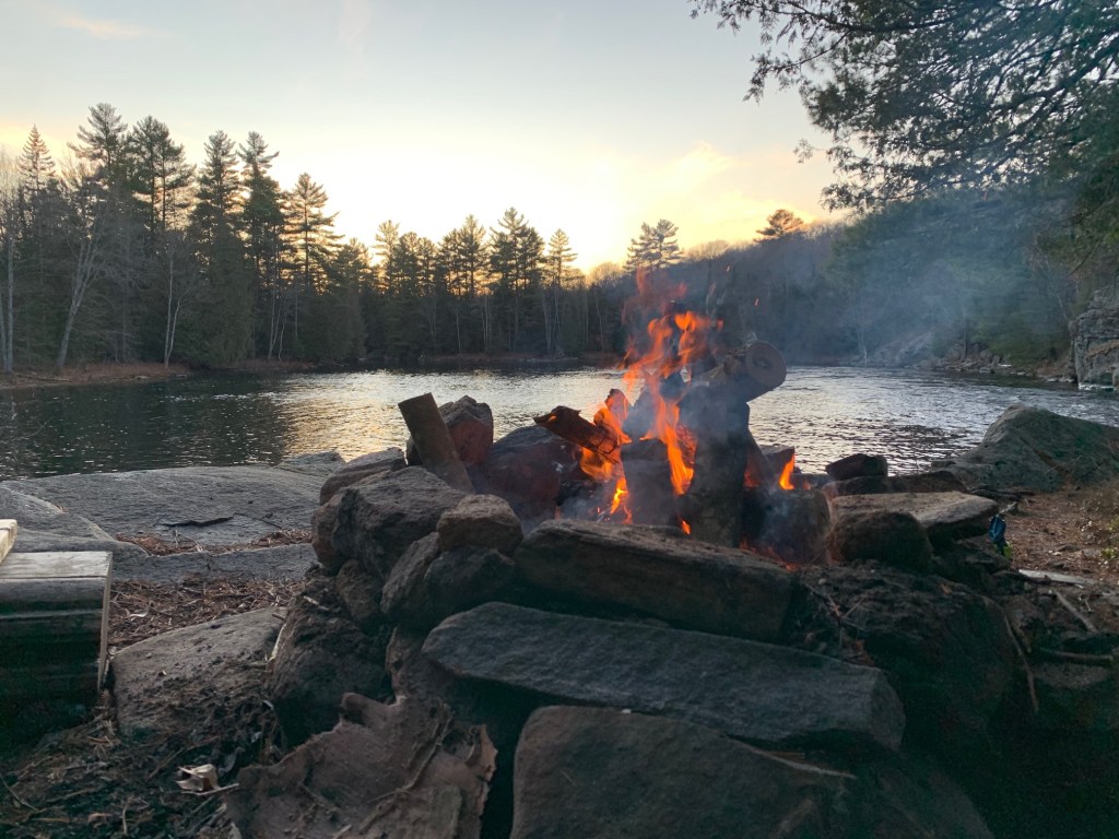
At Cook’s Falls, we found a well-used campsite that seemed to be in good condition. We realized that the site, which over-looks the rapids to the west and a large pool of water to the south, would provide us adequate sunlight for most of the remainder of the day.
After we pitched our respective tents and prepared our fire pit, I decided to step away from the group, put my dry suit back on and try my hand at running the rapids. In scouting the run more carefully, it was clear that the best path through would be to stick to the right bank. I would have to slide through a couple of rocks at the top of the set, before paddling over the brink and smashing through a large wave train that would draw me toward a prominent jutting rock on the right shore. Here it would be important to draw left and power through the waves at the bottom.
At the top of the rapids, I could feel that the unladen boat would struggle to track, but I set the line well and pulled off the run without much trouble. In this case, one good turn deserved another and I portaged the boat back up for a second bout of fun.
Dusk soon came and a pale, pastel sunset fell over our camp. We enjoyed a good fire and hearty meal and were visited by a family of mice which had made a home in one of the big white cedar trees behind us. Our good spirits were only (slightly) dampened with the knowledge that a cold, heavy rain was in the forecast for the morning.
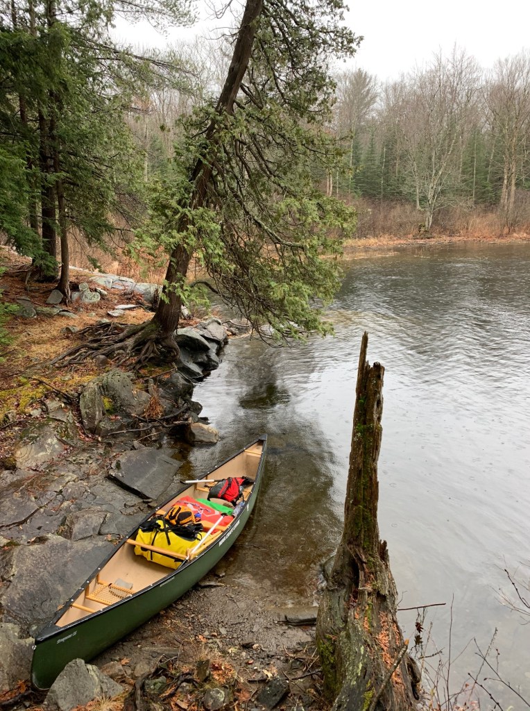
Not long after first light, I crawled out of my sleeping bag and shook a veneer of slush from the fly of my tent. The group soon emerged from their tents as well and we cooked a quick breakfast and packed up as a drizzle set in.
Down river from Cook’s Falls we came to Snake Chutes, a dramatic rapids that flows around a notch in the river. The rapids were clearly not runnable and we made quick work of the portage as the rain intensified. Cottages were again becoming more frequent along the edge of the river as we approached and bypassed our final obstacle at Slater’s Falls.
Past Slater’s Falls the river flattens and meanders. By now the rain was falling with a steady rhythm. With the temperature at no more than two degrees centigrade we paddled hard to keep warm. After a few final bends in the river we saw the Fraserburg bridge and hauled out our canoes. Lachlan and Kevin would wait behind, taking refuge from the rain under the bridge, while Kai and I retrieved the second car. Despite the harsh end to our short trip, it was another great time on the water in cottage country.