Date Completed: July 2017
Difficulty: Advanced due to distance, remoteness, difficult terrain and numerous rapids
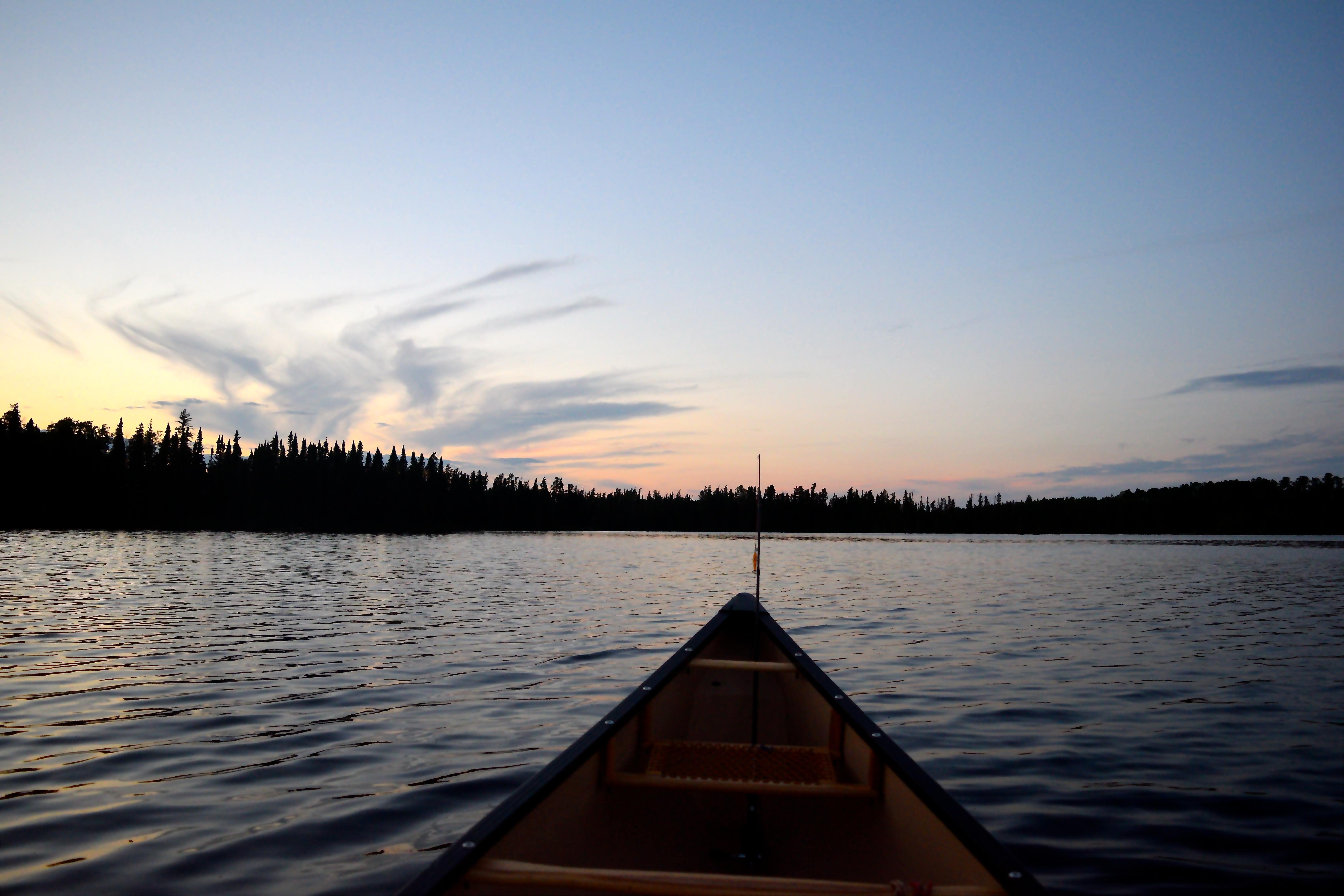
Method of Travel: Canoe
Region/Location: Northwestern Ontario, Wabakimi Provincial Park; Kopka River Provincial Park
Trip Duration: Seven days
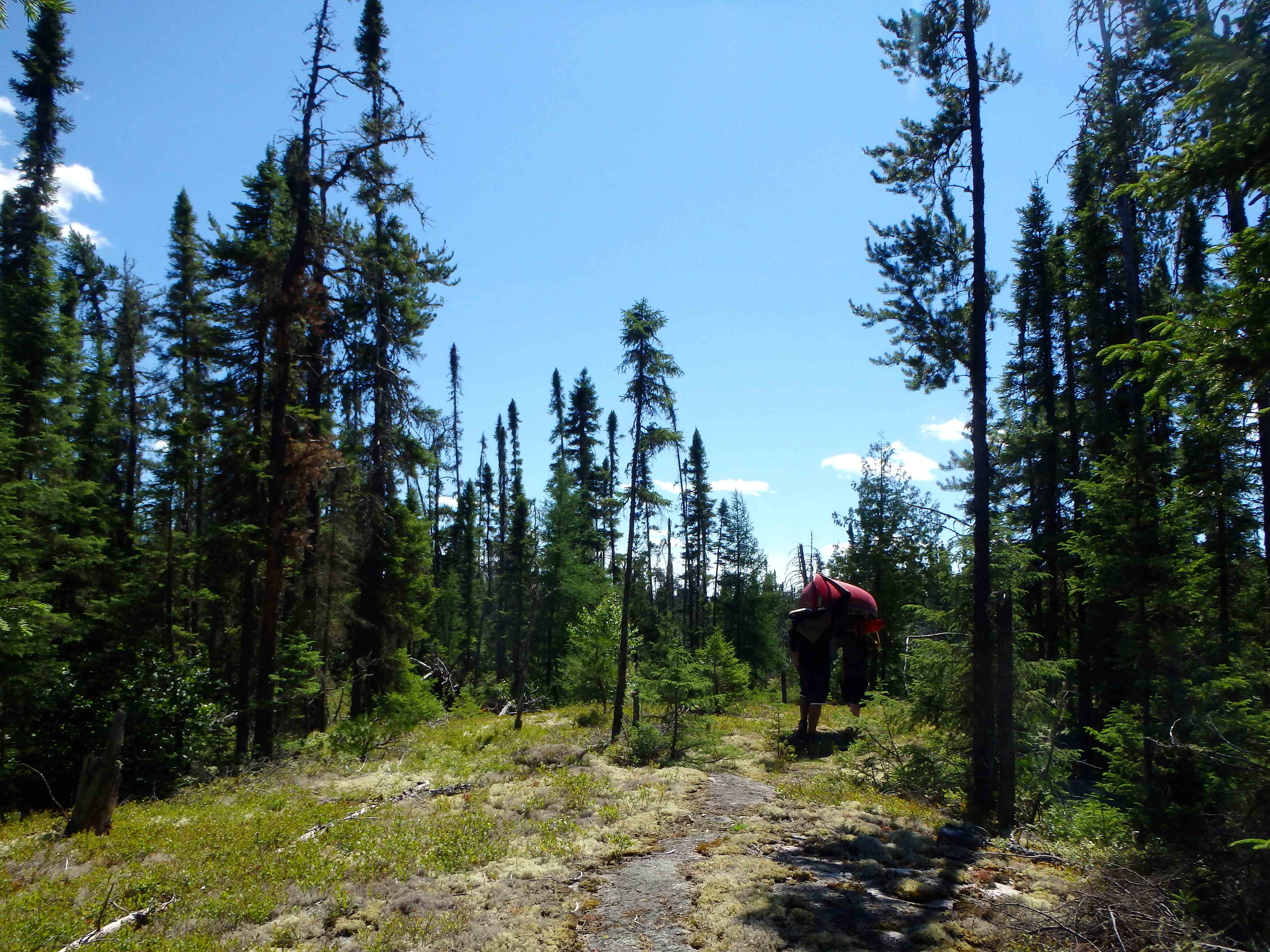
Distance: ~94km total (~86.5km on lake/river; ~7.5km over 30 portages)
Loop: No
Fees/Logistics: Park permit required within boundaries of Wabakimi Park; rail or float plane access required via Armstrong, Ontario
Trip Journal:
Preamble
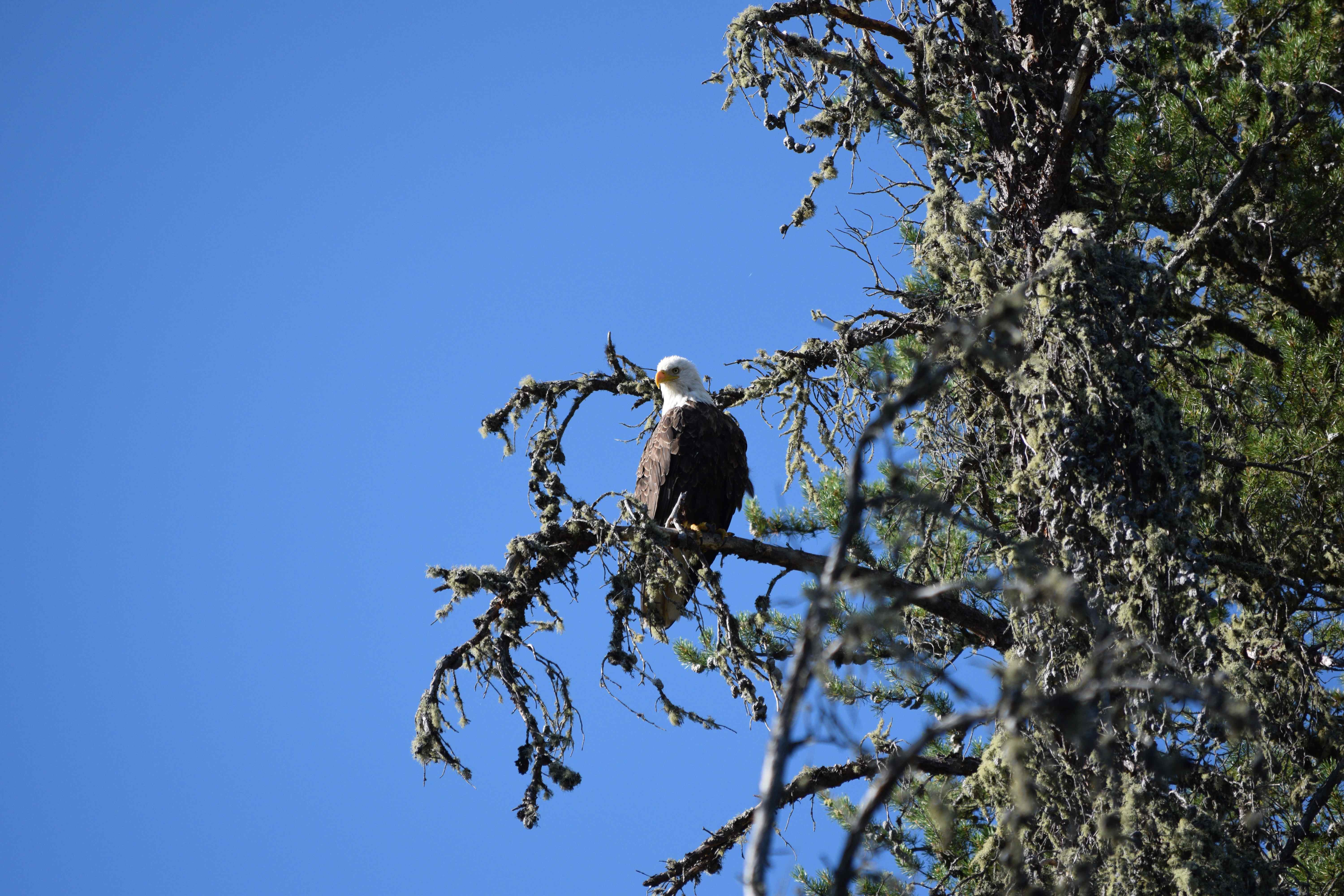
The magnificent, primeval ridges and valleys of Wabakimi were carved and scoured in the twilight of the last ice age, some 12,000 years ago. Black spruce, tamarack and jack pine, thin and stunted from long, harsh northern winters, cling to the shallow veneer of soil that scantly coats this portion of the Shield country. This harsh world still wholly belongs to the woodland caribou, the grey wolf and the bald eagle.
Signs of humanity are sparse; few tread here. But if you endeavour to pass through this land, look carefully under the shadowy canopies of those weathered and stunted tamaracks; under the beard lichen and Labrador tea; amongst the sphagnum moss, wood ferns and wild blueberries bushes; you will find trails of another time. Gaze over the placid waters, down the tumbling rivers, across the serpentine lakes, and envision the water trails of yesteryear. These canoe routes were established over centuries by the North of Superior Ojibwe – ancestors of the Whitesand, Mishkeegogamang, Saugeen, and Eabametoong First Nations. Today those canoe paths remain.
Should you heed the call of Wabakimi’s mystical waterways, you will traverse broad swaths of an untouched wilderness paradise. Travel this land and you will know the feeling of untried adventure in the boreal; you will find glory in turbulent rapids and boundless solitude on cold and glassy waters. You will discover new pathways, opened and blazed not by the axe, but through reflection and quiet contemplation in nature.
Wabakimi is a place to feel the thunderous fury of great waterfalls through your bones, and gaze at distant lightning storms as all the stars of the galaxy flicker off the rippling dark waters at your feet.
May your days, here, be sunny; may your evenings shine with fiery, orange horizons; and may your nights be cold and dark, save the silent sirens of midnight in their purple and green splendour.
Acknowledgement:
I wish to acknowledge, in this write-up, the assistance provided to our group by the late Phil Cotton, former Director of the Wabakimi Project/Friends of Wabakimi. Phil answered my innumerable emails/inquiries regarding logistics of our planned route and provided sage advice on many aspects of our plan – including how to efficiently bag Wabakimi’s famous walleye. Thanks for helping us make this one of the most memorable trips we’ve completed, Phil.
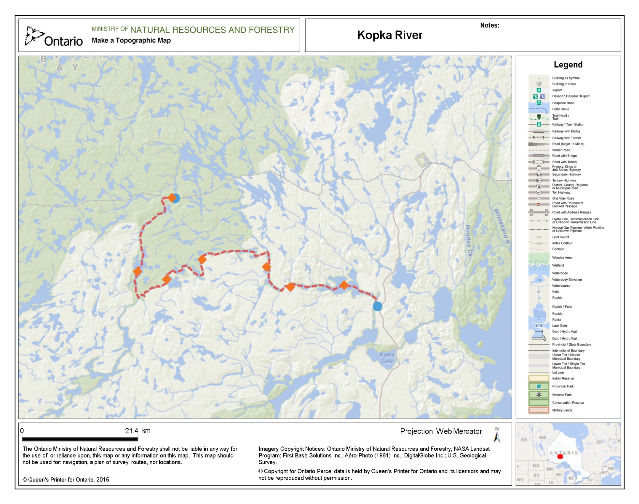
Day 1 (July 19) – Union Station to Unnamed Lake (Mile Marker 32.3)
Distance Travelled: ~100m (no portages)
Our decision to paddle the Kopka River via the lake system north of Aldridge Lake had to do with the remoteness of south central Wabakimi Provincial Park and its accessibility by train.
A few months prior to setting out on our adventure down the Kopka, I had made arrangements with Via Rail to transport four paddlers, two canoes and gear from Union Station in Toronto to an unnamed lake North of Aldridge at mile marker 32.3 from Armstrong, Ontario (well before Allanwater Bridge). Our plan would be to paddle from this location south, through a series of boreal lakes, to the Kopka River and follow the Kopka system east to Bukemiga Lake where a shuttle driver would take us to Armstrong Station. From Armstrong we would board the train and head home.
It is notable that Via was extremely accommodating throughout the booking process and indicated that they were willing to drop passengers off anywhere along the trans-Canada rail line, so long as the request was made in advance. Our trip to Mile Marker 32.3 and return via Armstrong cost $354.82 (total roundtrip after tax) per person. We also incurred an additional $100 fee (each way) to transport each canoes.
The only other fees we incurred for the trip were camping permits for our first two nights at $15 per night (Wabakimi is an operating park, but Kopka River is not), a $160 shuttle fee to take us from Bukemiga Lake to Armstrong, and two rooms at the Chateau North motel at $100 each for our last night of the trip.
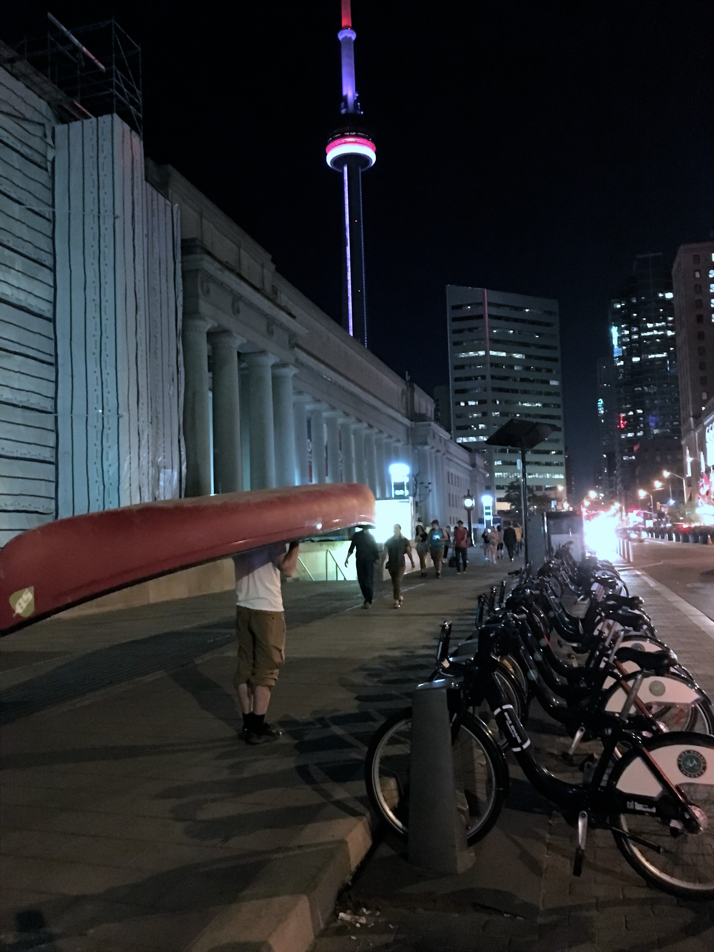
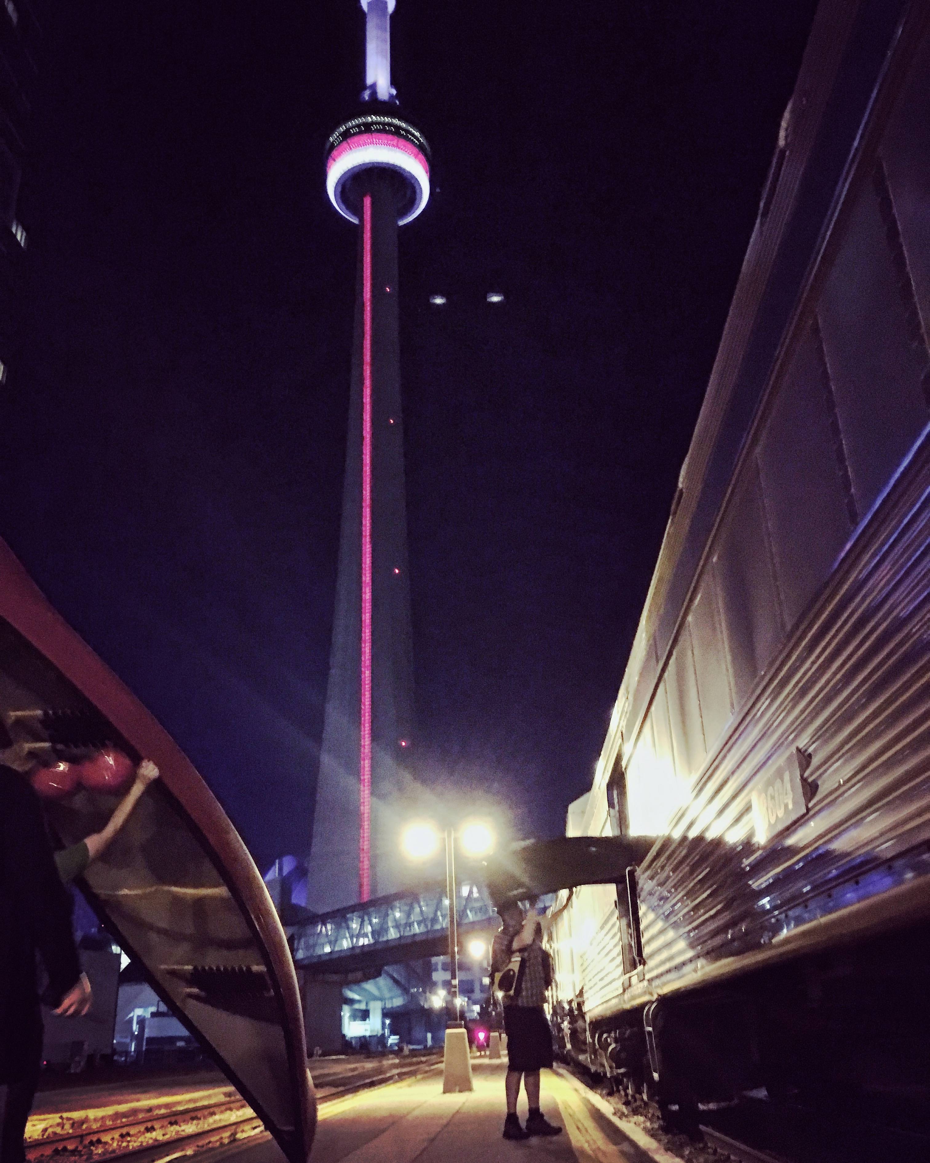
On July 19th, 2017, our group of four – Jono, Lachlan Mike and I – arrived at Union Station with our gear and canoes and prepared to disembark. We learned beforehand that the passenger service along the line is regularly delayed being that precedence is given to freight traffic – it’s normal for passenger trains to be delayed several hours before departure and, in our case, our 10pm departure was postponed by five hours until 3am.
Once we had obtained our boarding passes and checked our baggage, we were instructed by Via personnel to load our boats onto the freight cars ourselves. Thus we began portaging our two canoes through the bowels of Union Station and up to the departure platform. This resulted in a comical situation, in which several dozen other waiting passengers rose to their feet and applauded our group loudly as we marched through the terminal with our boats. I guess you don’t see canoes being portaged through Canada’s busiest train station very often.

The train ride from Union Station to marker 32.3 past Armstrong was long and uneventful. The ride takes approximately 24 hours and included rest stops at Capriol and Hornepayne, where passengers can exit the train to stretch their legs.
On a few occasions throughout the train ride, Via staff conversed with us about our trip and confirmed our drop-off point to ensure that their documentation was correct and that they would not miss our stop.
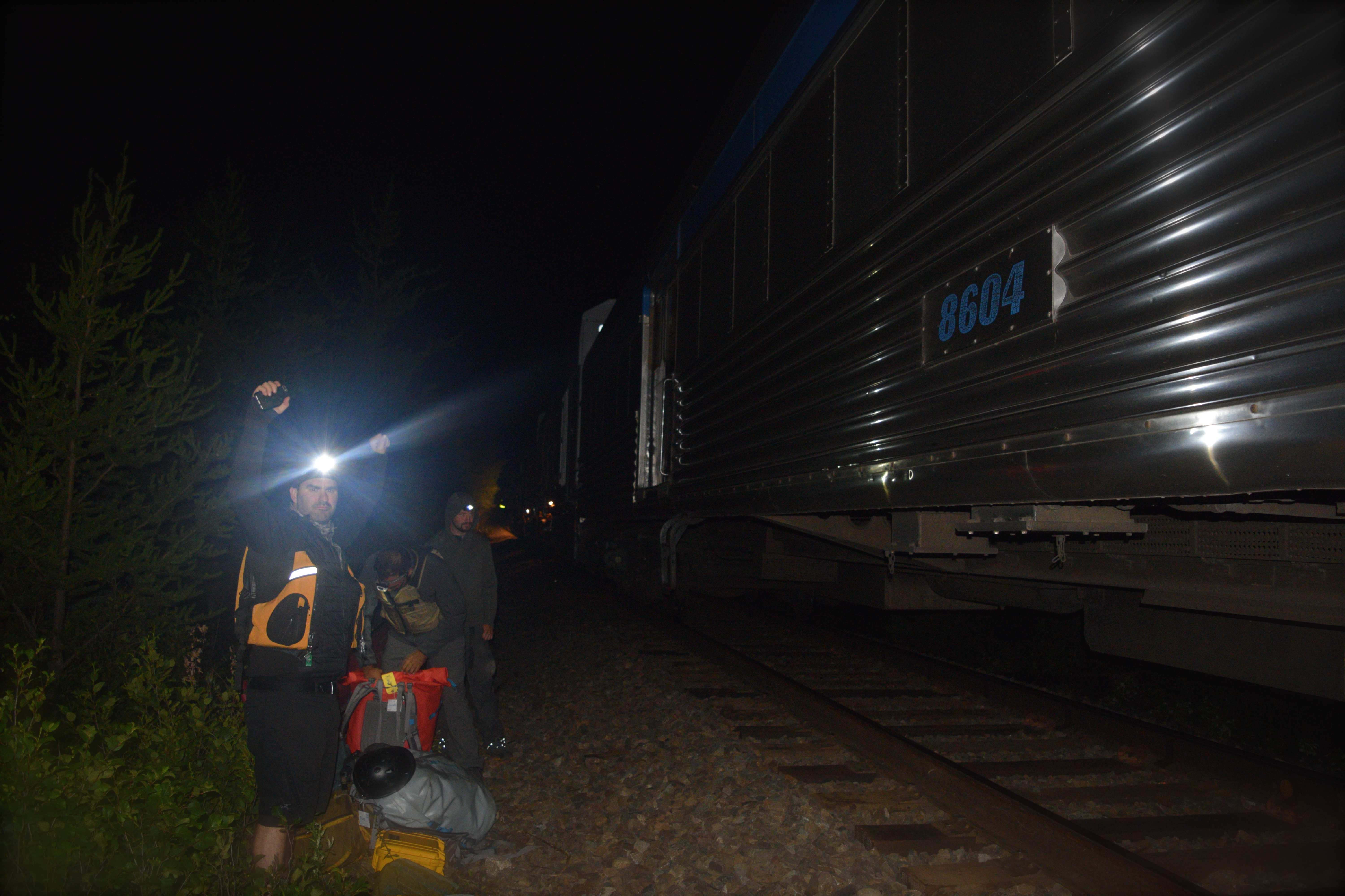
At approximately 2am, a feeling nervous anticipation overcame our group; we were called to the freight car where we would soon unceremoniously extricate ourselves from the train and head into the wilderness. It didn’t help our nerves that one of the engineers in the boxcar suggested that, in his 10 years on the line, he had never seen a group request a drop off at this particular mile marker. Regardless, the train soon stopped at marker 32.3, just east of a large culvert and we began unloading our gear/canoes.
Suddenly we were thrust into the wild and before we realized it, our train had vanished into the distance. Note that westbound Via trains pass through this area only in dark, so it is important to have any necessary gear handy (such as headlamps) before exiting the train.
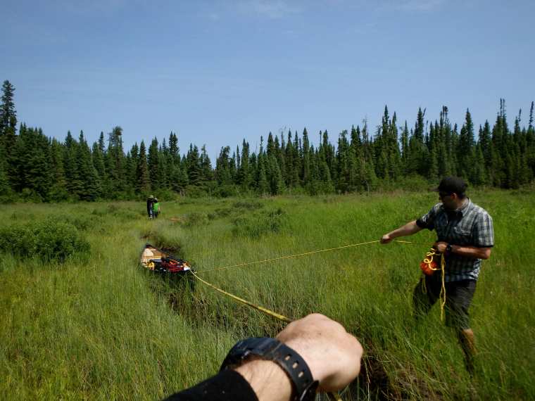
The track is set at least 20 feet above the unnamed lake to our south and it is necessary to negotiate a steep grade down to the water. To make things easier for ourselves we lowered our gear and the boats down to the water using ropes.
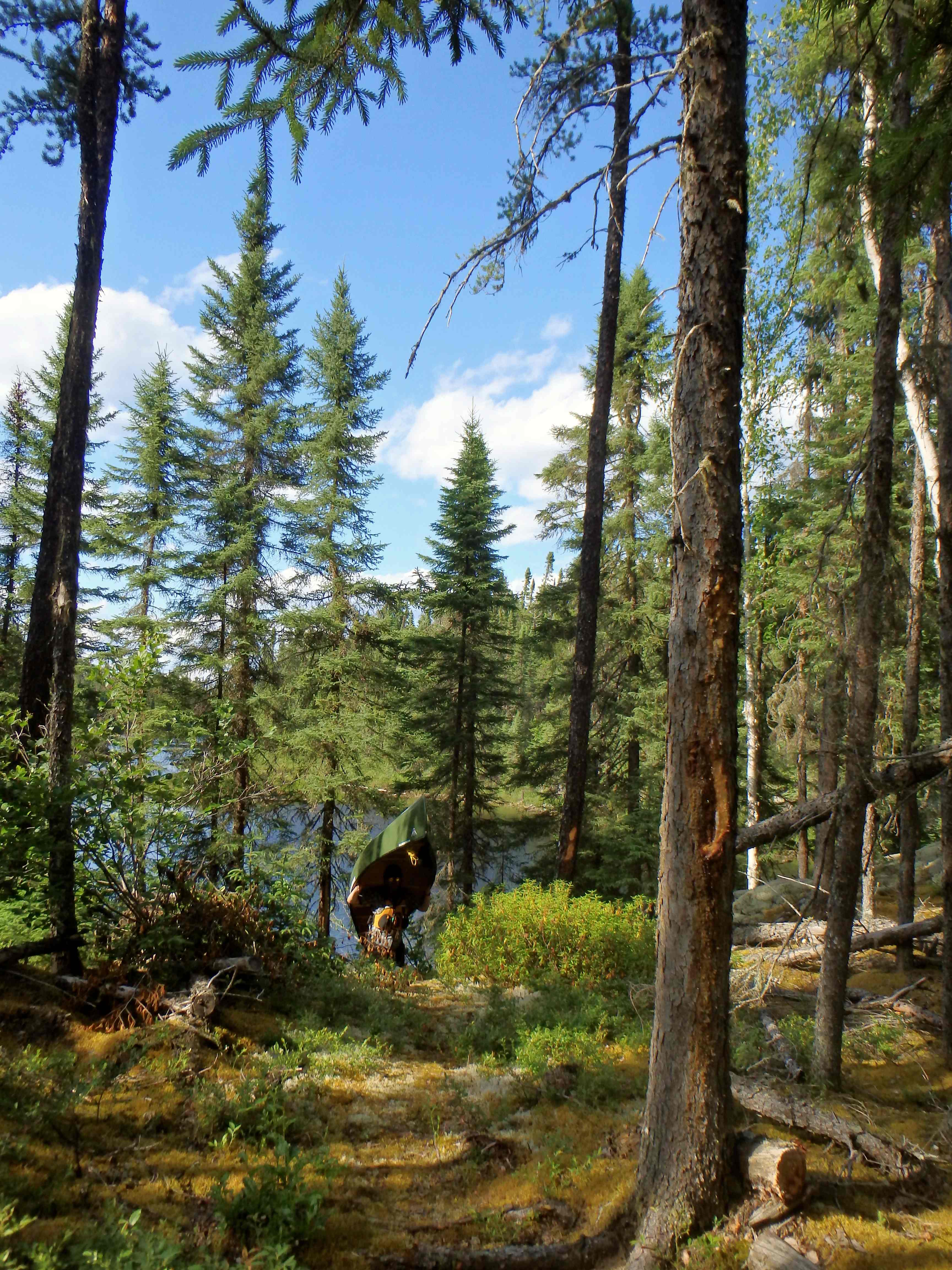
Once on the lake, we follow the shoreline west, past the culvert. After less than 5 minutes of paddling we came upon a good open campsite with room for several large tents – the site happened to be illuminated by hundreds of fireflies. This is where we set camp for the remainder of the night. The faint howling of wolves lulled us to sleep as the dawn began to creep over the horizon.
Day 2 (July 20) – Mile Marker 32.3 to Aldridge Lake
Distance Travelled: ~20km (including 1.5km over seven portages)
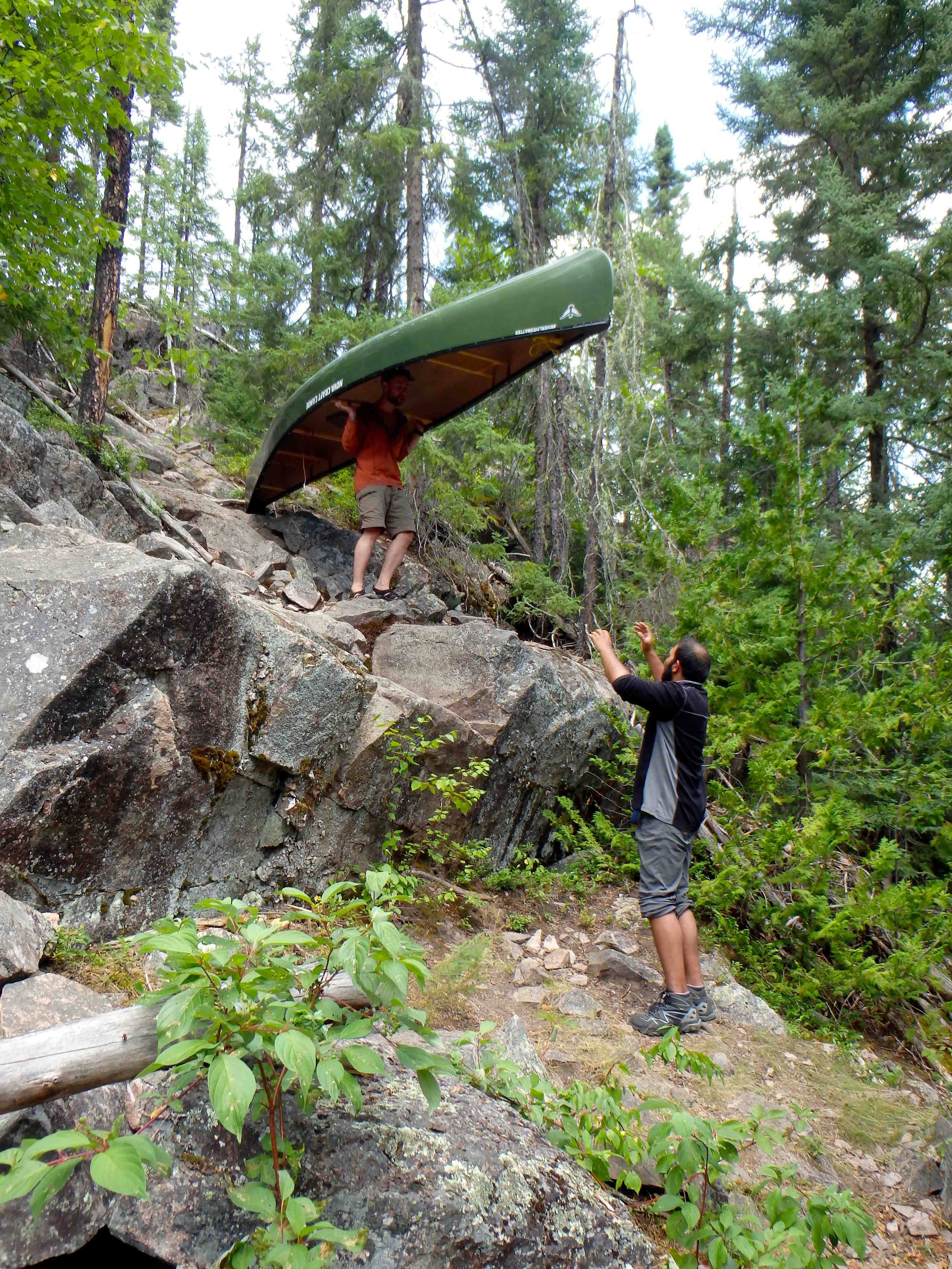
Upon rising, we ate breakfast, broke camp after 10am under fair skies and paddled to the west end of the unnamed lake where we traversed three short portages to reach Beagle Lake. On the day, we would traverse seven portages – all flat and easily negotiable.
It is worth noting, at this point, that in planning the trip weeks prior, I had also spoken directly with park staff about the condition of our route. The Kopka system, especially between our put in point and south to the river itself is seldom travelled. Fortunately, the rangers I had spoken with had informed me that a two-man crew had travelled along our precise route with a chainsaw early that spring (2017) – apparently their second time travelling the route in the prior ten years. This meant that the portages along the entirety of our trip were, for the most part, in immaculate shape.
It is important to beware that no portage trails or campsite locations on this route are blazed with plastic signs or trail tape; they are often difficult to find. The rangers that spring, however, had been nice enough to cut notches cut in waterside trees to help identify portage locations.
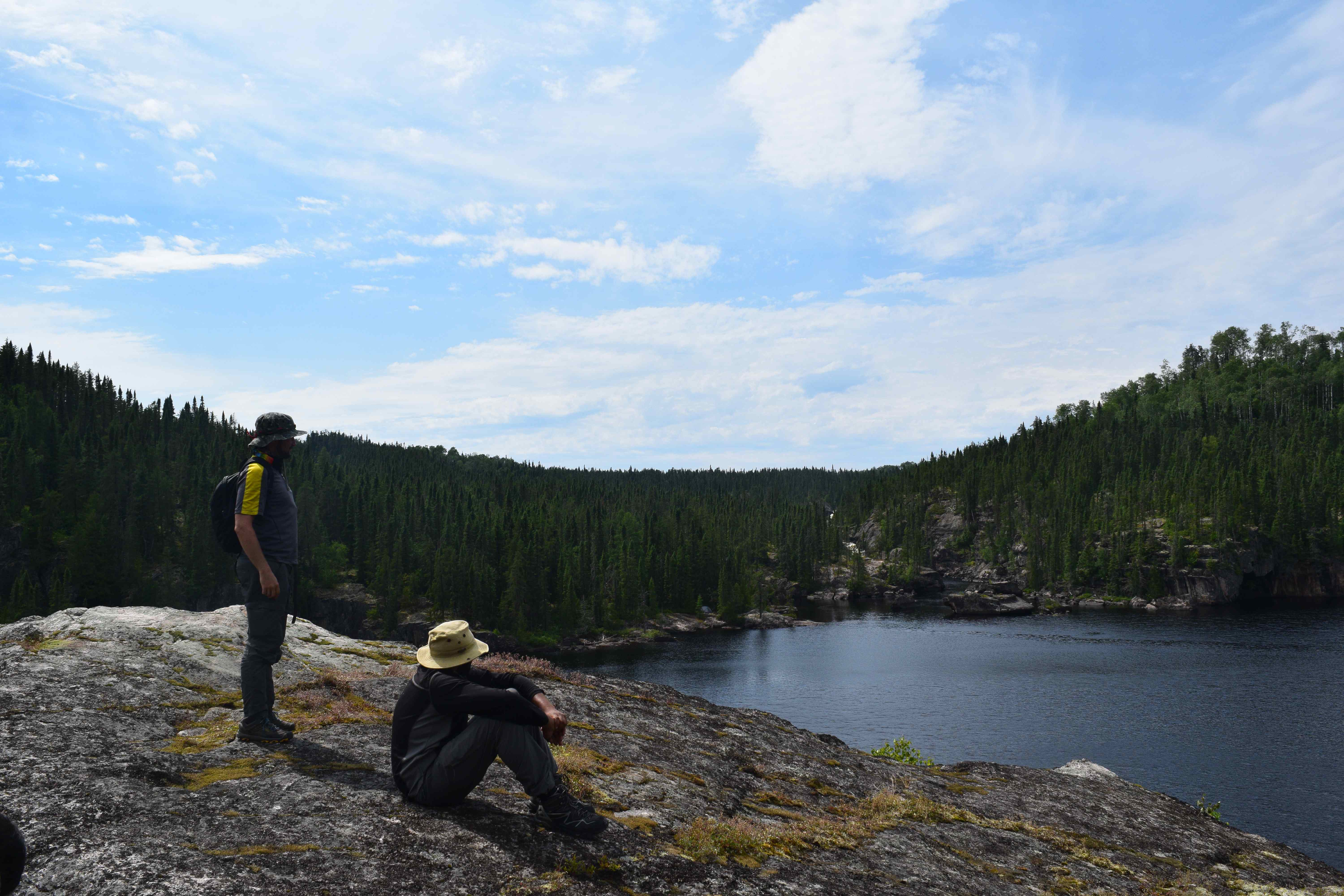
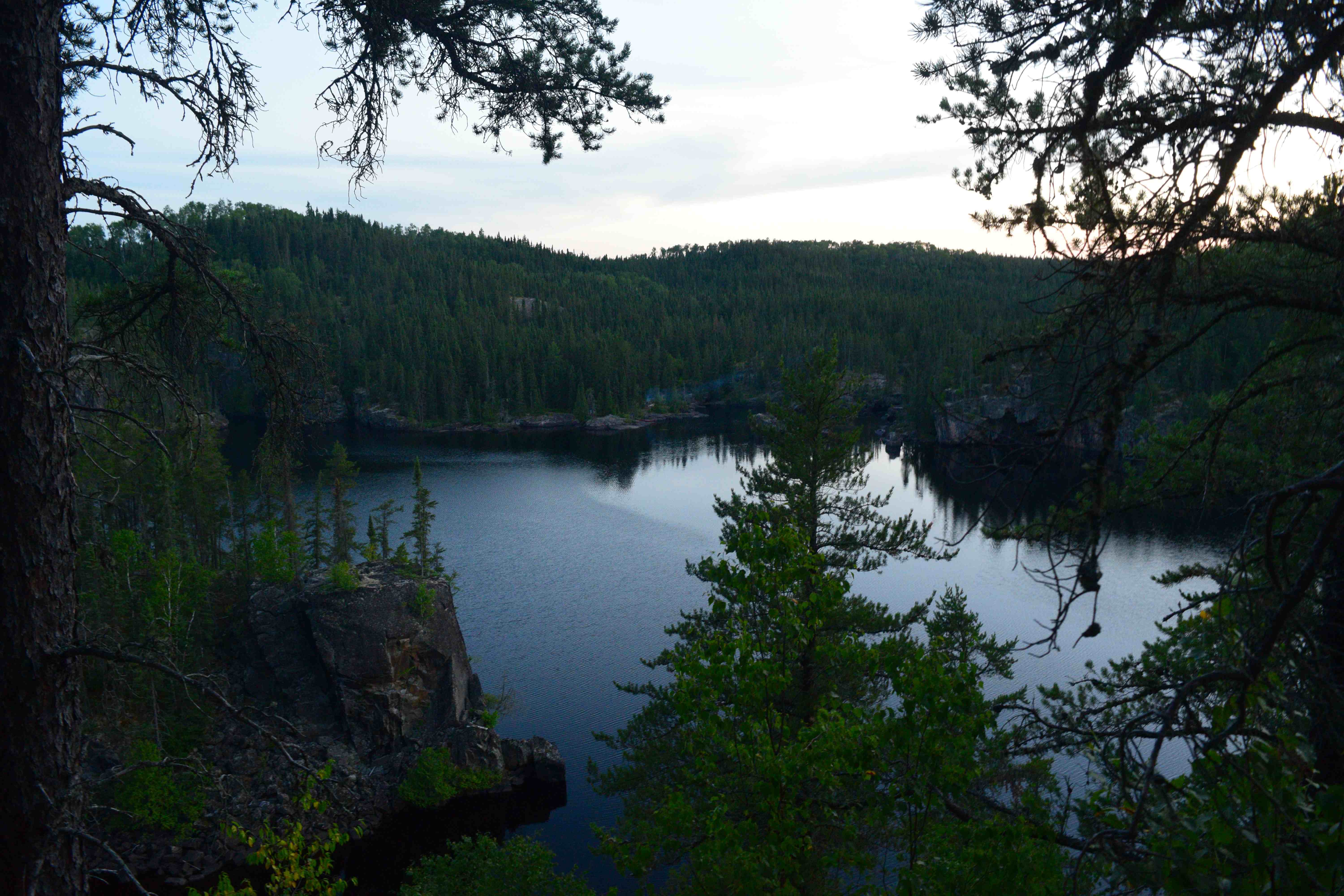
Beagle Lake is large and scenic, with beautiful, sheer 150’ granite cliffs at its north end. As we paddled along the base of the cliffs, two large bald eagles soared high above us.
The portage trail between Beagle and Laparde Lakes is intersected by an old logging road and camp. The road itself is badly overgrown by trees, but a number of relics – metal tools, cables and beams – have survived to this day. We also found evidence here of an old overgrown camp.
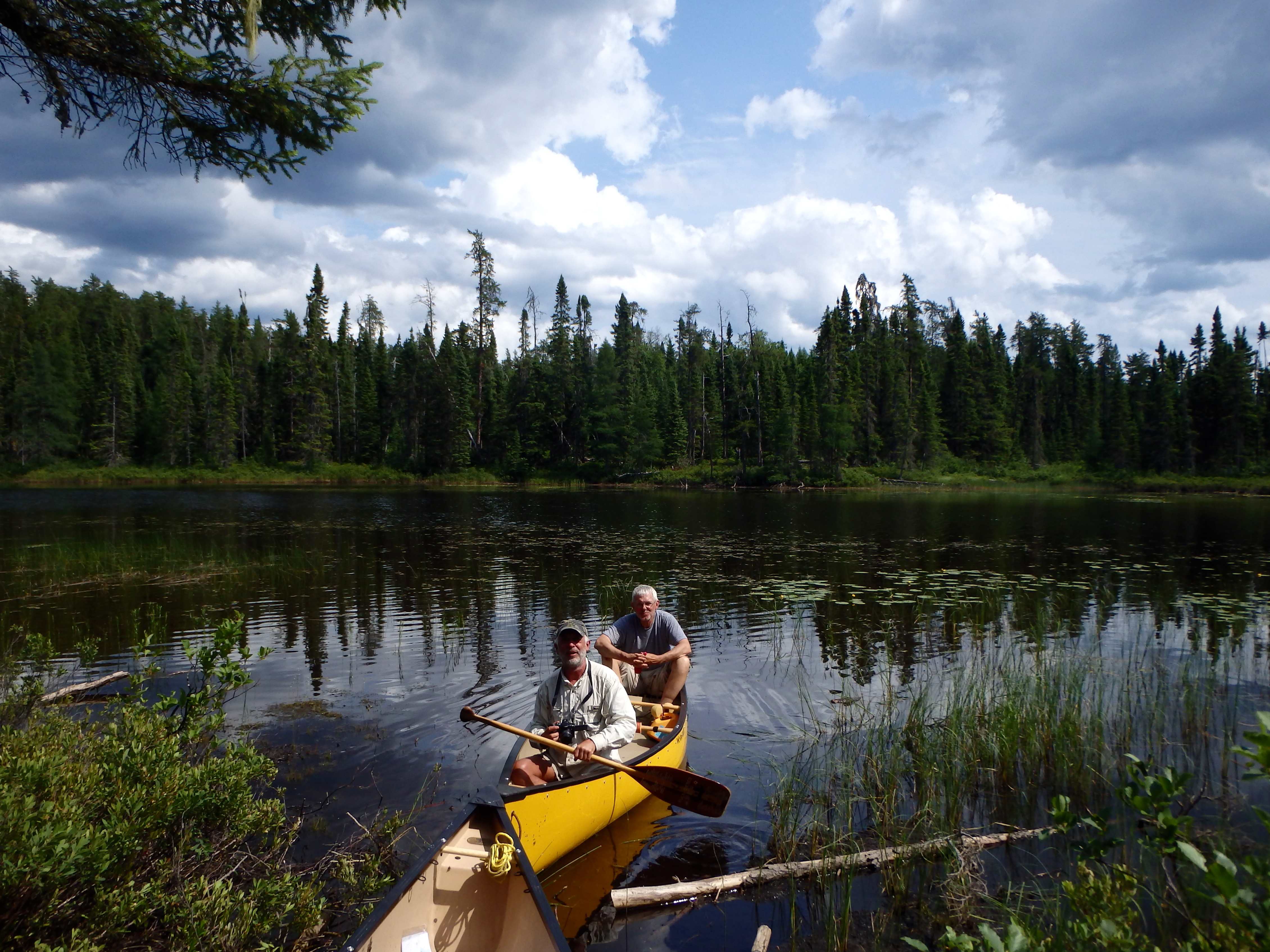
Past Laparde we entered Aldridge Lake – a large, windy, island encrusted body of water with multiple bays and arms. It was on Aldridge that we planned to camp.
In planning the trip, I had relied on maps and trip journals from WabakiMaps.com, Ontario Parks, Kevin Callan’s “Top 50 Canoe Routes of Ontario”, Albinger.me, and topographic data from the Federal government (at the time Volume V of the Wabakimi Project’s canoe route series had not yet been released). These sources provided more than enough information to easily plan and navigate the route, but for whatever reason, we struggled to find anything resembling a campsite on Aldridge.
After searching for about an hour, we thought we had finally found a suitable spot for tents on one of the lake’s central islands, only to discover that the clearing was a recently razed fly-in fishing outpost that had been burned to the ground. Little remained in tact amongst the ashy rubble of the lodge and the ground was not ideal for setting up tents. It would have been quite a horrific and spectacular site to witness the fire – the dense forest surrounding the heap of rubble was badly burned and blackened.
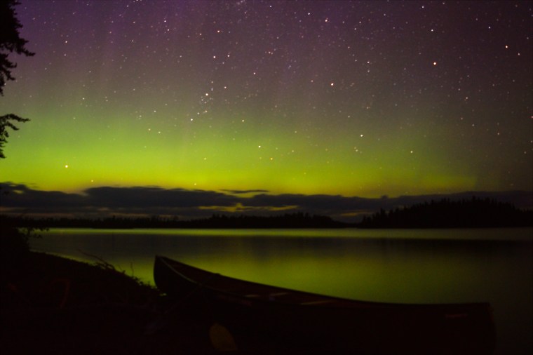
We departed the island and continued our search until finally, late in the day, we encountered a ministry boat cache on a small beach along the southwest shore of the lake. The cache was overgrown and clearly not used in recent times, but notwithstanding the dense cover of ferns and tangled saplings on the forest floor, there would be enough room for our tents. We got to work clearing the site and before long had erected a nice little camp, just before dusk. We built a fire on our little beach, ate dinner, fished (Lachlan even caught a pike) and sat in awe of the northern lights as the emerged in the ever-darkening sky; an incredible start to our trip.

Day 3 (July 21) – Aldridge Lake to Sandison Lake
Distance Travelled: ~13km (including 2km over five portages)
The group woke up at around 9am to beautiful conditions and we took our time in preparing to set off. At around 11am we finally departed from our site to the south end of Aldridge Lake where we carried over a 75m portage. This portage would have been very difficult to spot had the rangers not blazed these trails with their chainsaws the month prior.
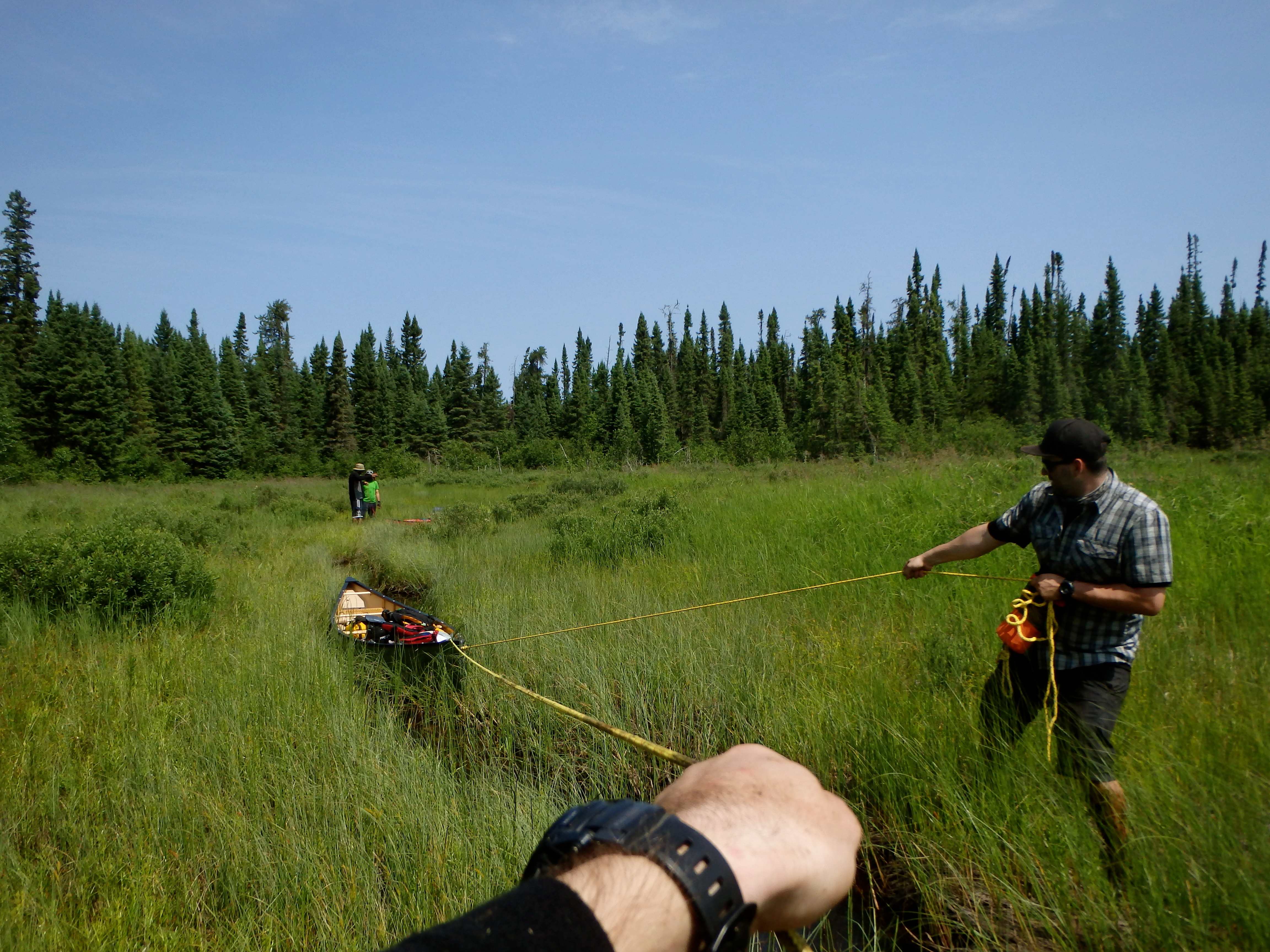
At the end of the next lake was a woody portage that gives way to an open section of rich, reedy marshland that stretches for over half a kilometre before the trail continues through a thick stand of conifers to the south. A cold, thin stream cuts through the marsh but is not navigable by canoe. Instead of paddling here, travellers are required to portage their boats and gear over this precarious section of peaty muck. In our case, we decided it would be easier to haul out laden boats using two people and painter lines, on either side of the stream, to the beginning of the next section of the trail. Going was very difficult and we repeatedly broke through the peat and found ourselves waist deep in mud.
Thinking the worst was over, we began to portage our gear through the woods only to find that beaver activity had entirely flooded out the trail. Not even the work of the friendly chainsaw-wielding rangers that had passed through the area before us could salvage this disastrous portage, which was a mess of thick, dense trees, mud, roots and deadfall.
We rewarded ourselves for finally completing the portage with a leisurely lunch of pitas, cheese, sausage and whiskey, which we consumed on the dark waters of the last lake before the Kopka River.
Again, the kilometre-long trail to the Kopka was difficult to find, and was severely overgrown with Labrador Tea and bramble. Evidently, part of the trail had been recovering from a wildfire. In this middle section, it would have been quite easy for any one of us to wander off the trail without realizing it.
As we finally approached the river, we came upon two fellow paddlers sitting in a yellow canoe at the base of the trail. They identified themselves as Barry and John – volunteers, out of Wisconsin, with the Friends of Wabakimi and the Wabakimi Project – and were out on three-week trip to map the watershed east to Lake Nipigon. We had an interesting conversation with the duo about their route and the river, and have since kept in contact with Barry who is a kind fellow and a great champion of the wilderness.
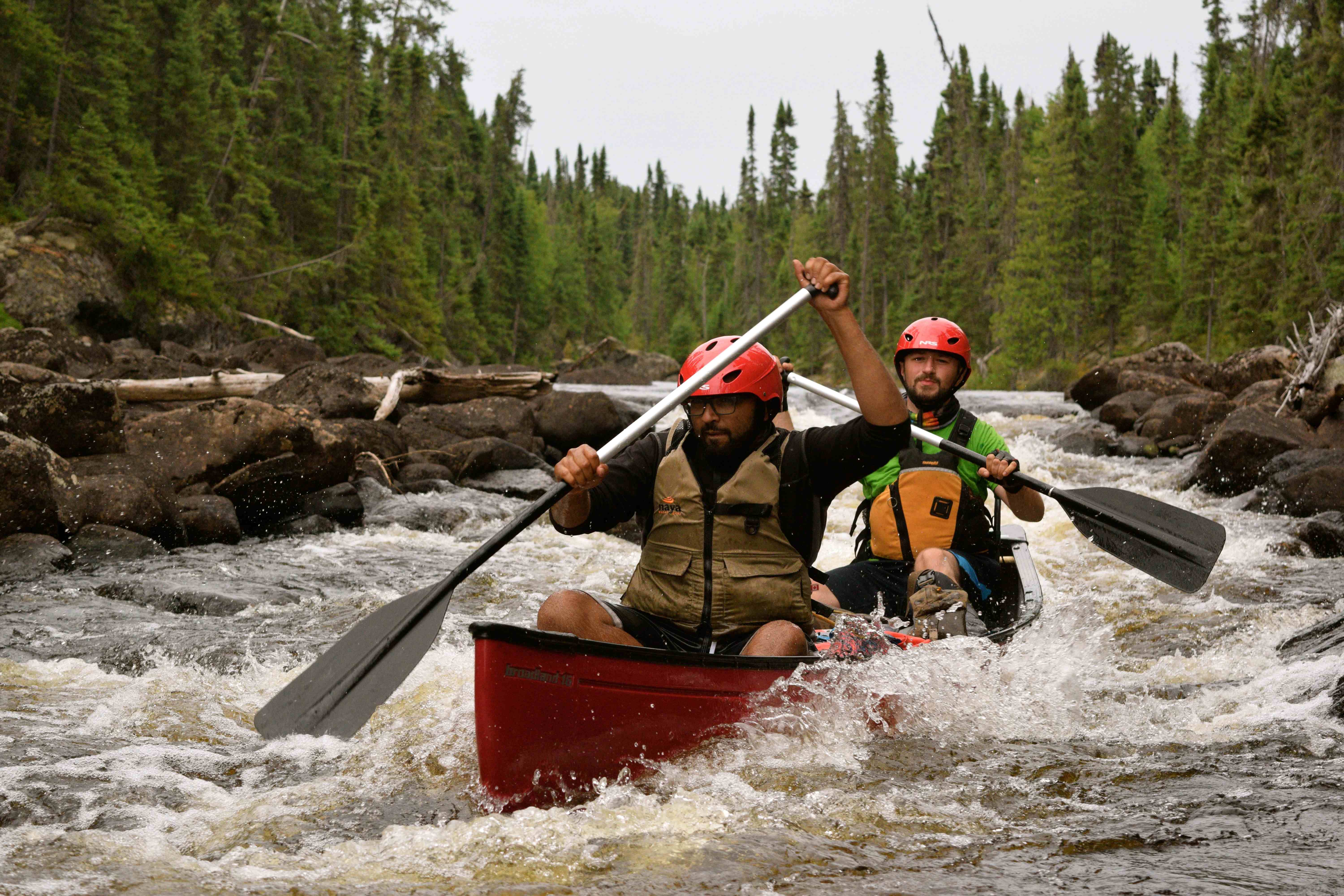
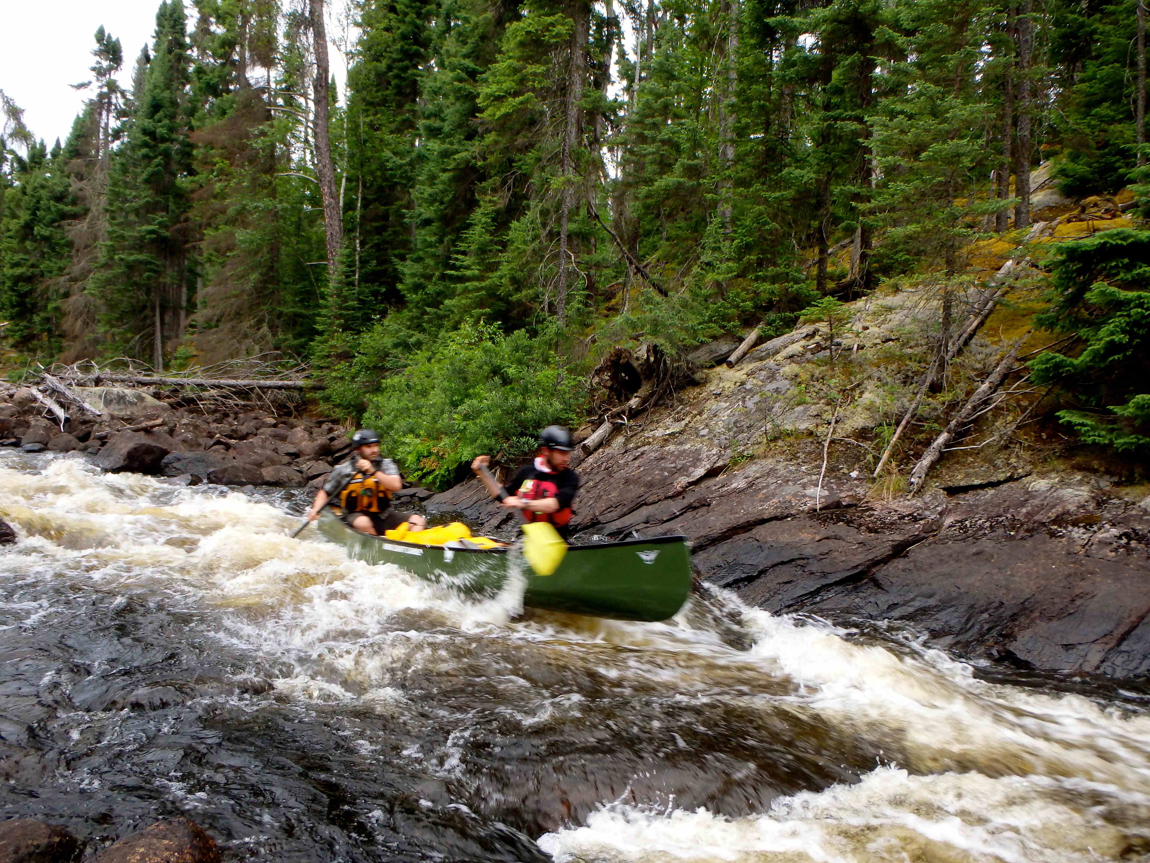
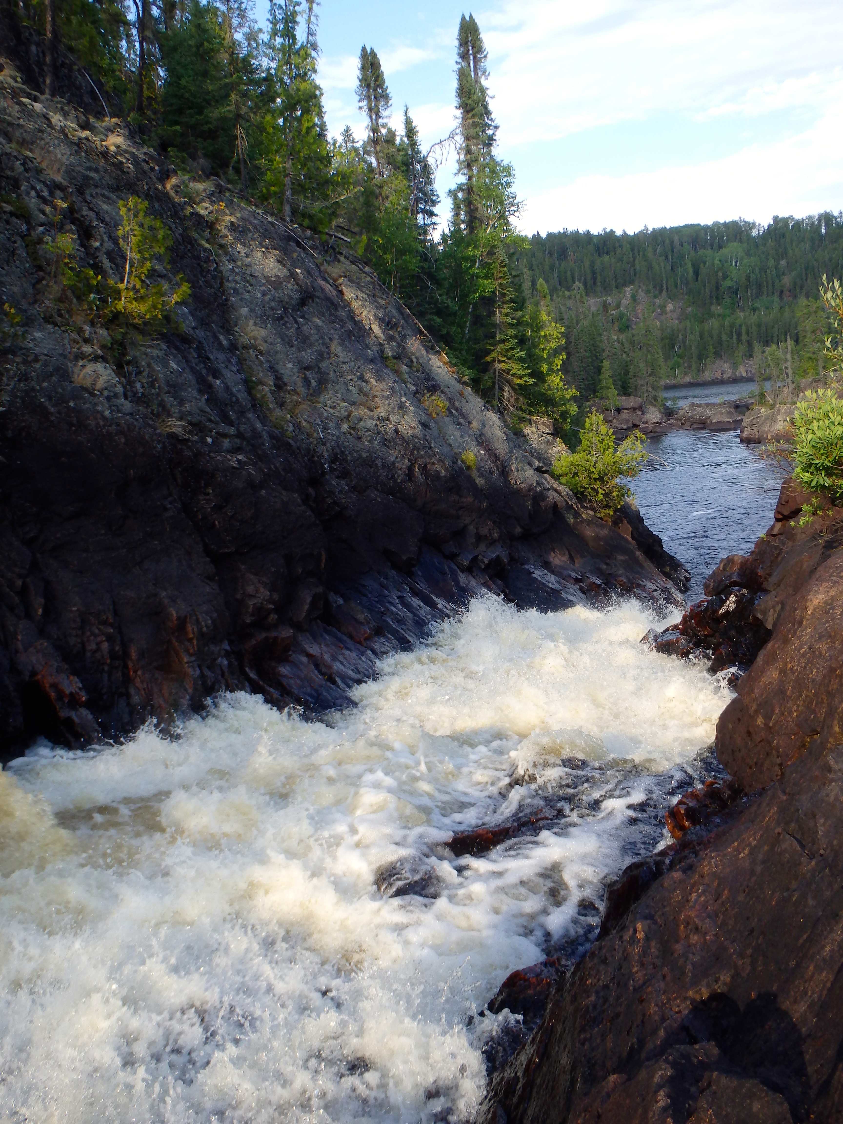
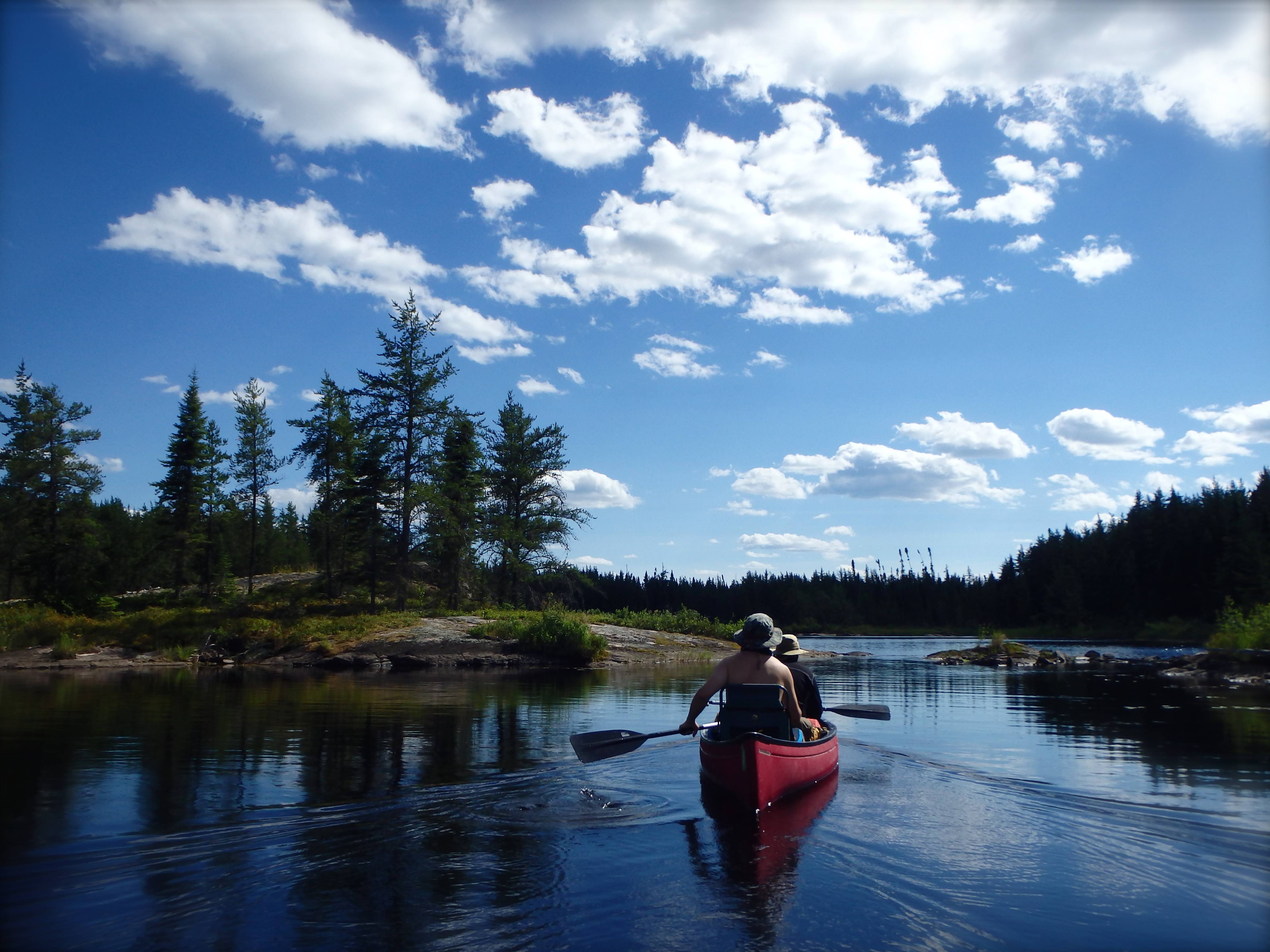
We continued to paddle down the river and encountered our first rapids of the trip – a few easy CIs that we were careful to negotiate given the apparent low-level of the river.
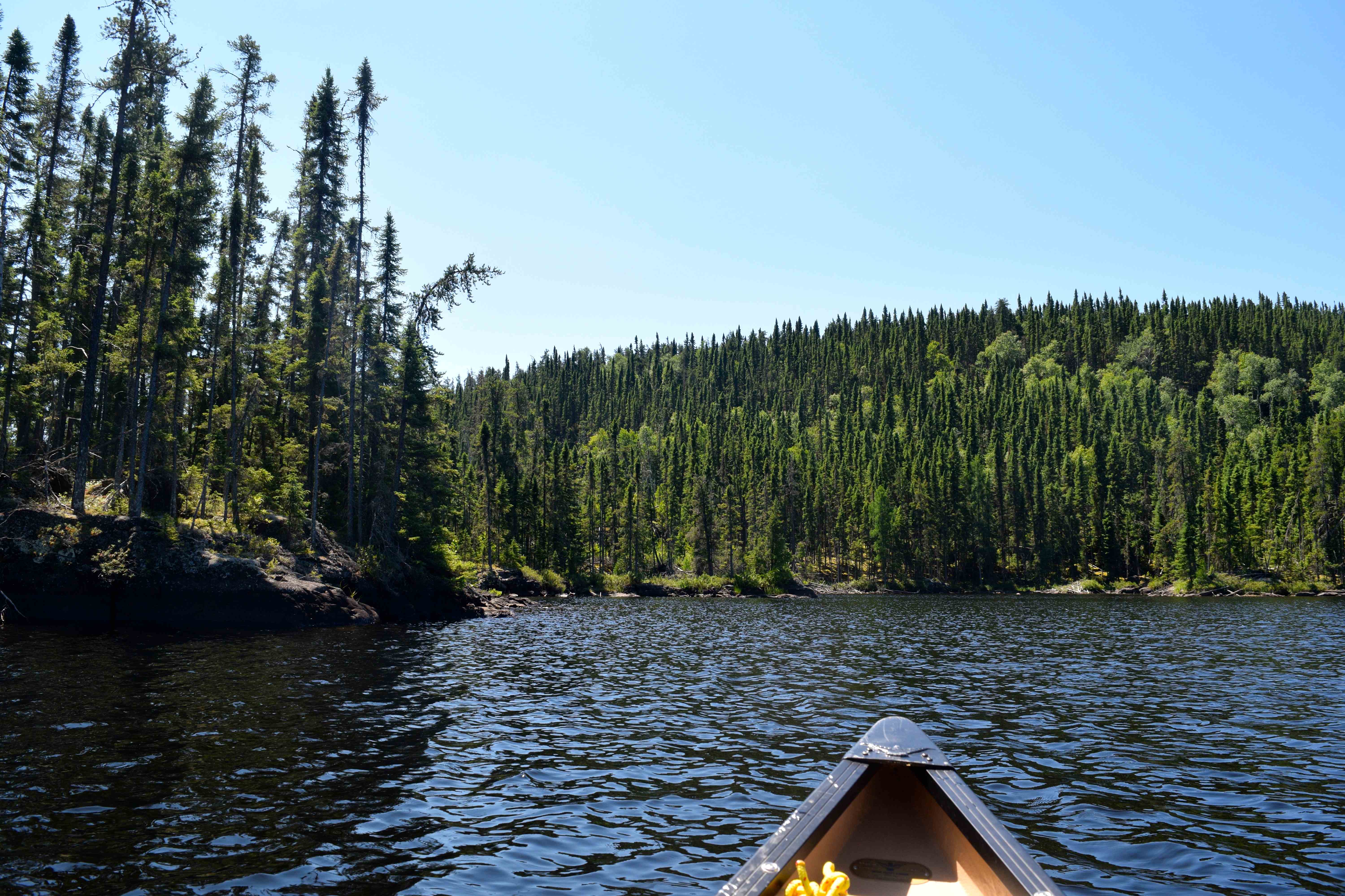
The Kopka is dark, winding, bouldery, narrow and enclosed, shrouded by stunted spruce and pine, and the boreal forest here is as beautiful a place as I’ve seen. After an additional six or seven kilometres of travel on this magnificent river, we arrived at an open rocky site on the west shore of Sandison Lake.
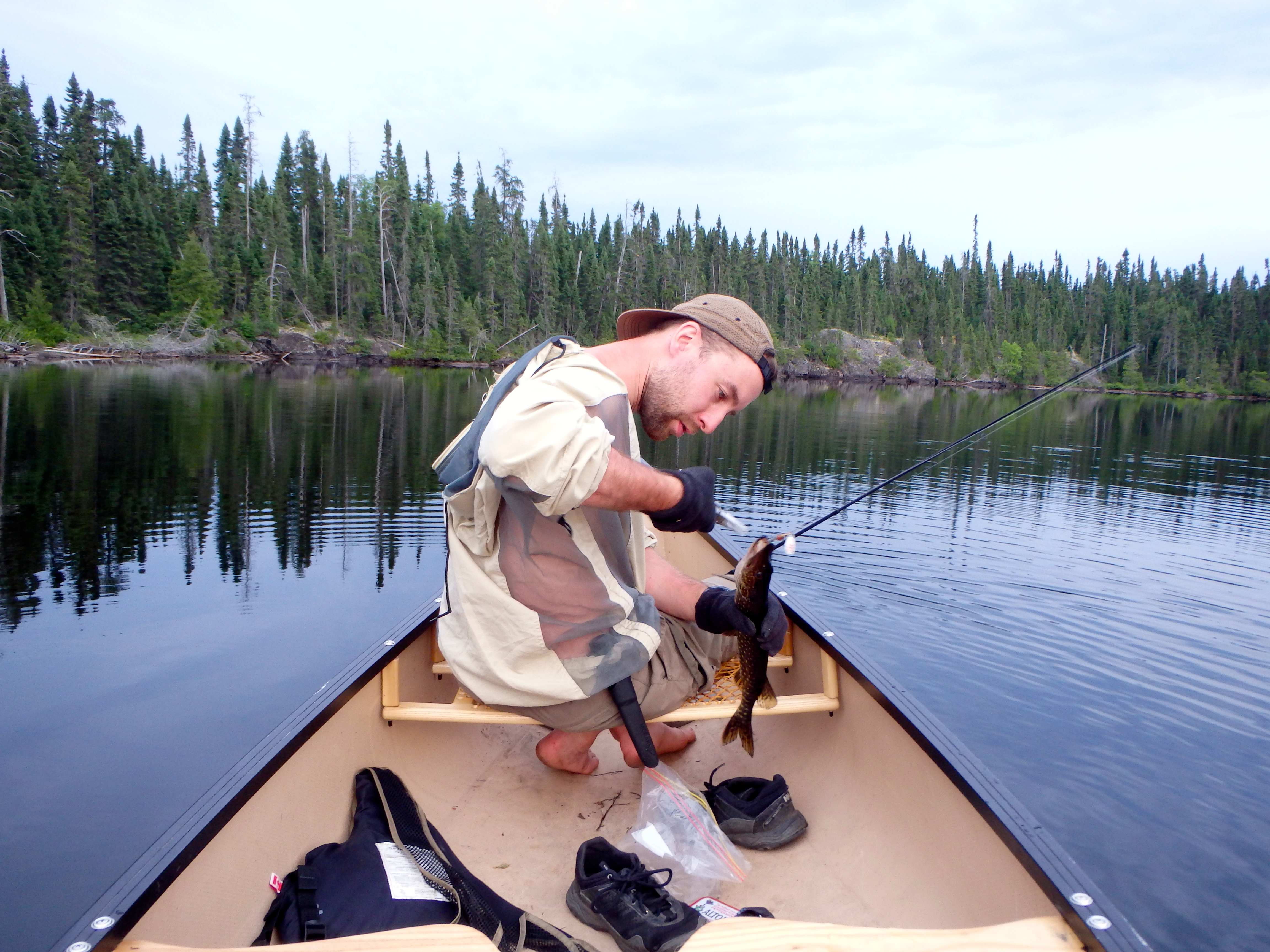
We prepped the site by clearing a couple of dangerous pieces of hanging deadfall from old forest fires. Lachlan and Jono went off fishing and returned with a plump walleye, which we filleted and cooked to supplemented our freeze dried dinners.
The stars came out in vivid splendour as we sat by the campfire.
Day 4 (July 22) – Sandison Lake to Unnamed Bay on the Kopka River
Distance Travelled: ~15km (including ~450m over four portages)
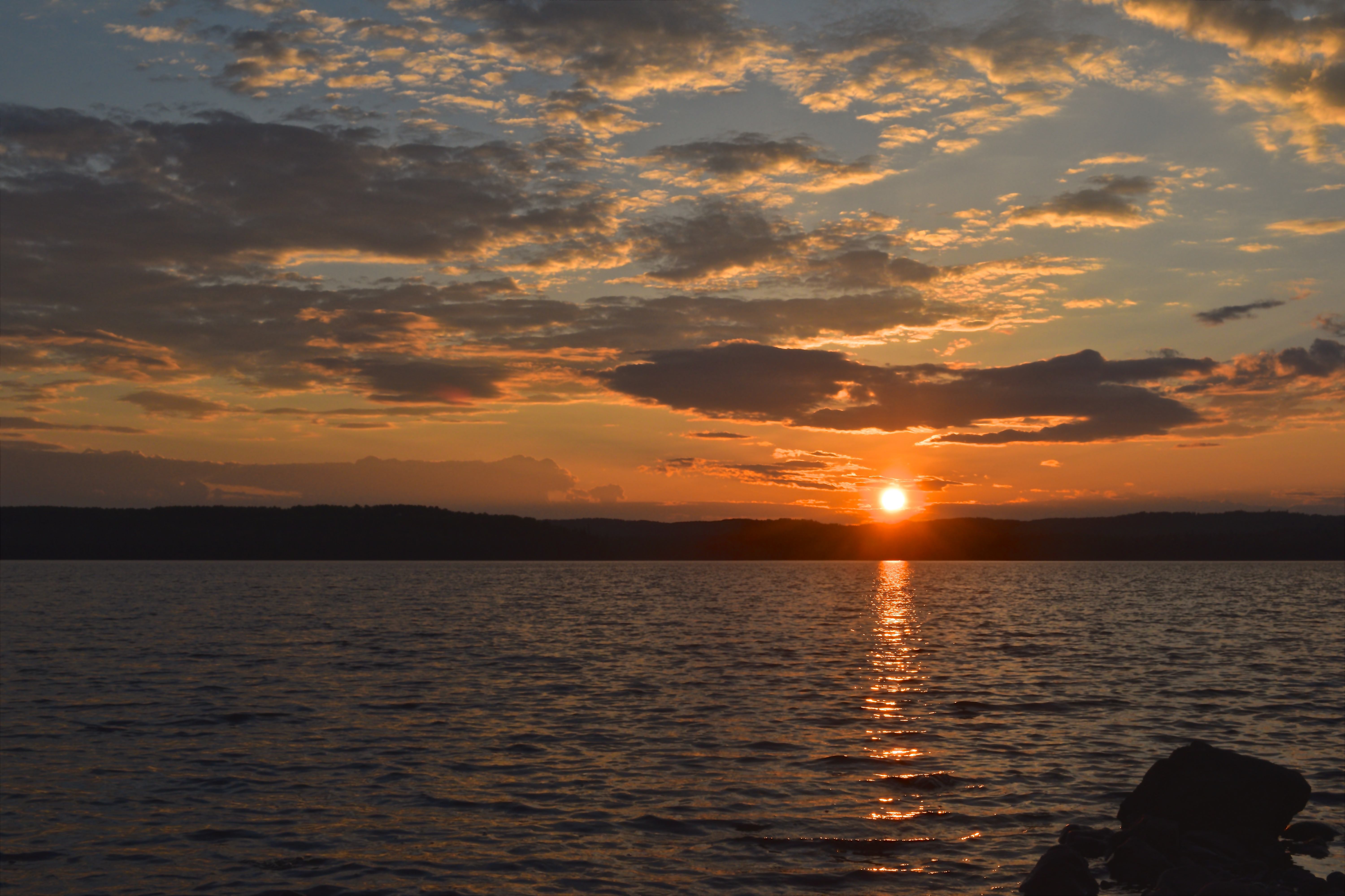
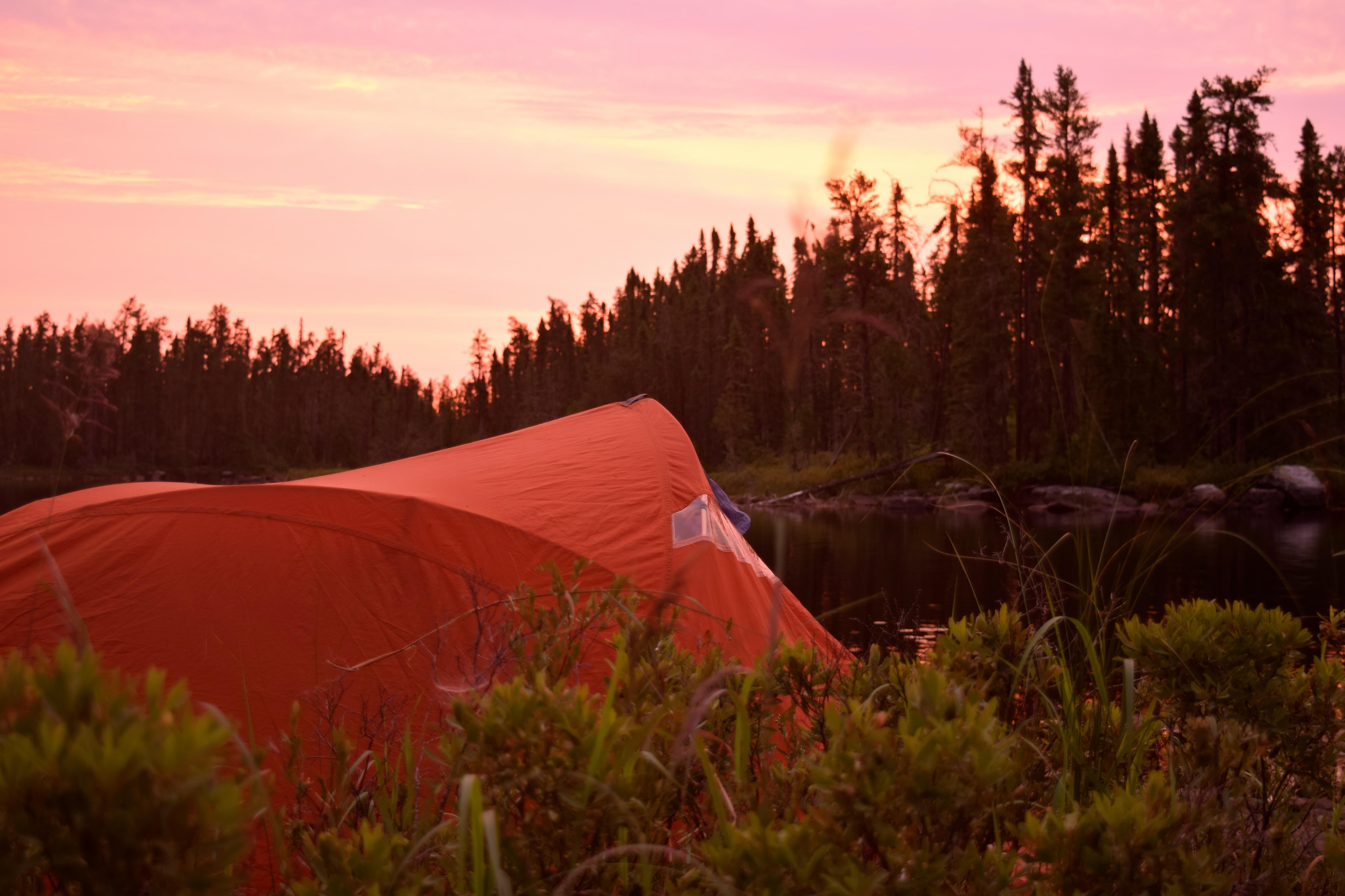
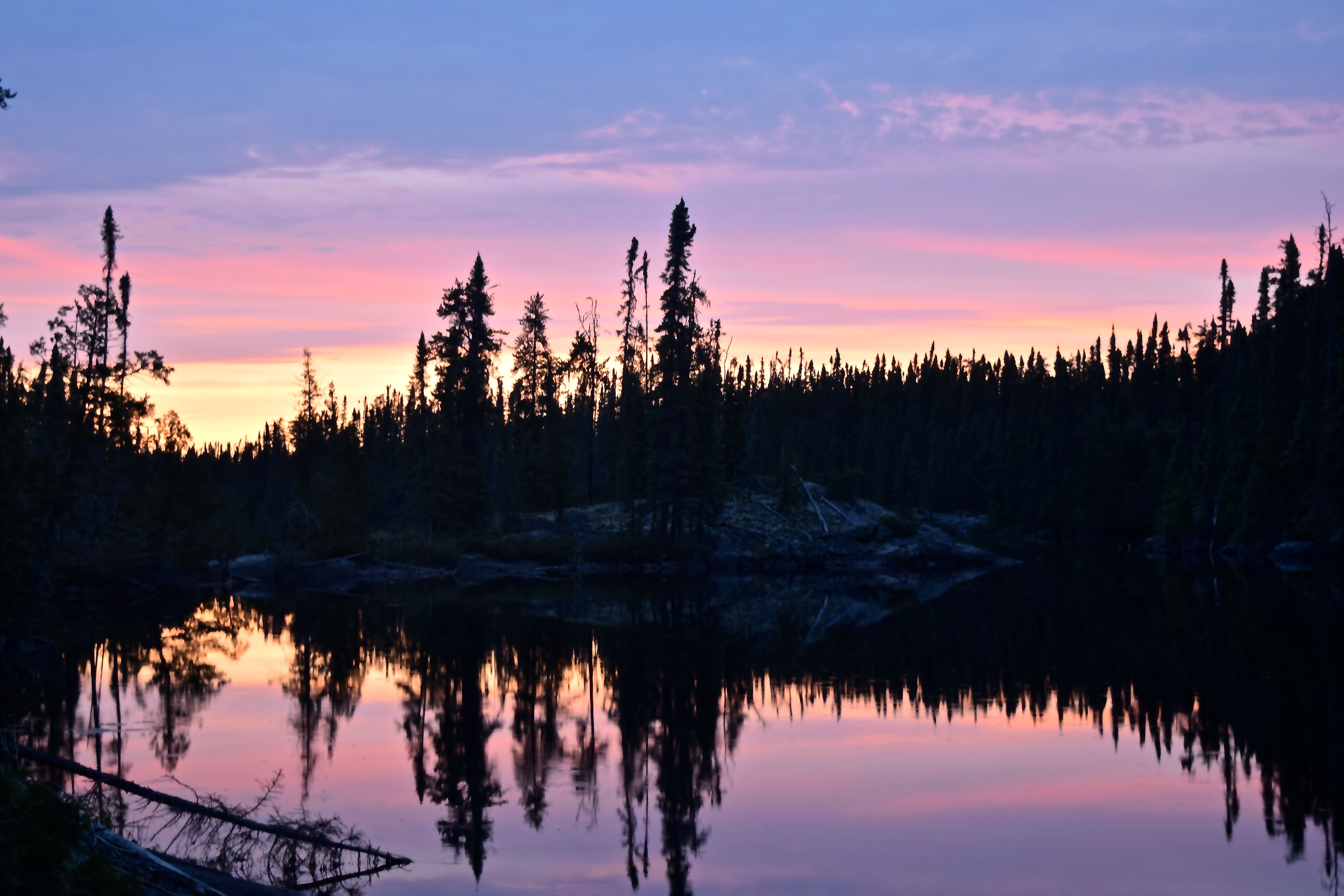
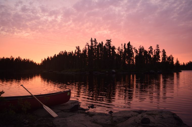
I went to bed earlier than the others – at around midnight – and roused from sleep with the break of dawn. A pink, iridescent light illuminated the walls of my tent and I decided to step outside into the warm morning air to watch the sunrise unfurl. I made the right call – the sky was a panoramic spectrum of pastel pinks and oranges, capped by a light purple smattering of altocumulus clouds. I could sense that it would be another good day.
The morning began with the group coasting along the calm waters of north Sandison before hauling over two portages. The second portage – a 100m carry through the middle channel of the river – begins precariously close to the top of a falls.
The weather this morning had been so pleasant that we decided to hop in the water at the base of the falls and cool off. We spent a good deal of time here fishing too and Lachlan had the good fortune to bag another walleye and pike.
The remainder of the day was spent paddling stretches of picturesque flat water interspersed with exhilarating rapids up to level CII+.
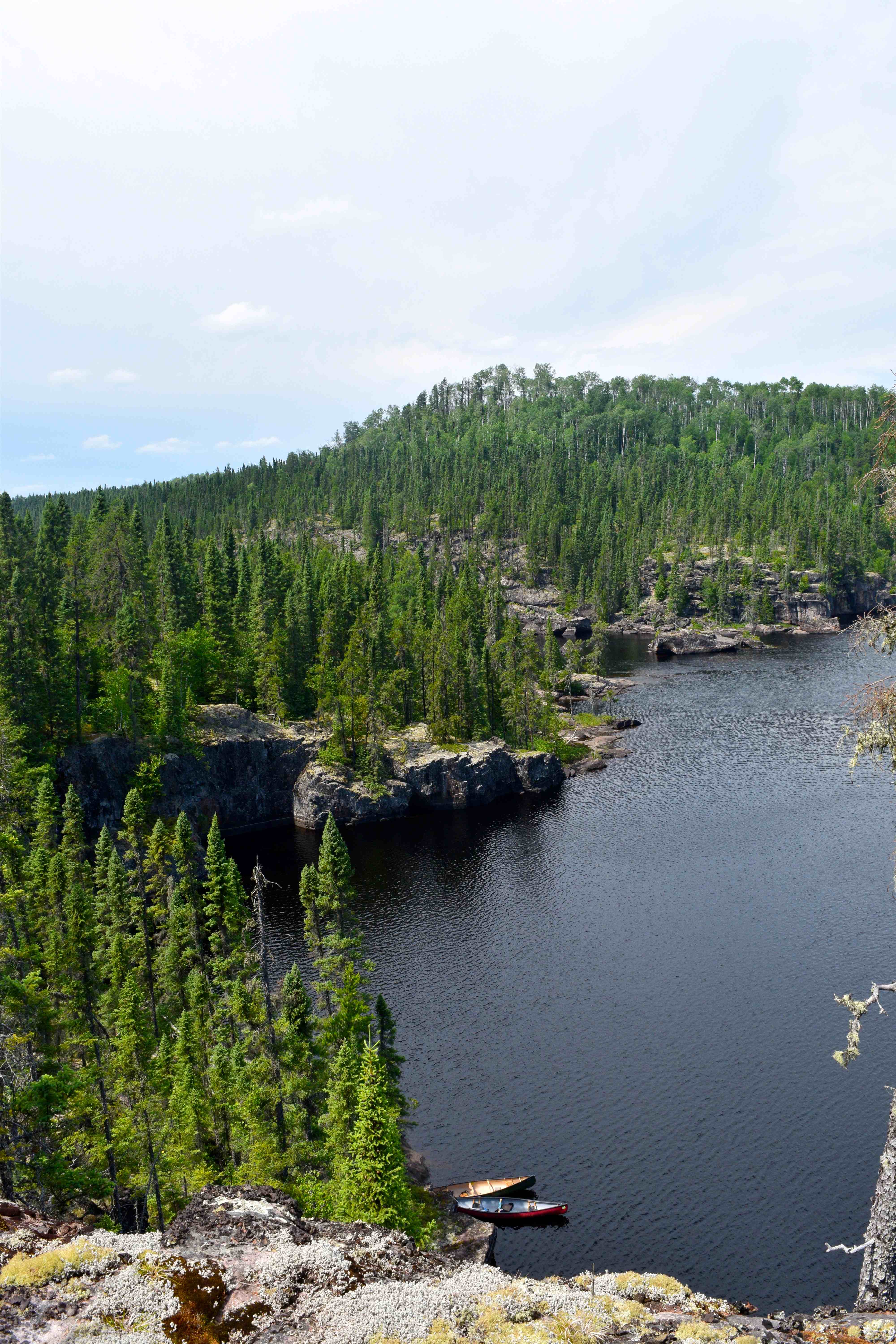
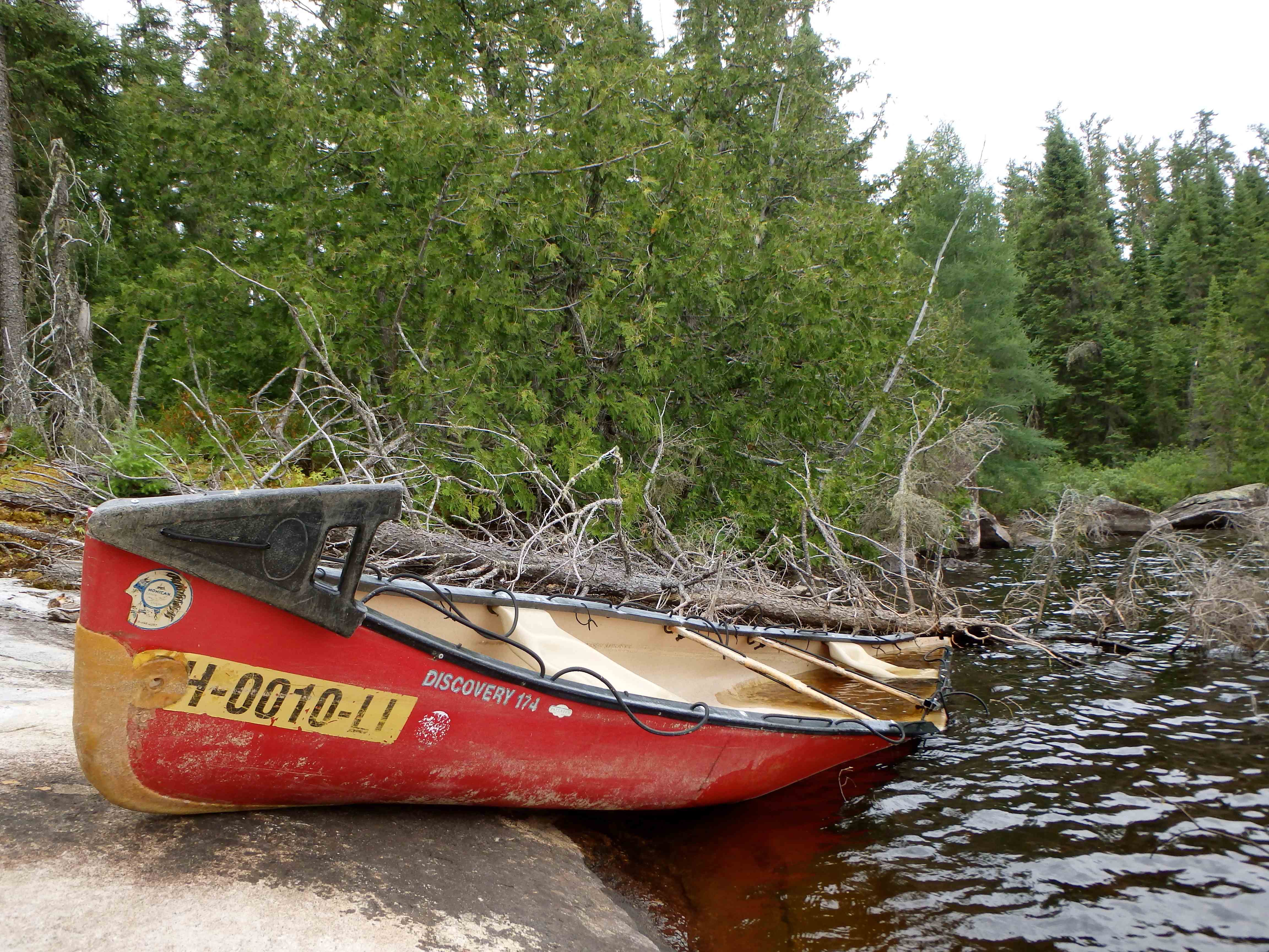
Upon completing a set of four successive rapids at a narrowing in the river, approximately 8 km past Sandison, another large unnamed lake opened up. In exploring the lake, we discovered a small island with a fish cleaning table and an abundance of ripe blueberries. We stopped to snack, but soon noticed an unusual red piece of debris sitting along the south shore of the lake approximately 400m to our south. Lachlan and I paddled off to investigate and found that it was a wrecked canoe with a registration sticker from 2014 that indicated the boat belonged to the Ohio Watercraft Livery. The damage to the boat suggested that its paddlers must have wrapped it around a rock in one of the rapids up river – a chilling reminder of the power of this land. The boat, I guess, belongs to the wilderness now.
Our next obstacle, two kilometers to the northwest was another impressive tumbling waterfall. The 300m portage circumventing the falls was also intersected by another old logging road that devolved into a rugged ATV trail. A bridge extended across the river, following the road, and signs of recent human activity was apparent in the form of a bonfire pit and refuse. Beyond the falls we ran another Class II set and paddled onto another unnamed bay as clouds subverted the sky.
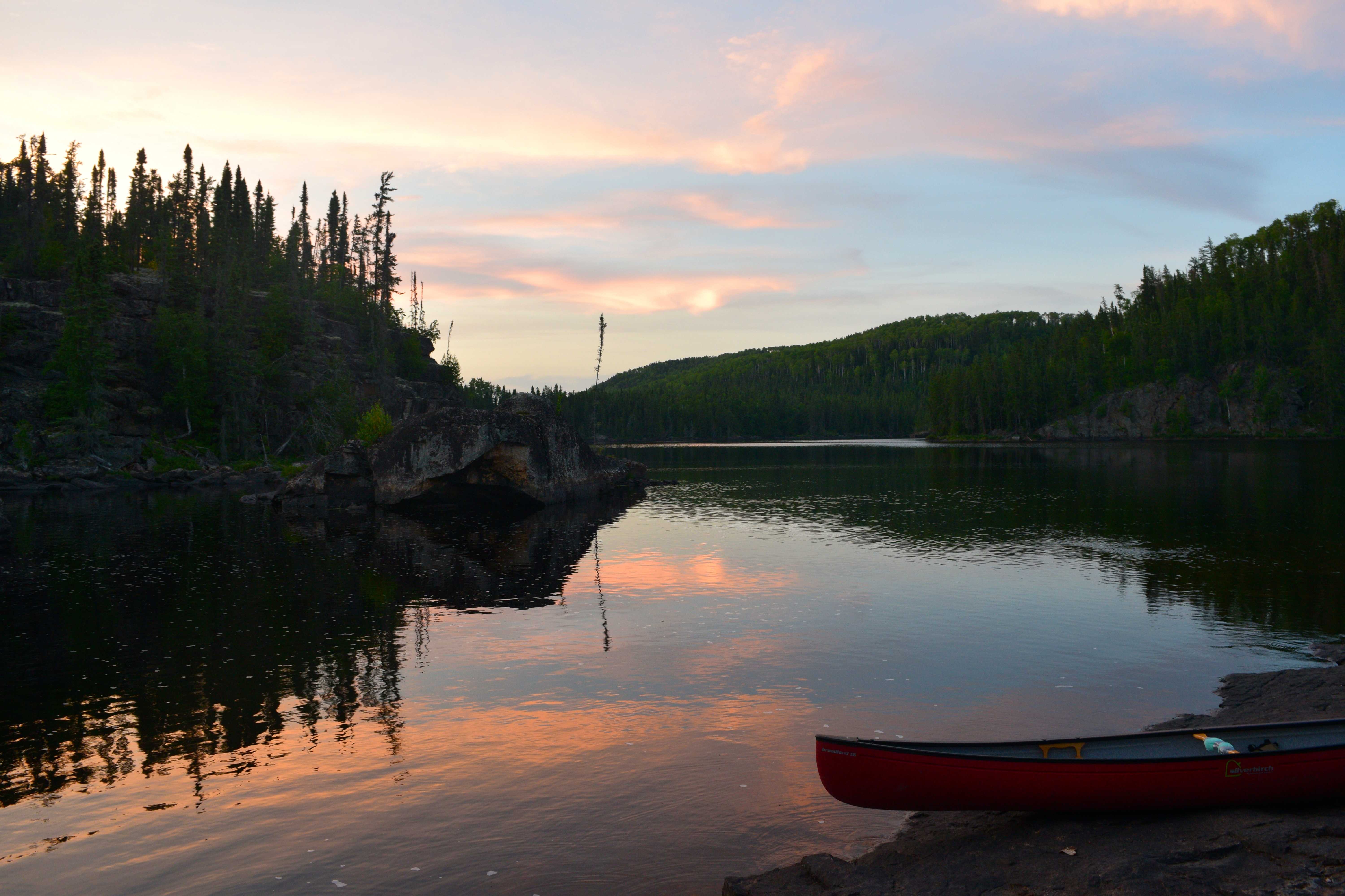
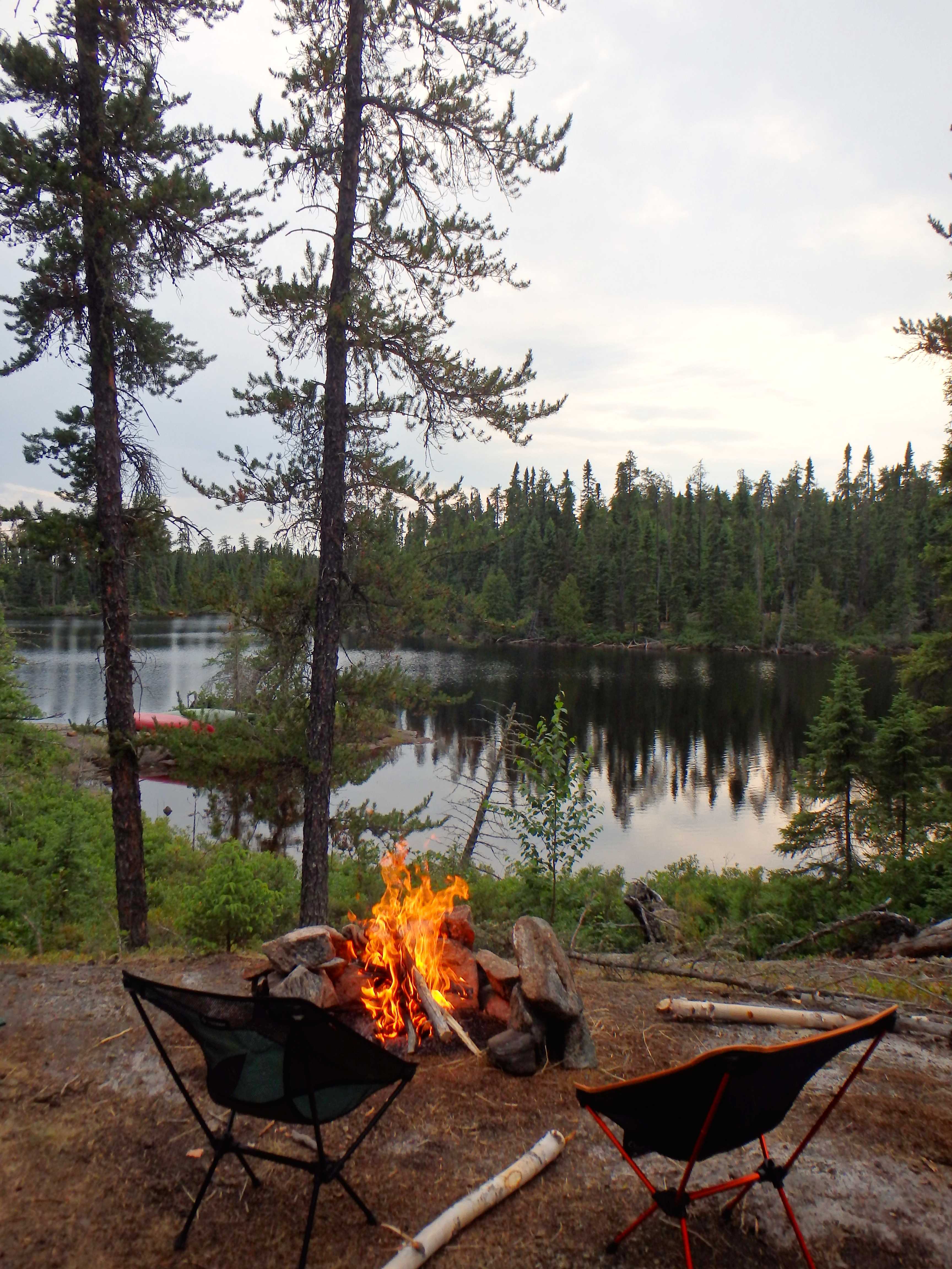
The day concluded at an incredible multi-levelled, medium-sized island campsite. The site, which was rocky and tree encrusted, was clearly underused and held an abundance of firewood. By this point, the sun had been entirely replaced by hazy monotone grey clouds and we experienced a light misting of rain for the first time in the trip. The rain quickly subsided and an opening in the clouds emerged to the east. Mike and I went out in the canoe and hooked a walleye before heading in to watch the sunset over the gloomy dark expanses of boreal beyond our island. We built a great campfire and went off to bed after midnight.
Day 5 (July 23) – Unnamed Bay on the Kopka River to Kenakskaniss Lake
Distance Travelled: ~18km (including 1.3km over seven portages)
We rose at 9am this morning and took off from camp around 11. Late mid-summer sundowns at this latitude in the north mean that is no need to get the day started early. We’ve been graced with another sunny day.
After an hour or so of paddling, we glimpsed a bear swim across the river in the distance. We continued to follow the river system east, encountering a number of falls requiring mandatory portages – all in excellent condition.
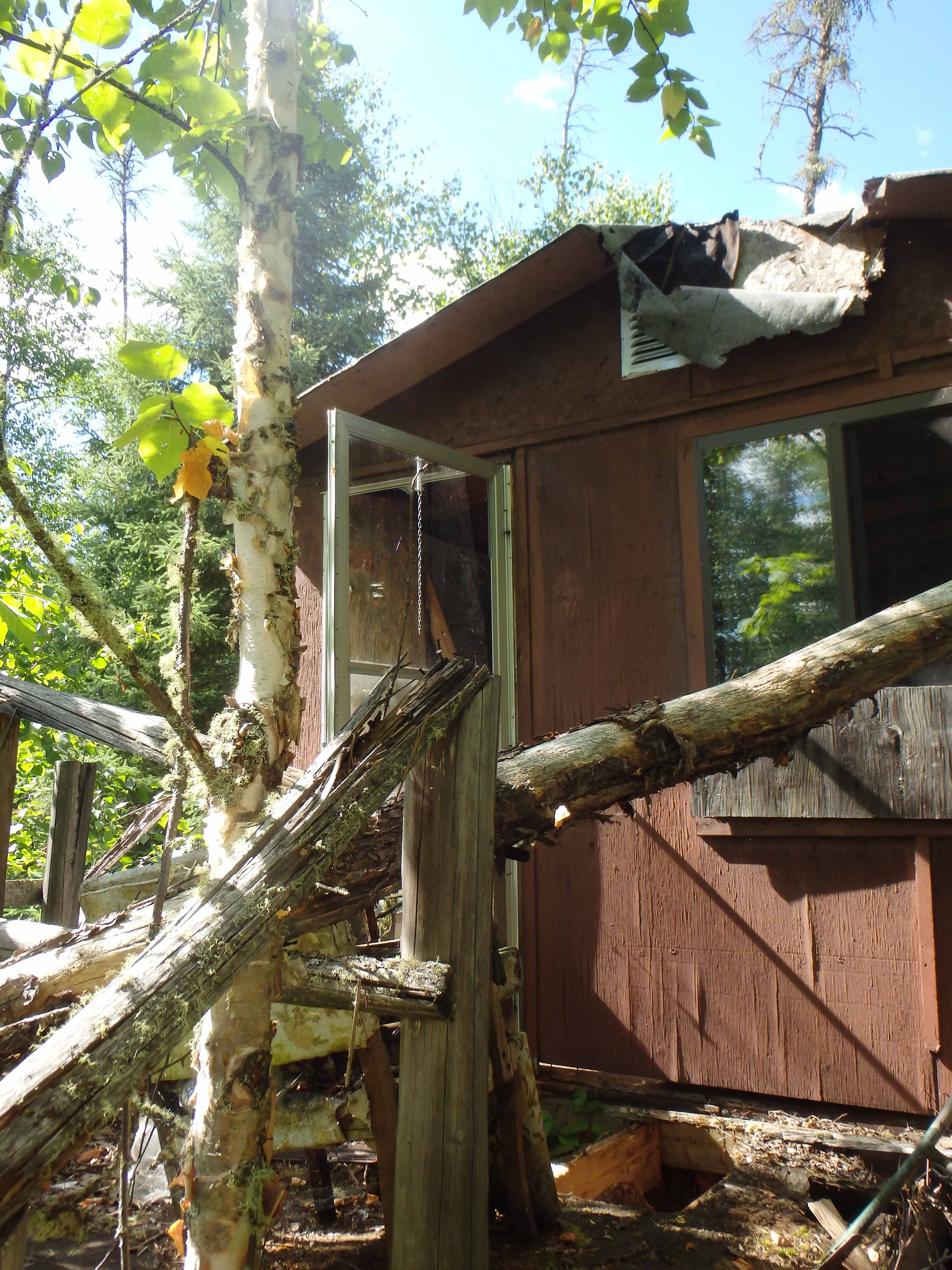
Half way down Hook Lake, through the forest on the northern edge of the water, an old dilapidated fishing lodge, consisting of a cabin and separate shower building, slowly appeared through the forest. A sign on a tree abutting the water identified the retreat as “Hook Lake Fly-in” – we decided to explore the area further.
The compound was badly overgrown with brush and the lodge itself was in particularly bad shape. However, despite gaping holes in the walls, and the rotting skeleton of the building, there was a surprising abundance of intriguing items in the cabin. The wall was adorned with a fishing log that seemed to indicate that the lodge was last used in 1997 (some groups reportedly caught up to 30 walleye/pike in a single day). The date of abandonment was corroborated by a few dusty magazines found on a nightstand. The building contained a kitchen, dinner table, old bunks, and a number of old useless artifacts, including cutlery, dinnerware, old fishing supplies and expired foodstuffs. Outside we found a large rusted chainsaw.
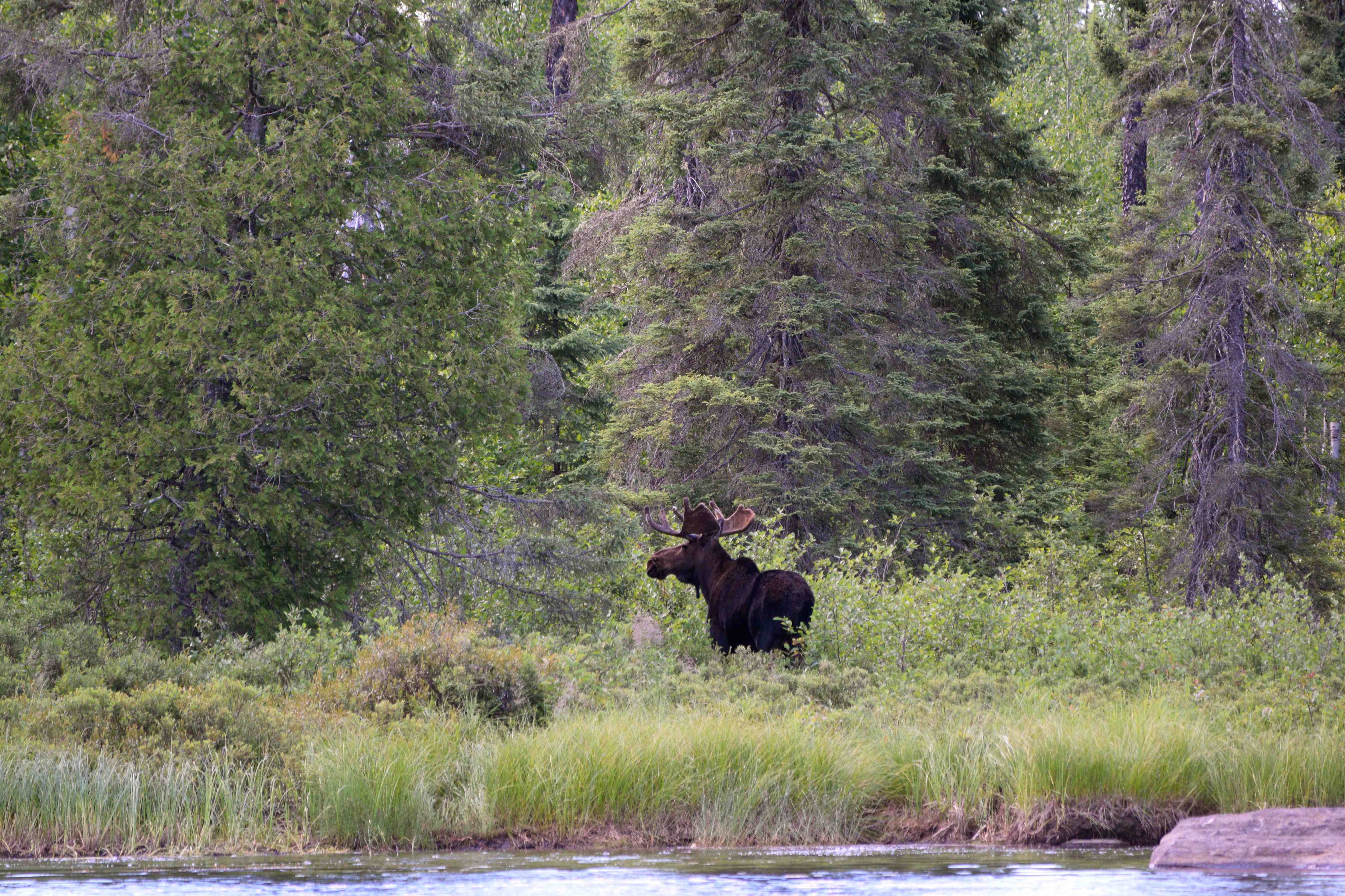
Back in the boat we cast off from shore and within two or three minutes spotted a massive bull moose eyeing us from a bog behind the compound. Further ahead, travelling close to the north shore of the next lake, a bald eagle fluttered into the sky leaving a large fish carcass on the rocks below.
We approached mid-Kenakskaniss Lake – an expansive 5.5 km lake shaped like a crooked finger – in the early evening and found a large open, granite site on the west shore. The site was excellent, with a large bouldery fire pit, and beautiful panoramic vantage. The site had clearly been overrun by wolves recently as there were a dozen or more large plots of dried wolf scat strewn about the area.
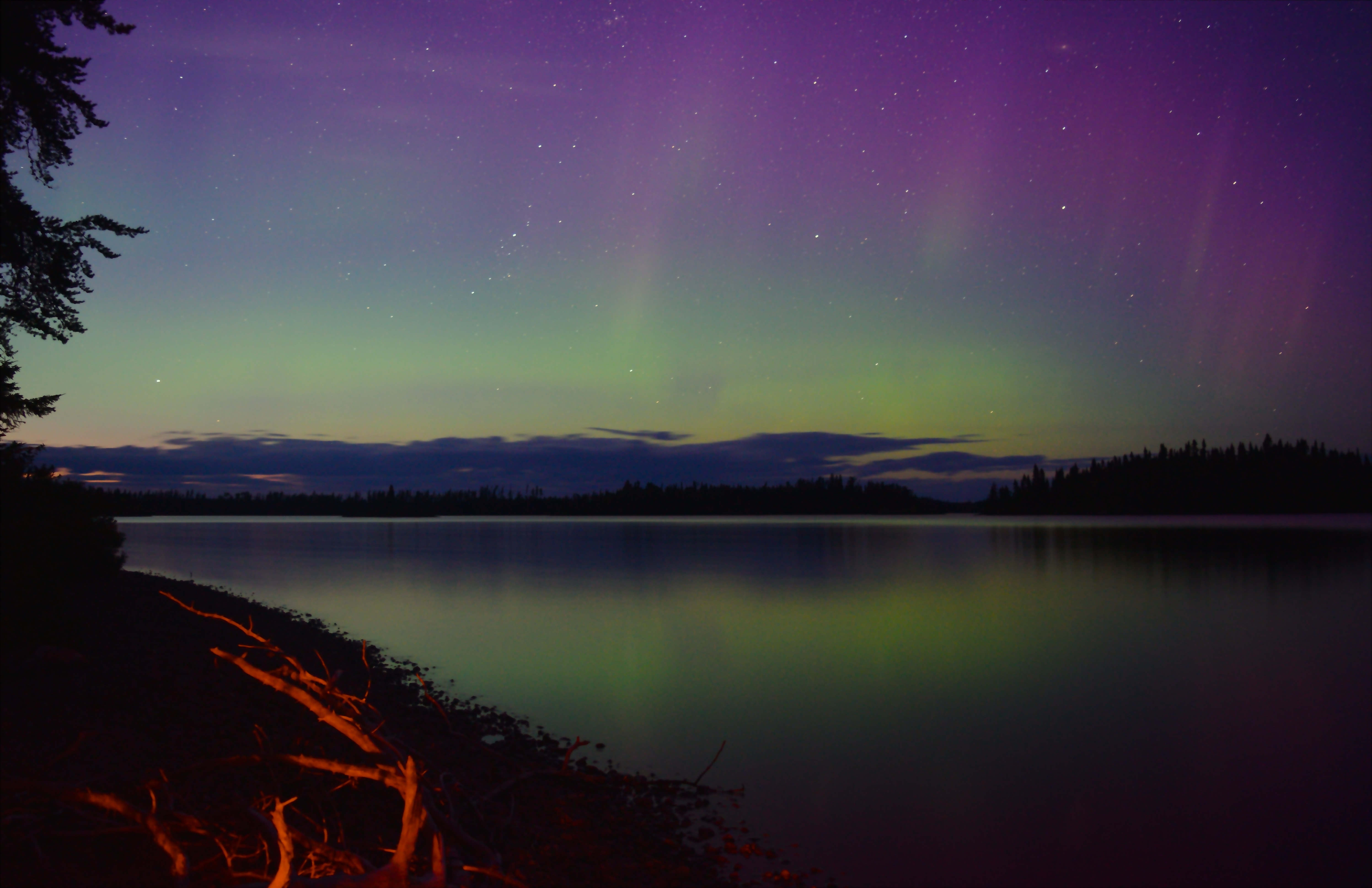
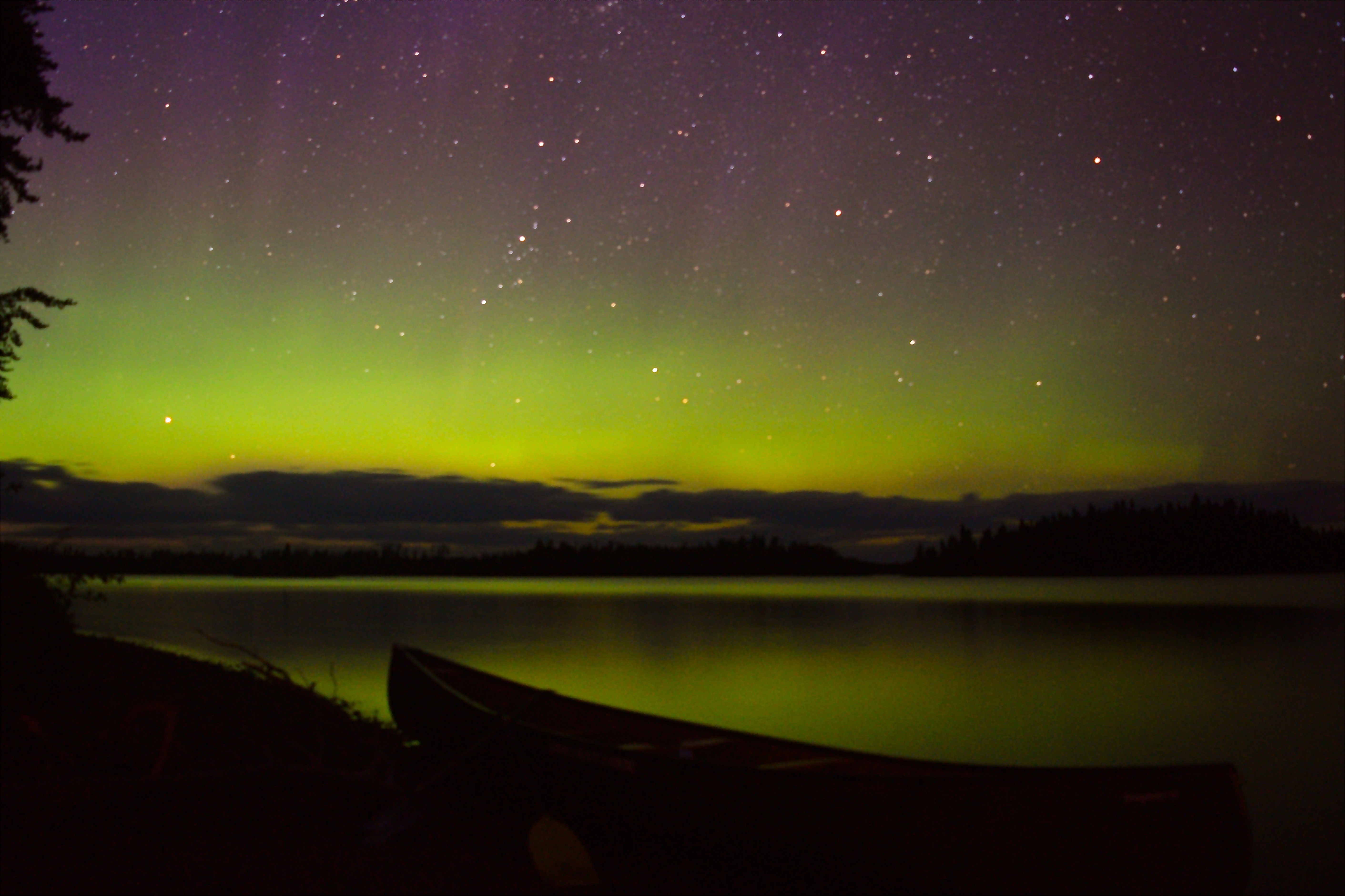
After erecting our tents, pulling together a large, hot fire, Lachlan and I each took a canoe out onto the open, placid lake and fished under the purple vapours of the late evening; to no avail this time. We soon turned in and beached the boats, and photographed a faint but beautiful aurora emerging in the North.
Today we travelled from 11:30-8:30pm and took plenty of time to intermittently fish and swim along the way.
Day 6 and 7 (July 24 and 25) – Kenakskaniss Lake to the Seven Sisters
Distance Travelled: ~8km (including 1.4km over four portages)
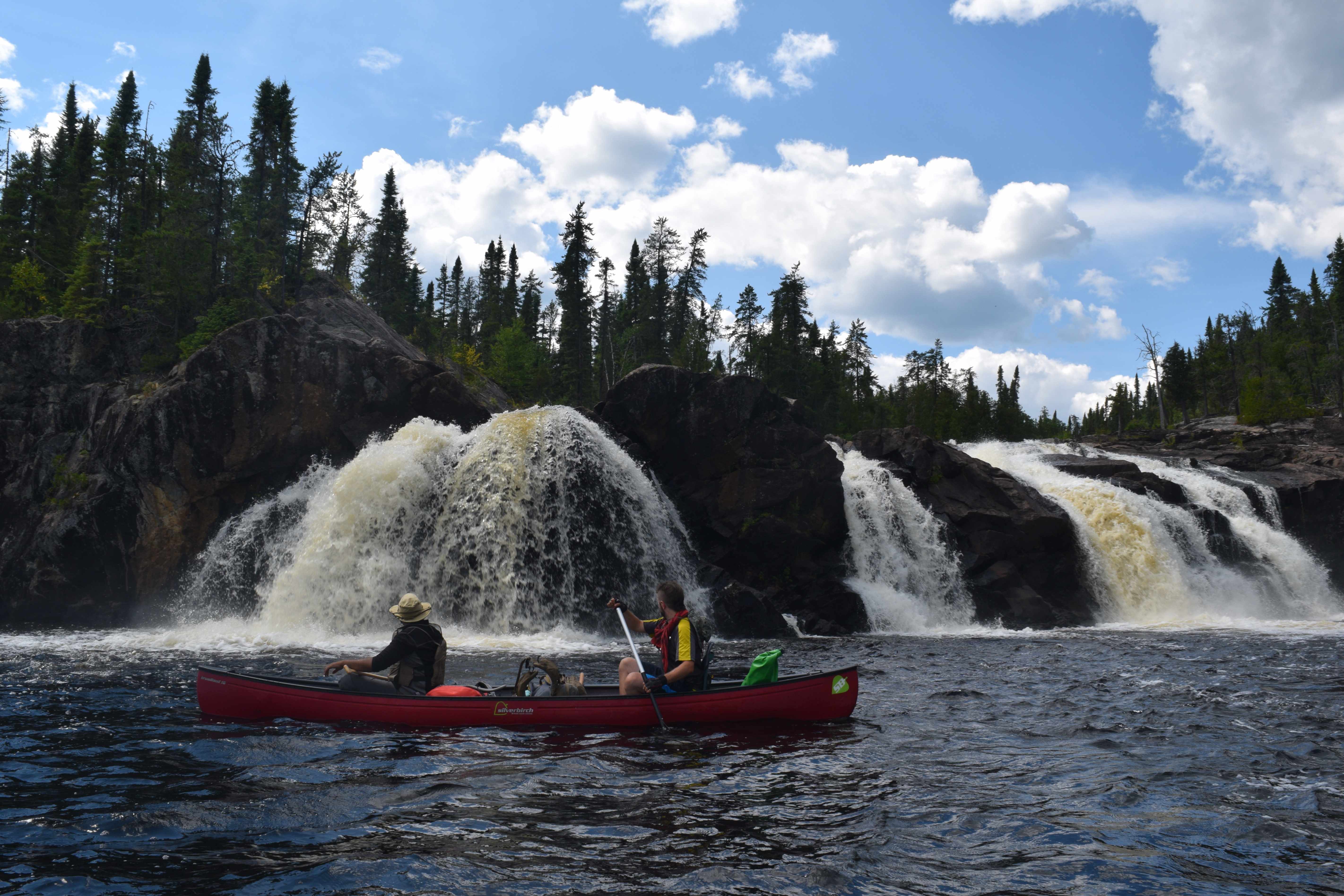
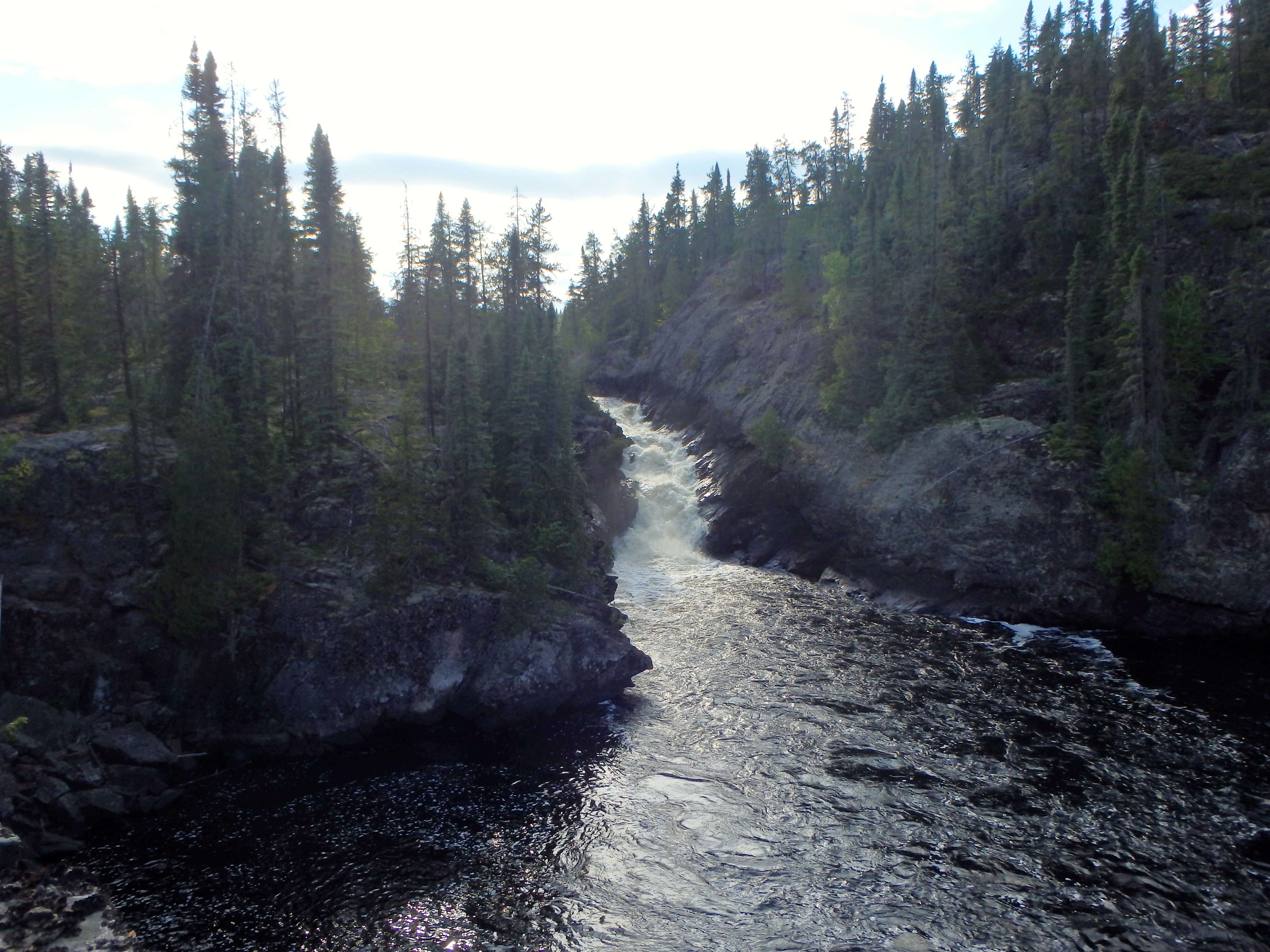
Today is our sixth day on the route. Our plan was to paddle approximately 8km to the “Seven Sisters” section and camp near one of the waterfalls. The Seven Sisters area is a collection of powerful, breathtaking waterfalls that is, without exception, the highlight of any trip down the Kopka River.
Knowing we had a relatively light day in travel distance, we again took our time setting off and launched the boats around noon. We were fortunate to have fair skies and equally fair winds once again that pushed us down Kenakskaniss Lake and around the corner to the river.
Before reaching the first portage of the Seven Sisters we were forced, due to the water level, to paddle and haul through bouldery patches of river rock – which may be extremely treacherous to those who let their guard down.
Though relatively flat, a large portion of this 700m trail winds through a precarious field of glacial cobblestone that requires utmost care to navigate. While waiting for the others at the end of the portage, I pulled out my rod and caught another walleye almost instantly. Fishing at the base of the innumerable falls and rapids in the Wabakimi area had been tremendously fruitful for us.
Just after pulling out a fish, I noticed that two green canoes slowly edging their way toward me at the base of the portage trail – we had not anticipated that we would see other groups in the area. Each boat was operated by a fellow of no more than 25 years of age and they seemed to be in no hurry. We learned, in speaking with them, that they were Keewaydin guides leading a party of 10 young teens up the Kopka River on a 28-day canoe trip ending at Allanwater Bridge.
As a youth, I had never participated in any backcountry canoeing/wilderness camps and had never previously encountered a camp this far into the backcountry. And so it was to my complete shock and amazement to learn, after reaching the next portage and speaking with some of the campers, that they were hauling 100lbs cedar canvas canoes and large wannigans up river through this rugged country. Considering some of the lads in the group looked to be hardly 100lbs in weight themselves, this feat was pretty incredible. We wished the boys well, encouraged them to always find time to paddle their canoes as long as they live, and went on our way to scope out the impressive and deadly set of falls to our north, before heading down the extremely steep, 400m portage trail (take your time here).
At the end of this trail we entered a shallow pool and carefully ferried our canoes into a large bay to watch this spectacular section of the Seven Sisters up close. Be wary that an error in ferrying across the current here could result in being swept over a small waterfall to the east.
The falls here are something to behold. It is very difficult to justify the supreme majesty of the Kopka River and especially in this incredible section of massive cascading waterfalls and cataracts. At times, here, it is easy to feel wholly insignificant. The rugged rolling, pine studded hills and canyons of the boreal and the big waters that flow through them will make you feel small, vulnerable and uneasy, but make no mistake, they are as alluring and enchanting as they are humbling. I have not yet met a person who has travelled this part of the country who does not long to return. Such is the spellbinding grip of Wabakimi.

Beyond another 200m portage and by 4pm, we were at our campsite – the only site on the shores of a spacious, open pool of dark, pristine water that acts as an intermediary between two additional massive waterfalls. This pool was shrouded on all sides by cliffs of 100 and 200 feet (or more). The site was open and flat, excellent for swimming and fishing, and the vista offered at this location would be hard to parallel anywhere. This place was a veritable eden. We decided quite quickly, given the excellent weather we had had all trip, that we would use our rest day here.
For the remainder of the day, we swam and fished, and watched a beaver swim in the cool waters before us. At dusk we climbed a nearby peak and, amongst birdsong, a slight breeze in the trees, and a faint rumble from the rushing falls in the distance, marvelled at this earthly paradise, from its dizzying heights.
Our rest day offered an opportunity to more thoroughly climb and explore the massive cliffs surrounding the area. After breakfast, we paddled to three locations and, again, revelled in the grandness of this place. Atop one of the peaks, we found hundreds of ripe blueberry plants with fruit edible by the handful. Atop another we gained an excellent view of the dramatic chute we had portaged around the day before – a long narrow tumultuous falls that was so powerful it could break a tree in half.
This was a day where we swam and fished, and soaked in the midsummer sun. Mike made a pirates mast/flagpole for one of our canoes and slowly paddled it around the corner to where Lachlan and I were fishing – we all laughed hardily. I wore out the day reading my book – Don Starkell’s Paddle to the Arctic – by a late day campfire.
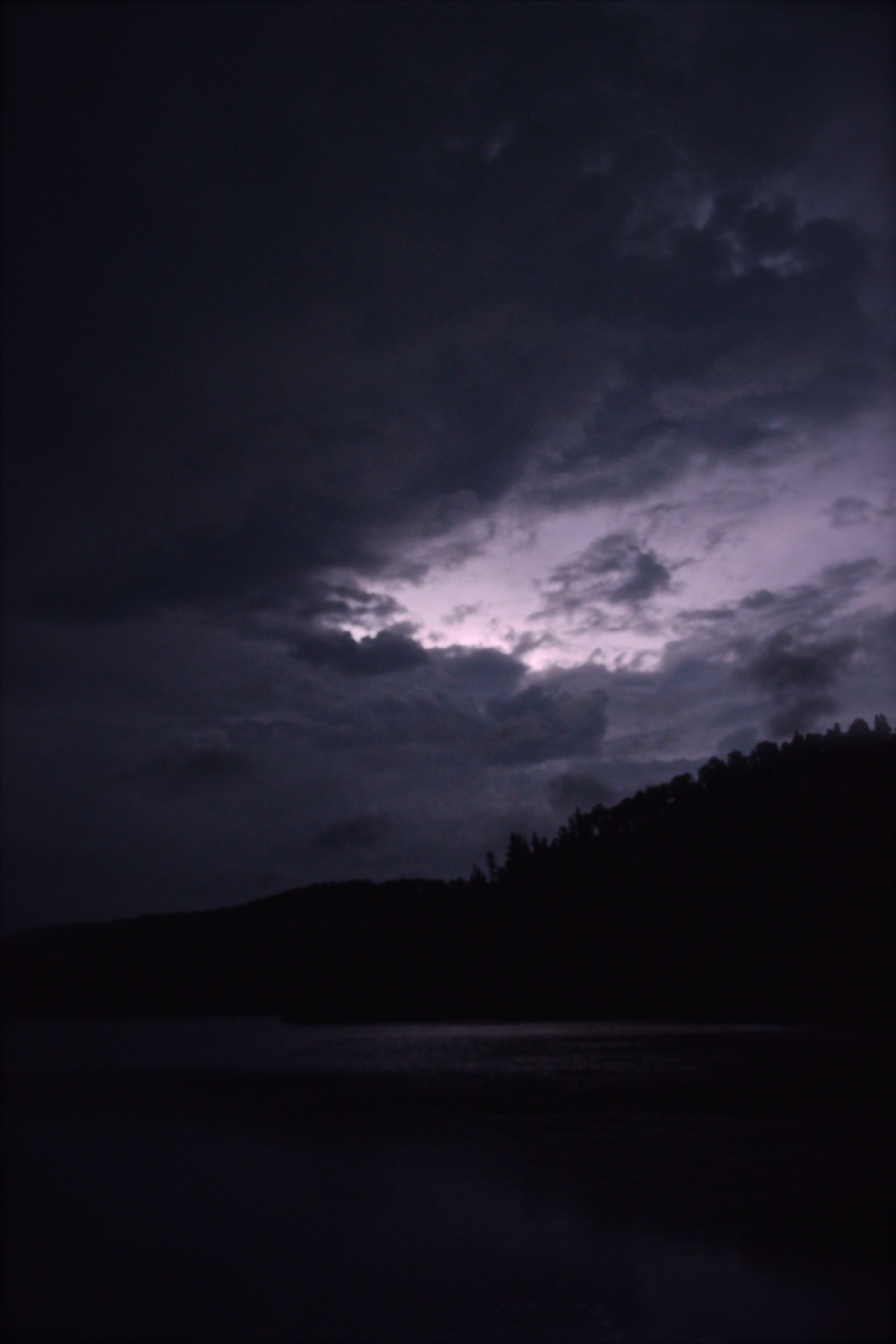
As dusk crept in, so did a strong wind. Clouds swirled and the barometric pressure dropped rapidly. Big, heavy drops of rain started to fall like rocks from the sky. We collectively agreed that, after over a week of impeccable weather, we were due for a large storm. Instead, though, continuing our string of good fortune, we were treated to an incredible show in the sky.
With the rain at bay, and the stars emerging, we watched clouds rapidly sweep across the northern sky in an easterly bearing. The crash of distant thunder could be heard beyond the ridges of our little lake, but the sky above us remained clear and full of twinkling stars. Intense flashes of lightning illuminated the metamorphosing clouds on the dark horizon every two or three seconds. It appeared as though this intense, raging electrical storm would miss our camp by no more than 3 or 4km.
Day 8 (July 26) – the Seven Sisters to Wigwasin Lake
Distance Travelled: ~12km (including 350m over two portage)
My eighth day journal begins with the following words: “Sometimes the Gods bless you. We’ve had some tough trips over the years, but this time we’ve had eight straight days of perfect weather, scenery, cliffs, waterfalls, cascades, swimming, fishing, no bugs; we’ve had hard portages and slogged through marshland; but we’ve had the northern lights, passing electrical storms, wildlife, forgotten and derelict cabins with relics of ages past, sunsets, blueberries by the handful, summer days… this place is like heaven.”
At around 9:30am, as we were packing up our tents and gear and getting ready to hit the water, Barry and John from the Wabakimi Project caught up to us and pulled up to our site. We stuck around and shot the breeze with them on camping and canoeing, conservation, politics and life in general. We even took the opportunity to snap a group picture, before exchanging pleasant wishes and heading on our way (they decided to stay back at the site we had occupied for two days).
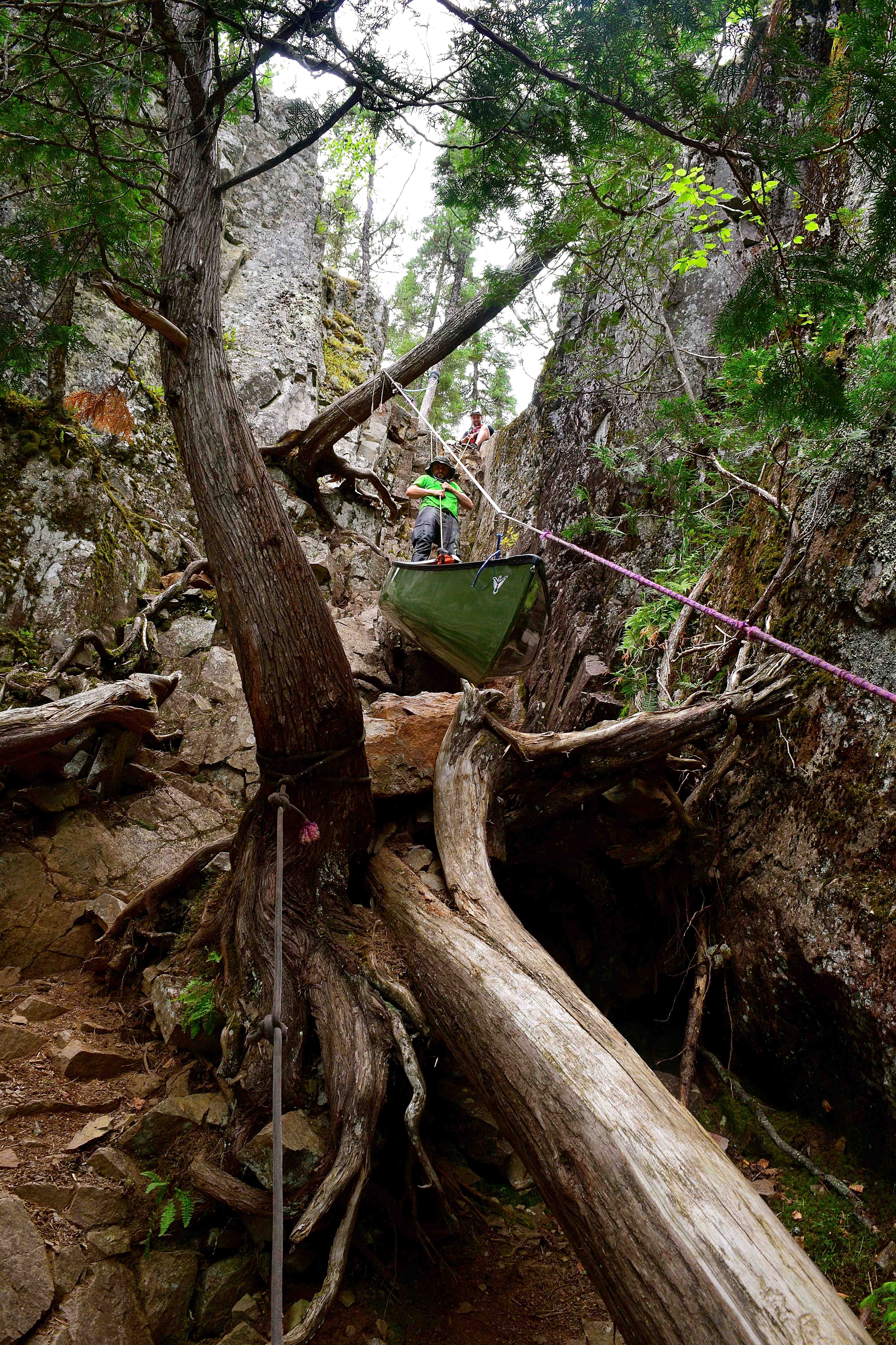
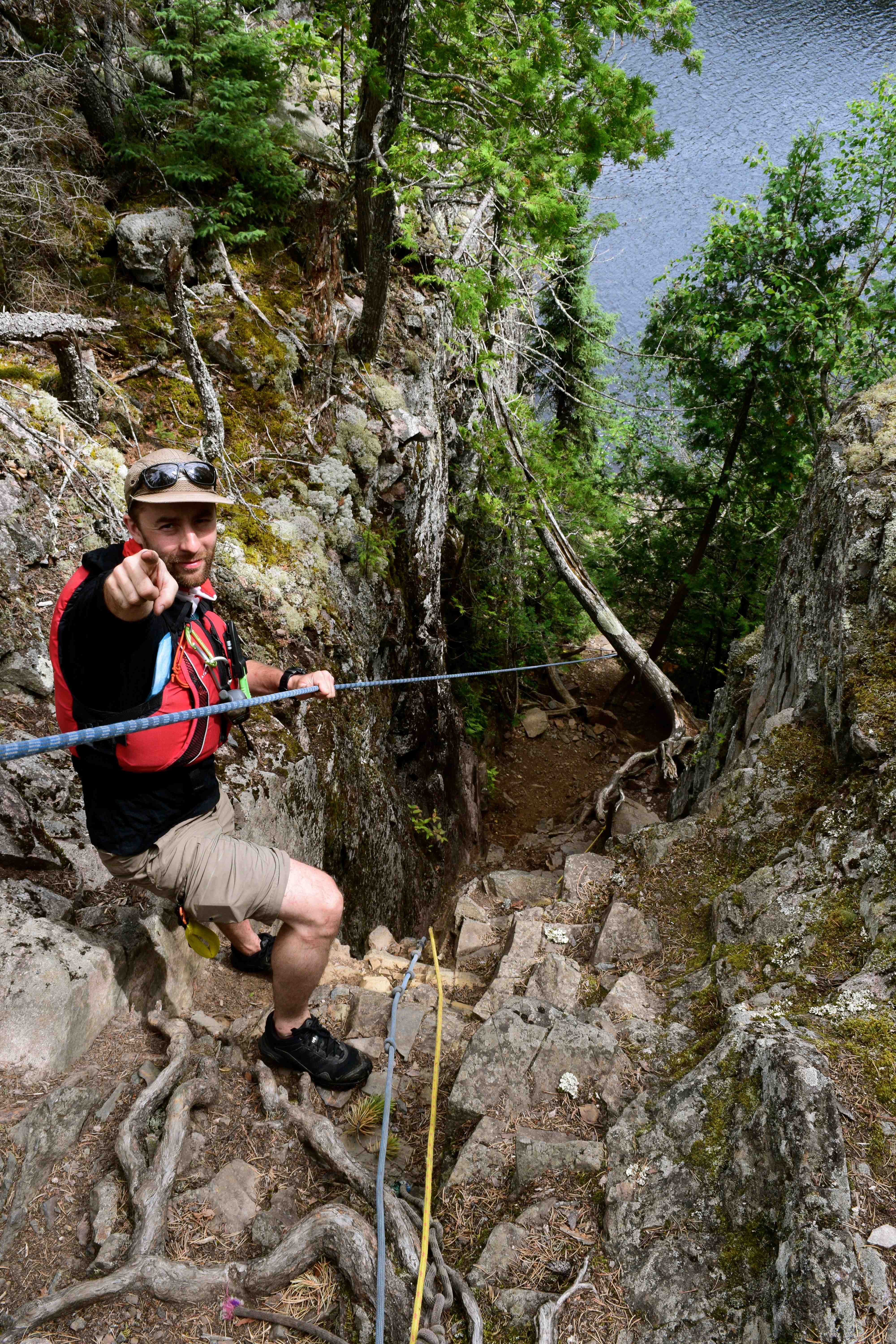
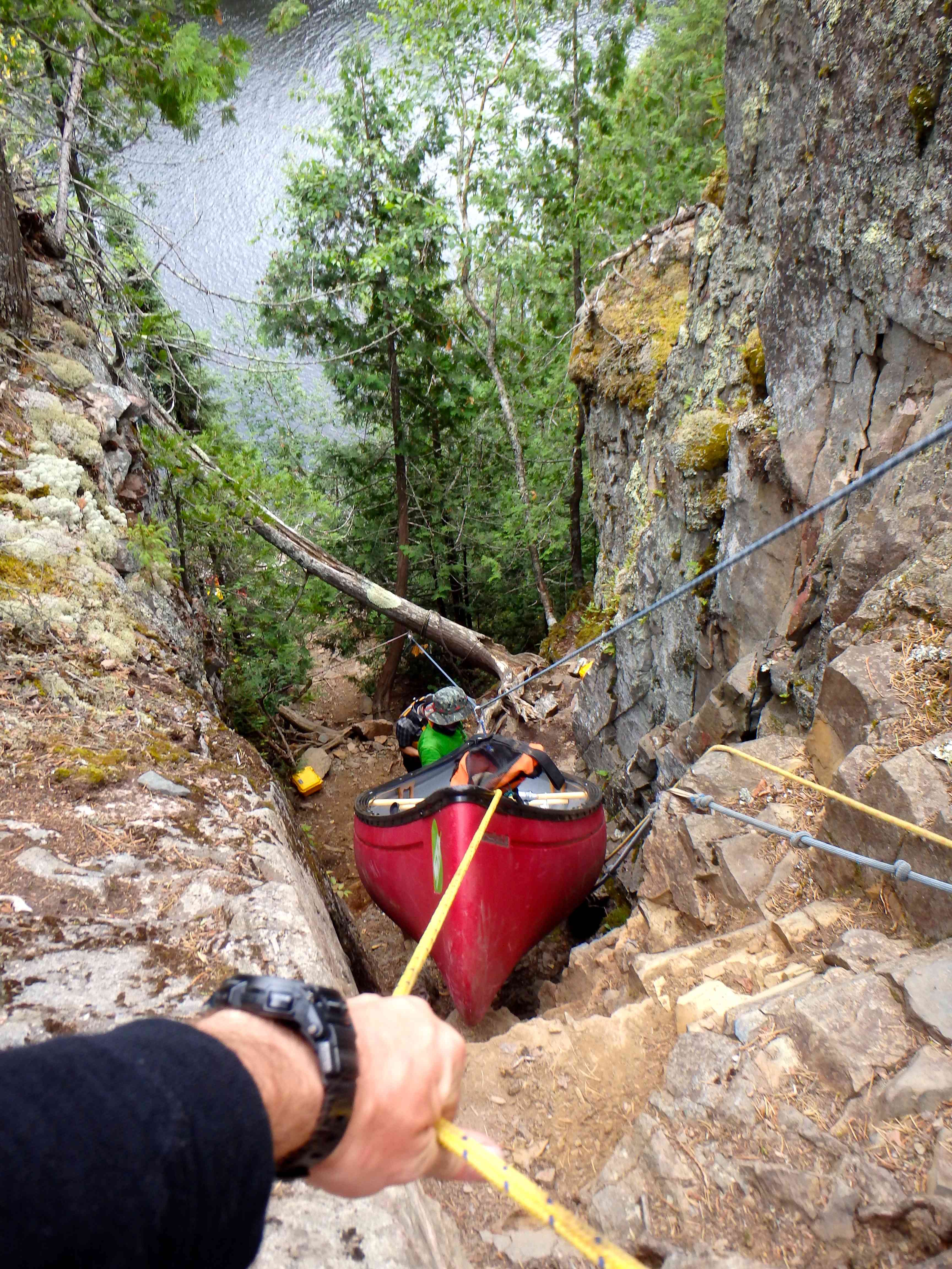
Across the pool, we came to the last and perhaps most famous, of the Seven Sisters. While this final waterfall, like the others, is spectacular, this section is probably best known for the ridiculously steep portage that bypasses the falls on river left. This 150m trail, known as the Mountain Goat Portage, requires travelers to lower their boats and gear down a sheer cliff using ropes and carabiners. Note that there is a more moderate alternative trail on river right for those who wish to forgo the dizzying challenges of the Mountain Goat.
On this day, though, we were up to the challenge and hauled our boats and gear down the first section of the trail to the lip of the drop. At the time we ran the route, there were a few old tethers and climbing ropes already fixed in place to assist in lowering gear and to help canoeists climb up and down the cliff as necessary. However, it would wise for any group interested in trying this portage, to bring their own ropes in the event that pre-existing lines have been removed or are too weak to support gear. Ultimately, while conquering the Mountain Goat was a novel accomplishment, having four strong men in place to carefully handle the load made the task relatively straightforward.
At the bottom of the Mountain Goat, we hit another CI rapid, left the Seven Sisters behind and began the final leg of our journey.
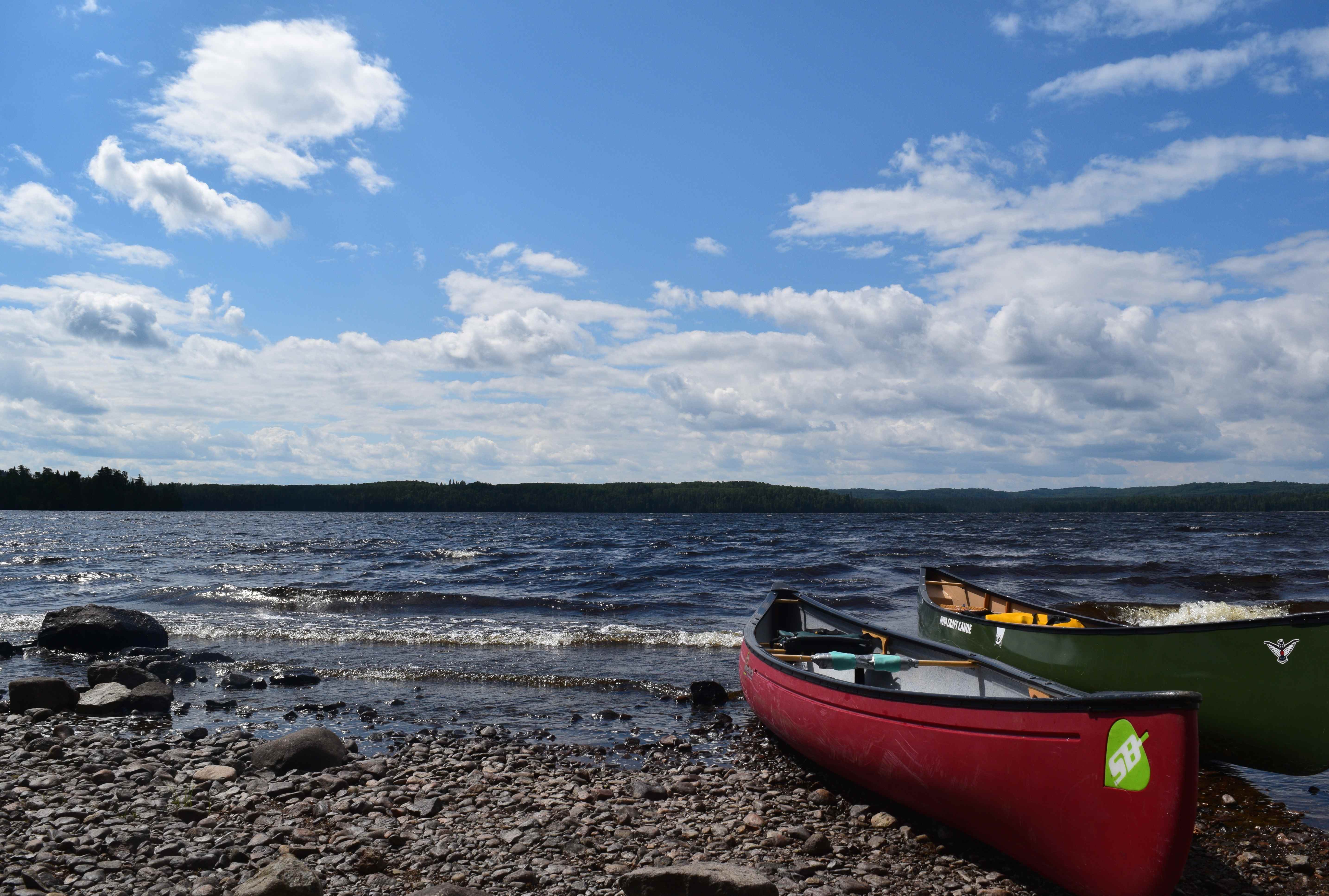
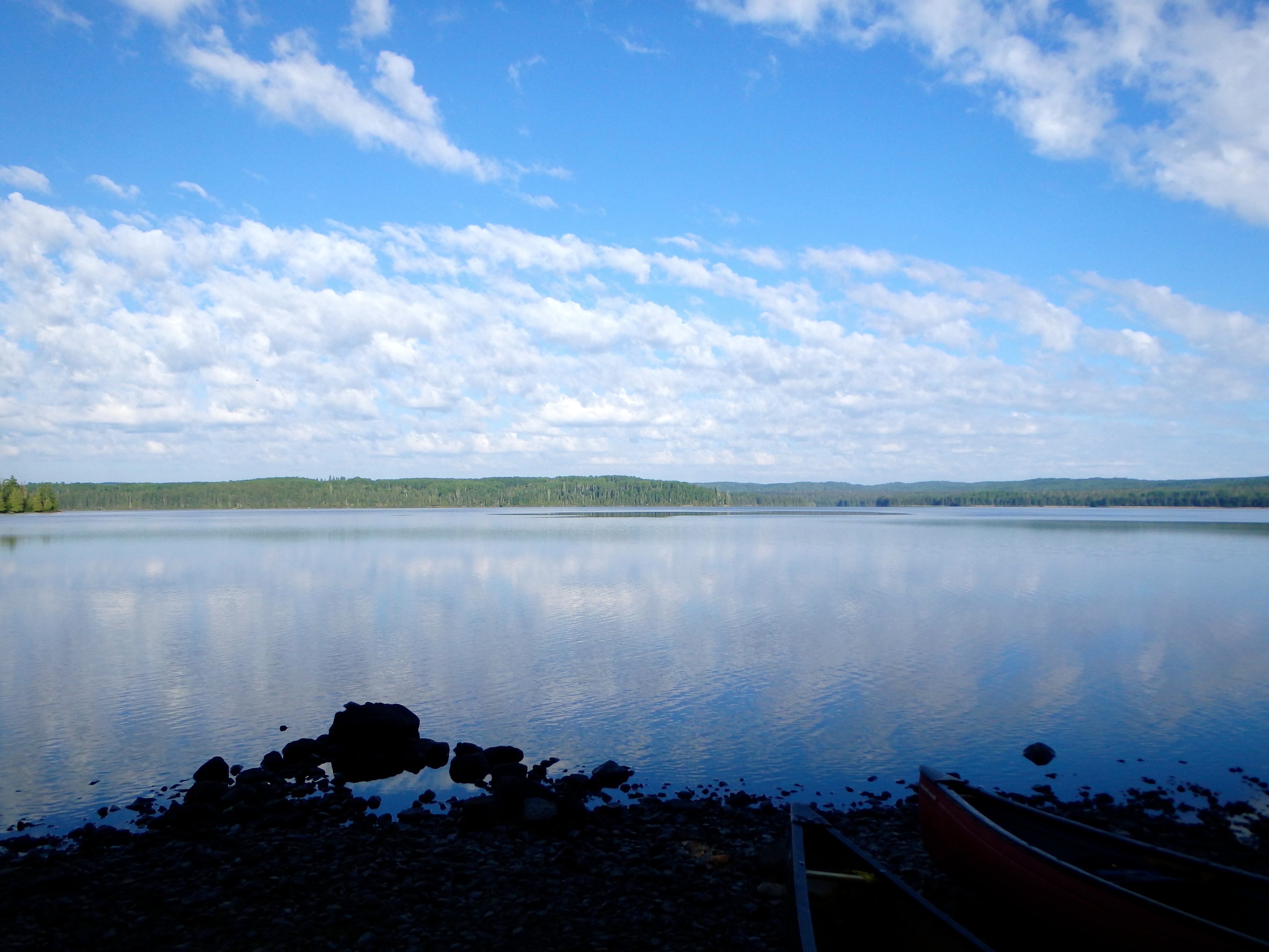
Tailwinds pushed us along the 5km long lake that follows the Seven Sisters and we ran a quick series of CIs before entering Wigwasin – a broad lake that includes an open 1.6km crossing. By the time we reached Wigwasin the wind had increased dramatically and large whitecaps had appeared at our back. We opted to attempt the crossing and made incredible time as the lake forced us along. At the end of the crossing, however, at the portage trail between Wigwasin and Bukemiga, we agreed that it was good to be off the water; had the winds been any highern we would have certainly risked a capsize.
Our final campsite of the trip abutted the portage trail between Wigwasin and Bukemiga. The site, which included a large boat cache, was well used by locals as a launching point for fishing on Wigwasin and beyond. As a result, the site is spacious and contains an assortment of lawn chairs, tables, gas cans and other debris. Still, the spot was good enough for us, especially being that the fishing was fantastic at the east end of the portage (where rapids wash into Bukemiga).
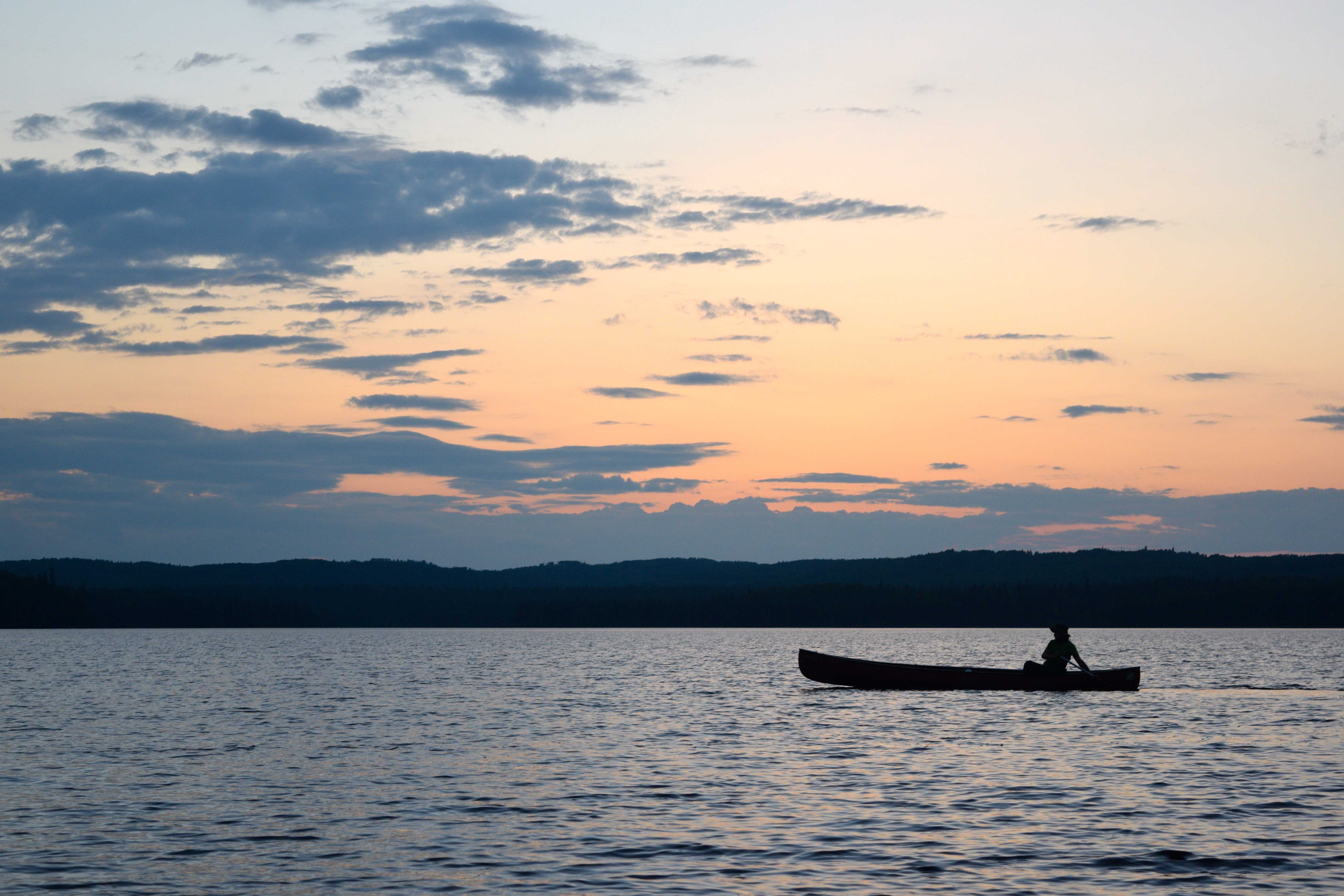
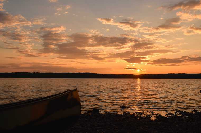
As we were preparing dinner on this, our last official night on the water trail, the high winds of the day exhausted at last and a beautiful golden sunset appeared off the beach and over the distant trees to the west. In the dying climax of sundown, Mike and I jumped into separate canoes and solo paddled our boats to the centre of the massive lake where we enjoyed the ethereal vapours of this purple dreamlike dusk.
Tomorrow we would wake early and finish the last few kilometres of Bukemiga and meet our outfitter for a ride at 2pm. Armstrong was our destination for tomorrow night.
Day 9 (July 27) – Wigwasin Lake to the Bukemiga Lake Access Point (Take Out)
Distance Travelled: ~8km (including 440m over one portage)
We awoke at 8am and started packing our gear. Our goal this morning was to leave early, hopefully mitigating potential big winds and waves on Bukemiga, and finally finish our route.
Today was another spectacular day in the north. The waters turned out to be glassy and the skies clear. We paddled the last stretches of the trip at a leisurely pace, perhaps subconsciously hoping it wouldn’t end. We finally arrived at our take out point on Bukemiga over an hour ahead of our prearranged shuttle.
Collectively, we were tired but ecstatic, this had been one of the greatest trips of our lives and offered us all of the very best elements of wilderness adventure – challenging distances, remoteness, hardship, but incredible scenery, conditions and solitude. We celebrated on the shores of Bukemiga with a swim while we waited for the shuttle.
Shortly after our designated pick-up time, we realized that something was awry and feared that our outfitter had forgotten us.
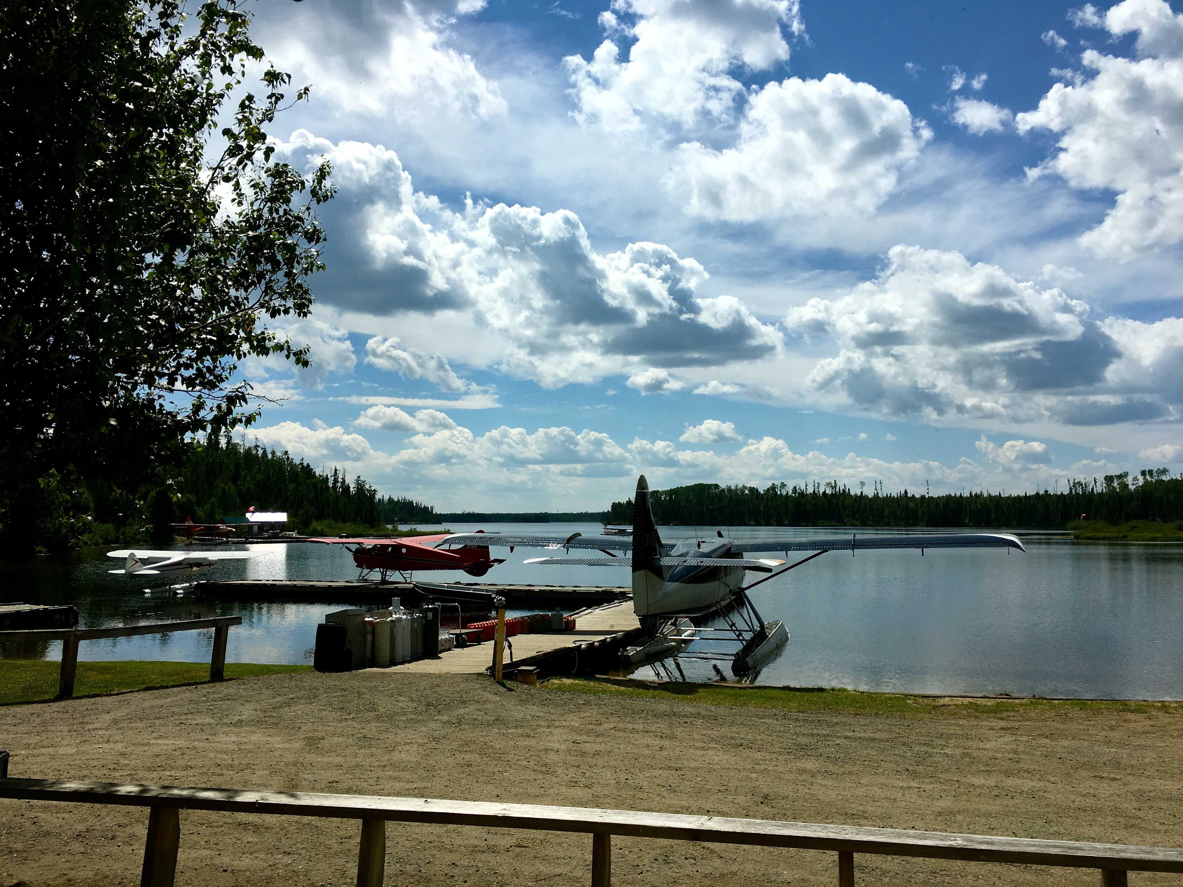
About four weeks before embarking on our trip I had called Mattice Lake Outfitters out of Armstrong and had spoken to the owner, who confirmed with us that he would have a shuttle waiting at the end of the Bukemiga Lake Access Road when we arrived at 2pm.
Our attempts to call the outfitter failed as cellular service was not available over most of the Highway 527 corridor. We waited at the pick up point until around 3pm and decided to make the 700m hike out to highway 527 to see if we could spot any signs of our outfitter, to no avail.
The Bukemiga Lake access road is about 20km from the outfitter’s office and even further from town. With the day fading fast, we decided that our only real option was to hitchhike to the outfitter. Mike and I decided to give it a shot and were quickly picked up by a pleasant couple from the Whitesand First Nation who agreed to drive us directly to Mattice Lake Outfitters. We chatted about the town of Armstrong, local industry (mining and, in the past, logging) and good fishing spots en route.
Upon arriving at the Outfitters we were shocked to learn that our shuttle booking was never logged/recorded, despite the fact that I had clearly arranged, confirmed and recorded a pickup time, date and location. No apology was made to us and the staff went so far as to blame me for not “following up”. I also later learned that they had overcharged my credit card. Unfortunately, my subsequent calls to the owner went unanswered and unreturned.
Ultimately, the outfitter did agree to retrieve our friends and our gear from the take out, and drove us all to the Chateau North Motel in Armstrong.
Armstrong – also known as Armstrong Station – is a dusty town of 200 residents, 250km north of Thunderbay. It is adjacent to the Whitesand First Nation – an Ojibwa reserve of about 300 on-reserve residents, which had resettled along the rail line from the north shore of Lake Nipigon in the 1940s.
In addition to its train station and motel, the town of Armstrong has two restaurants a general store and a small gas station. The town is a departure point for canoeing, fishing and hunting expeditions in the Wabakimi area.
Anxious to move on from the frustrating end to our trip, we dropped our gear off in our rooms (the rooms were sufficiently large to hold our canoes as well), cleaned ourselves up, and walked over to one of the restaurants to celebrate with food and beer.
Back at the motel we encountered a friendly crew of construction workers from Thunder Bay that were relaxing outside of their rooms after a long day of road maintenance in the town. We shared drinks and had a hearty discussion with them and they recommended that we check out the abandoned military installation 2km east of the town before nightfall. We took heed of their recommendation and left in a hurry.
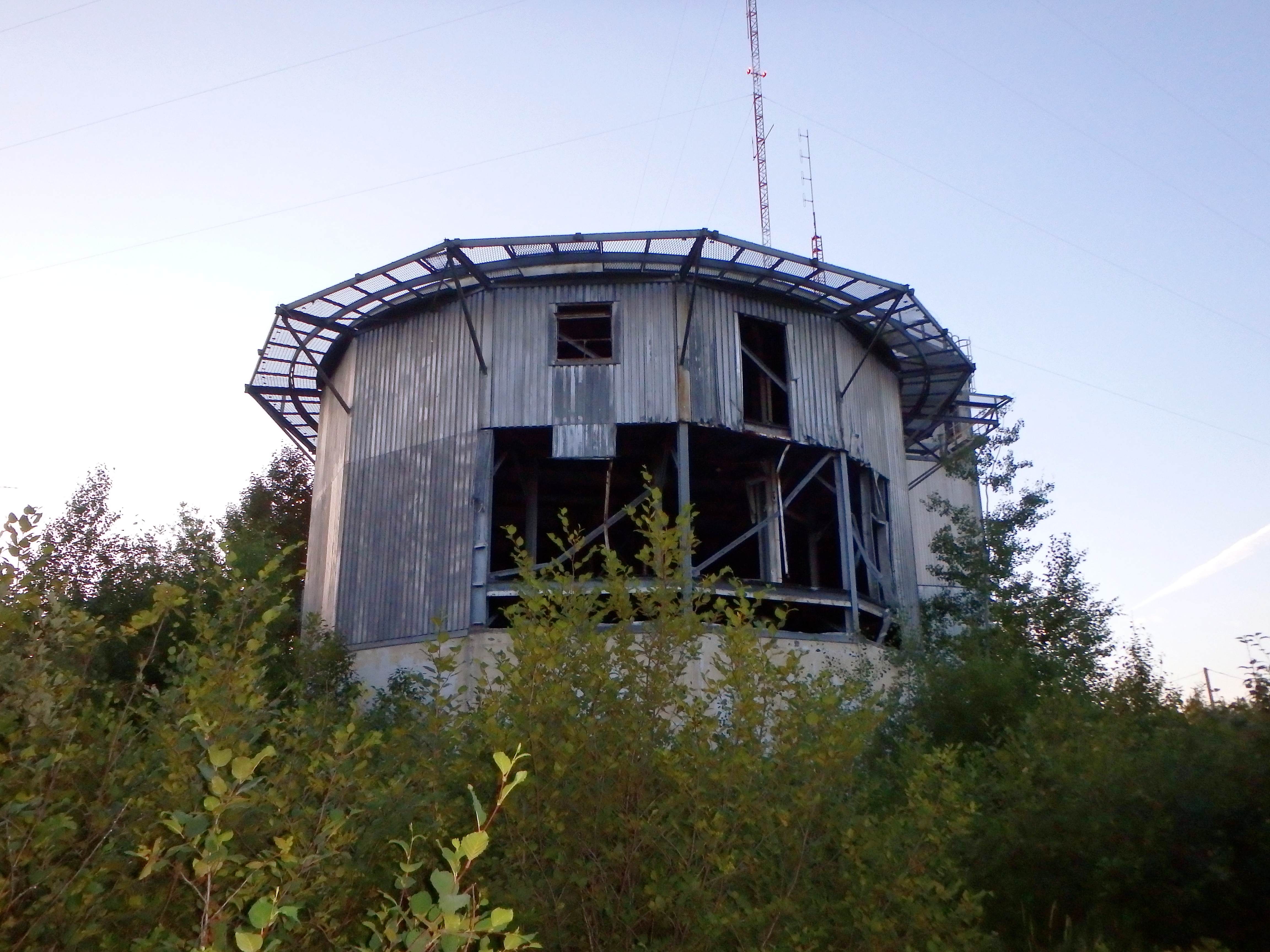
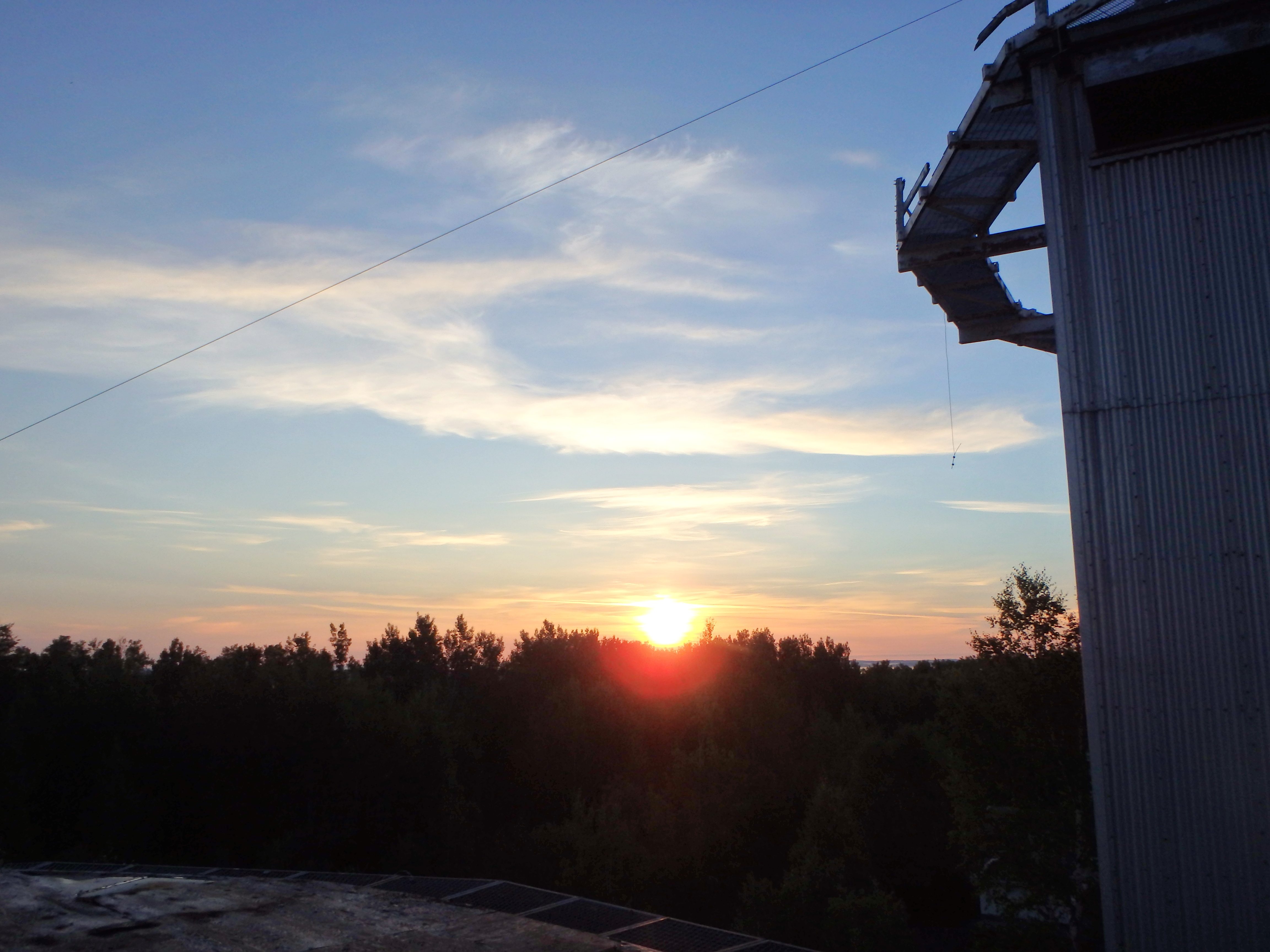
The installation they were referring to is the old Armstrong Canadian Forces Station that was initially opened during the Second World War, in 1942, to house American air defence units tasked with protecting the Soo Locks.
Following World War II – in the early 1950s – the site was reopened as one of the United States Air Force radar stations that comprised the Pinetree Line of Ground-Control Intercept radar sites, spread across the northern part of the continent. The site’s primary purpose at this point was to identify and help intercept Soviet aircraft during the Cold War. In 1974, the site was shuttered due to advances in radar technology, and for a time was partially revived as a community hub, before being fully abandoned in 1993.
The collection of old, dilapidated buildings here – residential units, stores, a mechanics garage, a school, the radar installation itself – are incredible to explore. This place is the epitome of a ghost town; walking the streets here one can not help but feel as though they have survived some sort of apocalyptic event.
After exploring the buildings, with night creeping in ever more intensely, we decided to hike back to our motel and get some rest as our train back to Toronto would be coming the next day.
In the morning, anticipating correctly that our train would be delayed by several hours, we resolved to explore the abandoned town for a couple of additional hours under the light of the sun.
At around 11am we checked out of the motel, grabbed lunch and walked over to the train tracks to wait out the arrival of our ride home. To kill time, we talked to a number of the locals and reminisced over the adventure that was now coming to a close.And what a great adventure it was. Over the years, our group of friends, with the aim of creating good memories, have traversed some of the finest swaths of untouched wilderness in Ontario. Of them all – of all our adventures in the wildlands of the north – it would be hard find a place that embraced us, enamoured us and took pieces of our hearts, quite like the rugged woodlands of south Wabakimi.